Kanab, Utah (Rock Springs Bench, Edmaiers Secret,
Canyon de Chelly, Hope Arch)

Personnel: Stan Wagon, Joan Hutchinson, JeanneMarie Mendesh, Bob Portmann, Elke Dratch, Bill Egbert.
Sunday, Oct. 13, 2024. Drive to Salida for a piano party.
Monday, Oct. 14. Drive to Kanab via Pagosa Springs, Durango, and Four Corners Monument.
Tuesday, Oct. 15. To Paria townsite. Stan, Joan, Merry Mattson, Kate Beery, Jane Williamson.
Wednesday, Oct. 16. Jeep driving. 4 hour hike. Stan, Bob, JM, Elke, Bill.
Thursday, Oct. 17. Powell Point from west. Easy drive to near point. . 4 hour hike. Stan, Bob, JM, Elke, Bill.
Friday, Oct. 18. East Rim Trail, 9.5 miles. Stan, Bob, JM, Elke, Bill.
Saturday, Oct. 19. Edmaier’s Secret. Stan, Bob, JM, Elke, Bill.
Sunday, Oct. 20. Drive with Joan from Kanab to Chinle via Page, Tuba City, the Hopi Reservation, and Ganado.
Sunday, Oct. 21. Tour of Canyon de Chelly and Hope Arch with Navajo guide Erika of Canyon de Chelly tours.
Tuesday, Oct. 22. Drive Moab to Silverthorne.
Trip Report
Sunday. We drove to Salida where I played Joseph Lamb’s Sensation at the Chaffee County Piano Club party. Spent night in Salida.
Monday. We drove to Kanab via the Four Corners Monument so I could stand on the four corners point. I had recently completed a math paper inspired by the map-coloring problem as it relates to four-corner points.
Tuesday. Joan and I were joined by Merry Mattson, Kate Beery, and Jane Williamson for a trip across the Paria River to the old townsite, where the ruins of two buildings can be seen. The drive to the bottom in the Rav4 was fine.
Wednesday. We picked up two rental jeeps (Gladiators) at 7 am and drove to the end of the road on Rock Springs Bench over about three hours. The dirt road starts just east of the entrance to Kodachrome State Park and is fine for a few miles, but then gets worse as it narrows and climbs. No real problems, though the large vehicles had issues at the end where the trees made the route very narrow and twisty. Bob, Elke, Bill, and I headed down a steep trail that ended in a sand hill and got close to Little Mollie’s Nipple. Nice hiking, but clearly our objectives of Stone Donkey or Cottonwood Peak were not going to be attainable. So we cut our losses and drove back down the road to find a campsite. We found an extremely pleasant site near the junction with the Cottonwood Canyon Road. Rain was in the forecast, so we were pleased to be done with the difficult drive; the route would be impassable with water in the washes.
My plan for this exploration was really overly ambitious. One can reach Stone Donkey from the end of the road, but it requires camping at the road end and starting very early. It makes me appreciate that Kim Clark and I did manage to visit the Donkey in one 16-mile day starting from the Cottonwood Canyon Road.
Thursday. The weather held so we headed to the west approach to Powell Point near Bryce Canyon National Park. That road was fine and we drove to the trailhead which is a half-mile from Powell Point. A year ago Katie and I got there on an 11-mile day. I always wondered about the road approach, and now I know. It is not too bad. Powell Point is essentially the highest point in southern Utah at 10,200 feet.
Friday. Poor weather early. There was a break around mid-morning and Elke, Bill, Bob, JM, and I went to the East Rim Trail near the east entrance to Zion and did a 9-mile walk. The trail is very nice and not very crowded.
Saturday. The weather was not bad, so Elke, Bill, Bob, JM, and I went to EdmaIer’s Secret, a superb expanse of Navajo sandstone. We got to the beautiful tower on the west side of the butte, and then climbed the butte (short class 3 section). Below the summit were some giant pools of water, a rare sight. We then descended the east side with its great lace rock and climbed to the plateau on the east side. We hiked north on that for a bit and then descended to the wash.
The wash was dry when we reached it, but within minutes water came pouring down it: a flash flood! I had never seen such a thing. It was only ankle deep, so not a problem. The road to the highway had dried out nicely in the sun; on our way in it was very muddy and a little difficult to get through in spots. We trusted the forecast, and it worked.
Sunday. Joan and I drove to Chinle via Tuba City and the Hopi Reservation. Bob, Elke, and Bill went to Water Canyon, explored the top a bit, and returned via Squirrel Canyon.
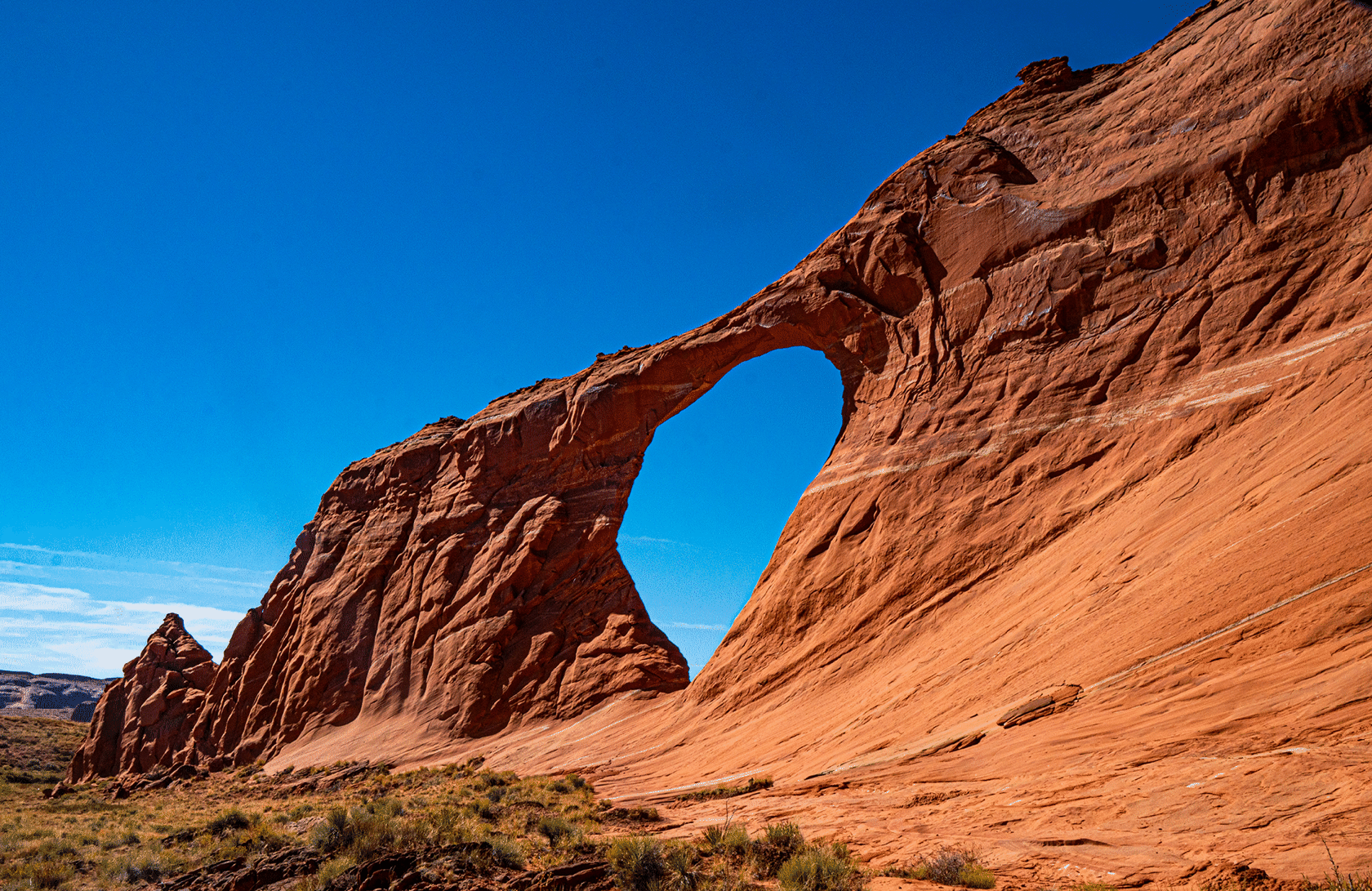
Monday. Joan and I had a guided jeep tour of Canyon de Chelly. Some Navajo families still live in the canyon, tending small gardens and orchards. This is a National Monument, but unusual because it is administered entirely by the Navajo. After a lunch break, guide Erica took me to Hope Arch which was truly spectacular at 70 feet high. I think it is in Entrada sandstone. The sandstone of de Chelly is much much older, so it appears that there are many missing formations such as: Moenave, Kayenta, Navajo. We then drove to Moab.
Tuesday. Easy drive from Moab to Silverthorne.
Photos