Page, Arizona (Buckskin, Hoodoos, Teepees, Mollies Nipple, Starlight Cave, Stone Donkey Arch)
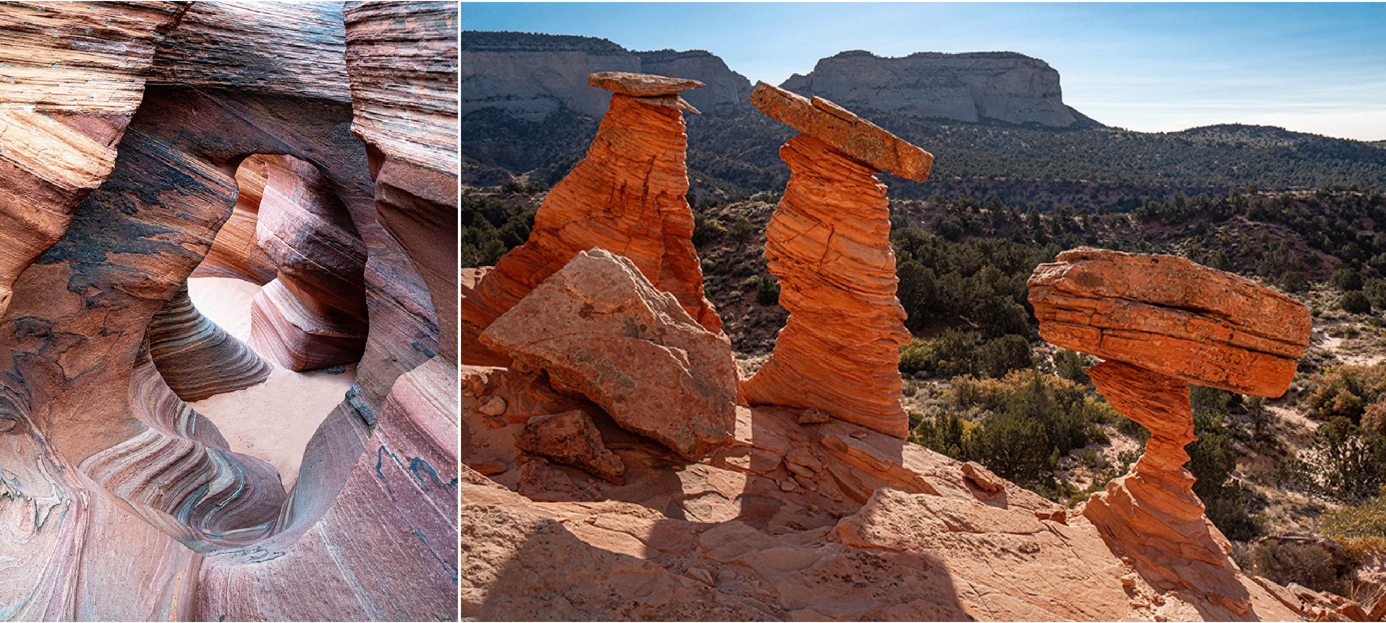
Above: Narnia Arch in a small slot canyon; some finely balanced hoodoos in Kane County.
Trip Report
10/19/2020 Drive Silverthorne to Page, about 10 hours. No problems.
10/20/2020 Wire Pass Slot Canyon and up Buckskin Gulch a short way with Joan. The route was quite crowded on the way out. And there was some horrible vandalism on the petroglyph panel near the junction. A ladder now exists at a difficult rock step. Apparently there have been rescues there recently, so the BLM placed this ladder. But this is a wilderness area so it might be illegal. Certainly it removes my chance of climbing the step. And there is an easy walkaround for those who don't wish to climb.
10/21 Guided drive with Joan and Bret of Dreamland Safari to some hoodoos and the Great Chamber. The hoodoos are excellent, with the one famous one in particular looking like it cannot last much longer. After the Great Chamber we visited the Red Pinnacles. We drove this as a loop, going past the Best Friends operation; they are a famous and large animal rescue center that operates on about 40,000 acres in a canyon north of Kanab.
10/22 Solo to Narnia Slot and Arch, and the North Teepees. This was a great day as the terrain was spectacular. About 10 miles in just under six hours. Entering the slot requires a climb up a narrow 8 foot step. I left my pack and tripod behind to make my way up. Then I was able to photograph the arch at the end of the slot and return. Getting to the North Teepees was simple and it was wonderful to photograph the colorful sandstone as I made my way around. It was very windy in the narrow slot to the left of the entrance on the west side. This slot led to the "vortex". On return I went into Narnia once more, this time with my tripod. But best pics were from earlier.
10/23 Mollies Nipple and Starlight Cave, with Kim Clark and guide Paul Gagner. About 10 miles in just under eight hours. After an hour of dirt road driving we easily ascended the 7200-foot peak. Then we went down a long way to the Starlight Cave with its interesting pictographs. On return we went around a nice unnamed butte of Navajo sandstone.
10/24 Stone Donkey Arch with Kim. Very rugged 15.2 miles in just under nine hours with 3300 feet climb. There are four parts to this route: The climb out of Cottonwood; the descent into Hackberry; upstream to the junction with the side canyon; and then up Stone Donkey Canyon to the exit and the sandstone walk to the arch. We tried to keep a good pace. In the third part we thought me might not make it due to the length, but we kept on and once we turned into Stone Donkey Canyon it went quickly. The climb out of Stone Donkey Canyon was easy and then we had some walking on spectacular Navajo sandstone to reach the arch. The return went faster as there were no surprises. Great day!
Photos
Wire Pass Slot and Buckskin Gulch
Mollies Nipple and Starlight Cave
Stone Donkey Canyon and Stone Donkey Arch (aka Howling Wolf Arch)