Page, Arizona (Hoodoos, Edmaiers Secret, Sidestep Canyon), and Cavern Arch (Moab)
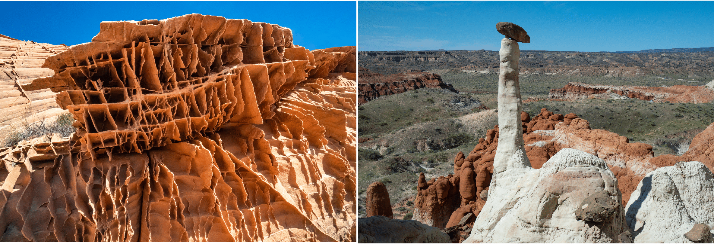
Above. Lace rock at Edmaier’s Secret (left); an elegant hoodoo at the Rimrock Hoodoos (right).
Trip Report
April 24, 2019. Joan and I arrive in Page after spending the night in Grand Junction.
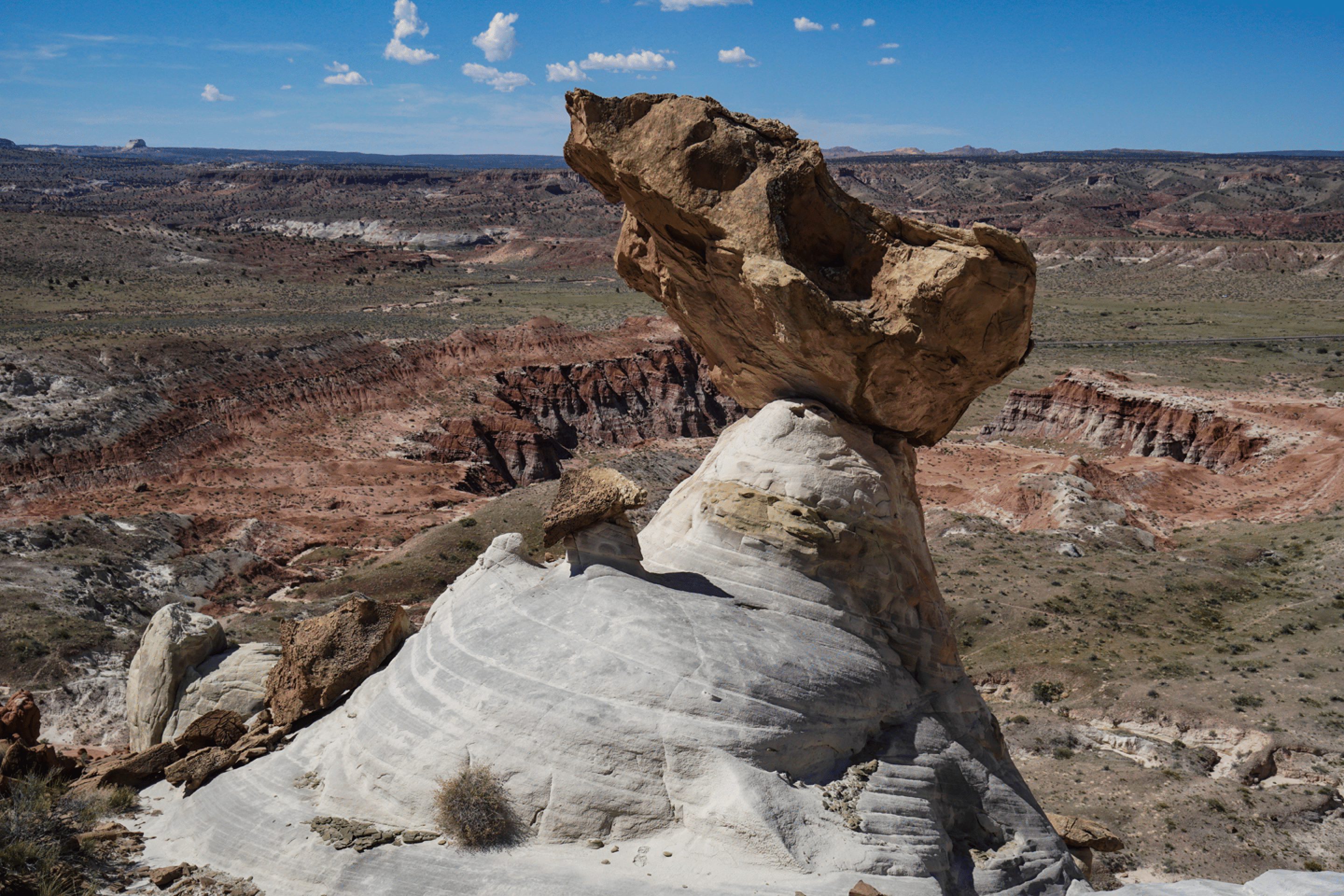
Thursday, April 25. Joan and I went to the toadstools above The Toadstools, starting from the parking spot at about the 3-mile mark on Cottonwood Road. Several years ago I had spotted these high toadstools from the trail into The Toadstools. Getting to them was straightforward and while this area is not as spectacular as the Toadstool Forest farther west, it was a worthwhile easy hike. In the evening we picked up my old friend Joe Buhler, who would join us for three long hikes.
Friday, April 26. Joe and I climbed from the Rimrock Hoodoos to the Toadstool Forest via a very steep (class 3) canyon. This was very satisfying as the route is steep and not obvious, and one sees great towers along the way. There appear to be two gullies that yield routes. We took the lookers left one, but at the top moved right into the top of the one on the right. I cannot be certain that the one on the right goes all the way through, but it appears to, and it would make a nice loop hike to go up one and down the other. Joan was willing to wait for us at the standard parking spot for the Toadstool Forest, so we spent a half-hour wandering in the Forest, and then exited to the top and out to the car.
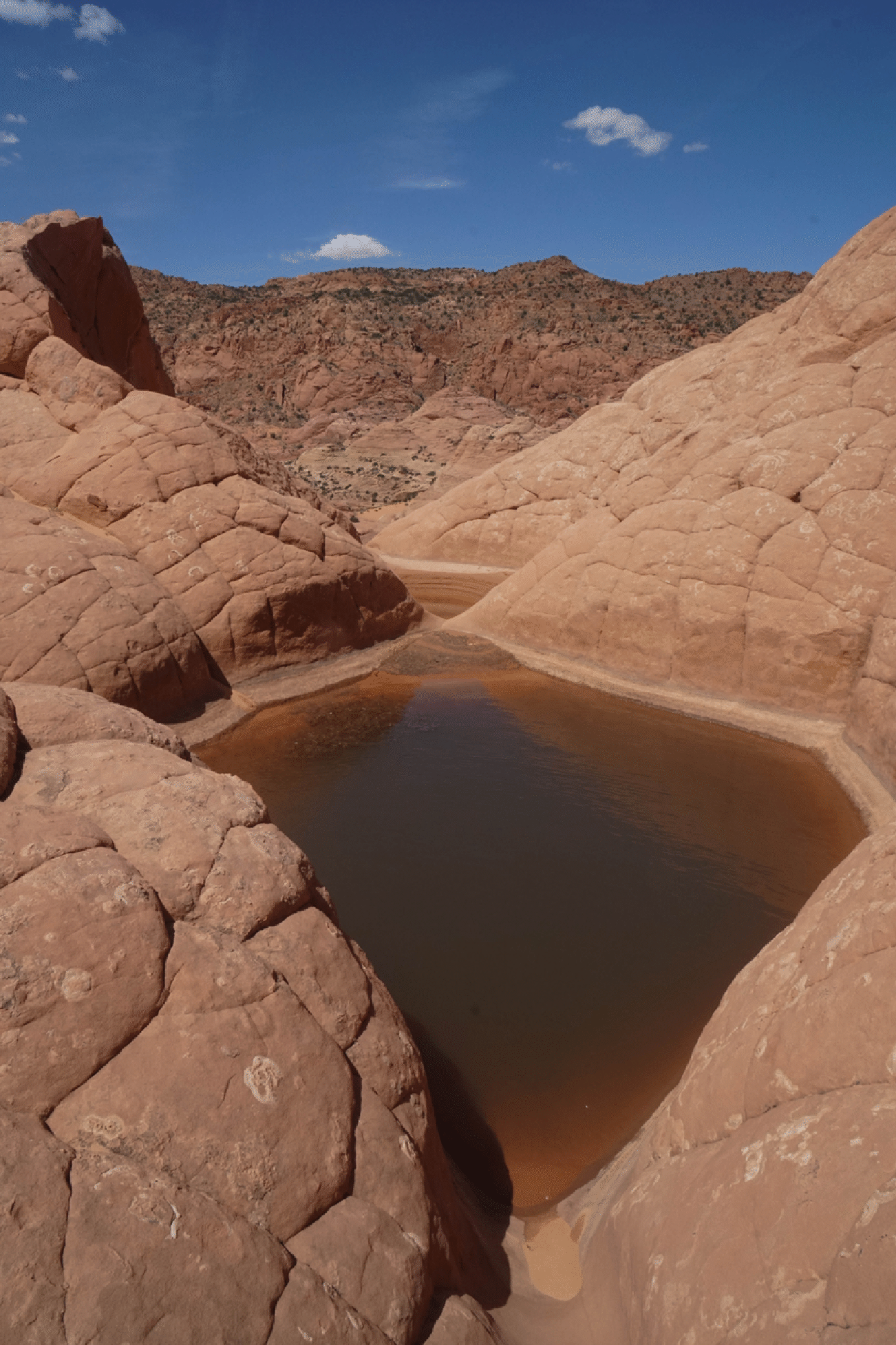
Saturday, April 27, 2019. Joe and I explored Sidestep Canyon from Church Wells. 8.5 miles, 4.75 hours. It was 88° on return to car, well above average April highs. We explored a bit along the main wash (this is the West Fork of Wahwheap Canyon) , and then into a slot canyon in Sidestep Canyon. We turned back after exploring the slot for a while, and then escaped to the rim via great terrain on the north side of the tributary. There was a steep lip to gain the rim, but it was not difficult. A rock had been placed to help one step up, so it appears that others have used this exit.
Sunday, April 28, 2019. Joe and I went to Edmaier’s Secret from the Buckskin Gulch trailhead. We visited the top of the main knoll, and then continued south to make a nice 7-mile loop. As with my last trip here, the highlight was the section of lace rock just below the summit of the main knoll (on the east side). But this time we continued south beyond the knoll and had a visually stunning descent through the Navajo sandstone down to the Buckskin drainage.
Monday, April 29, 2019. Joan and I drove to Moab, with a stop at Natural Bridges National Monument. I ran the lovely 3.6 mile trail from Sipapu Bridge to Kachina Bridge. Lots of rain this day, but weather cleared for our hiking break.
Tuesday: We abandoned plans for a remote hike out of Moab and just drove home, as this was a very wet day.
A month later (May 29, 2019) Joan and I returned to the Yellowcat Road area and hiked down Lost Springs Canyon to Cavern Arch (in Arches National Park). This was about a five mile hike, and the canyon was quite beautiful, with large cottonwoods and Navajo sandstone walls. Around the corner from Cavern Arch we spotted an arch high to the east that appears to be inaccessible.
Toadstools above The Toadstools
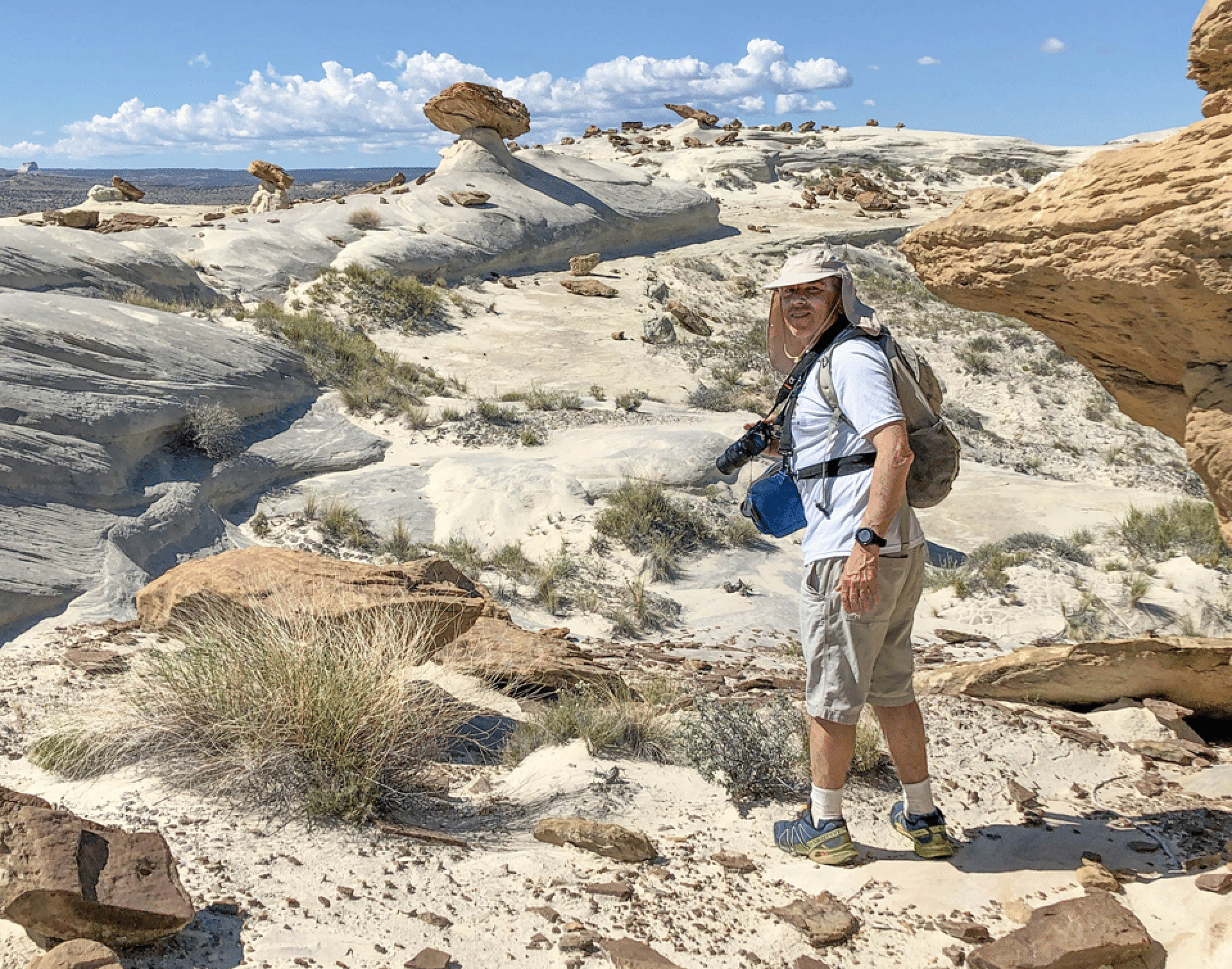
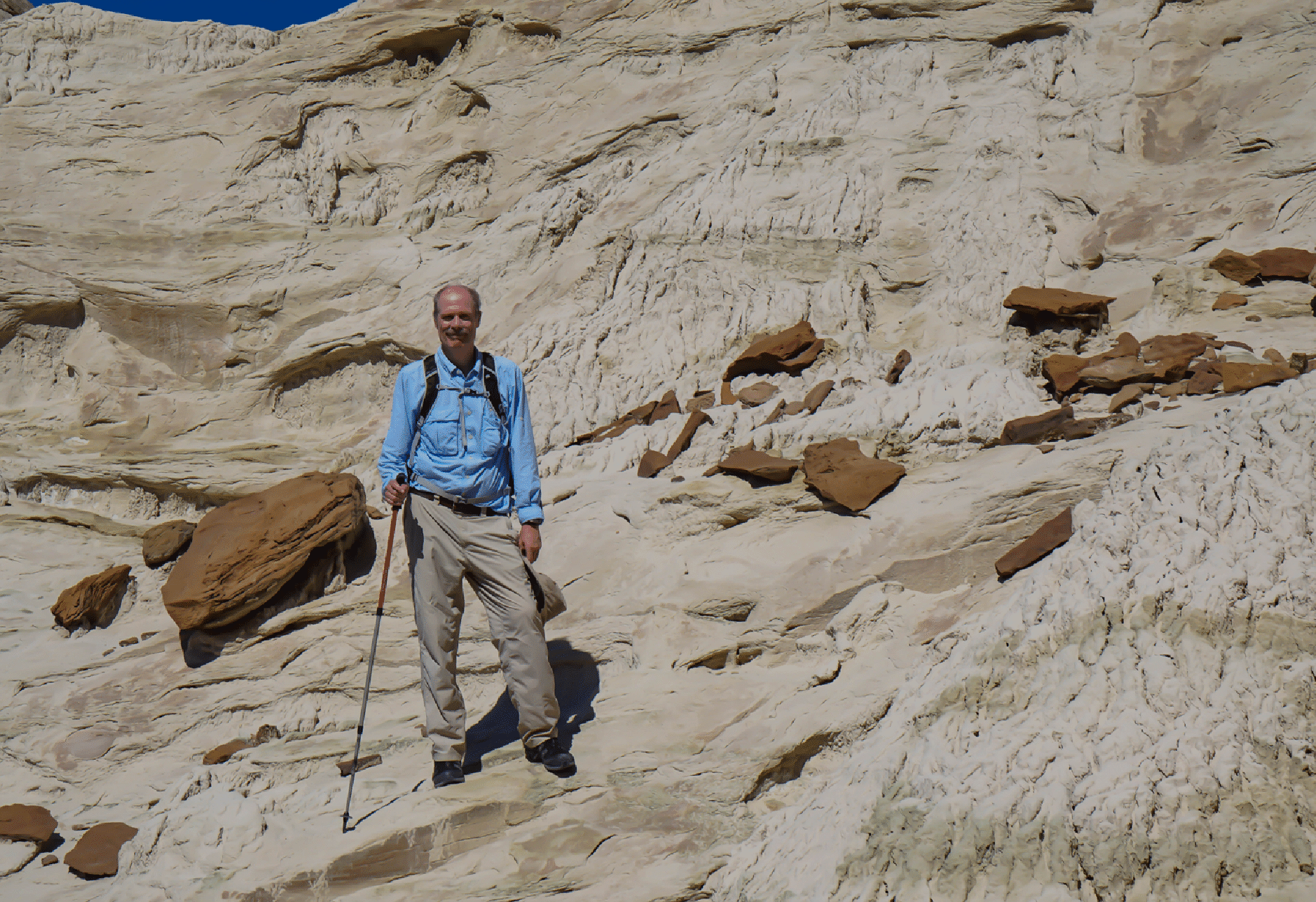
Stan approaching the toadstools (Photo by Joan Hutchinson)
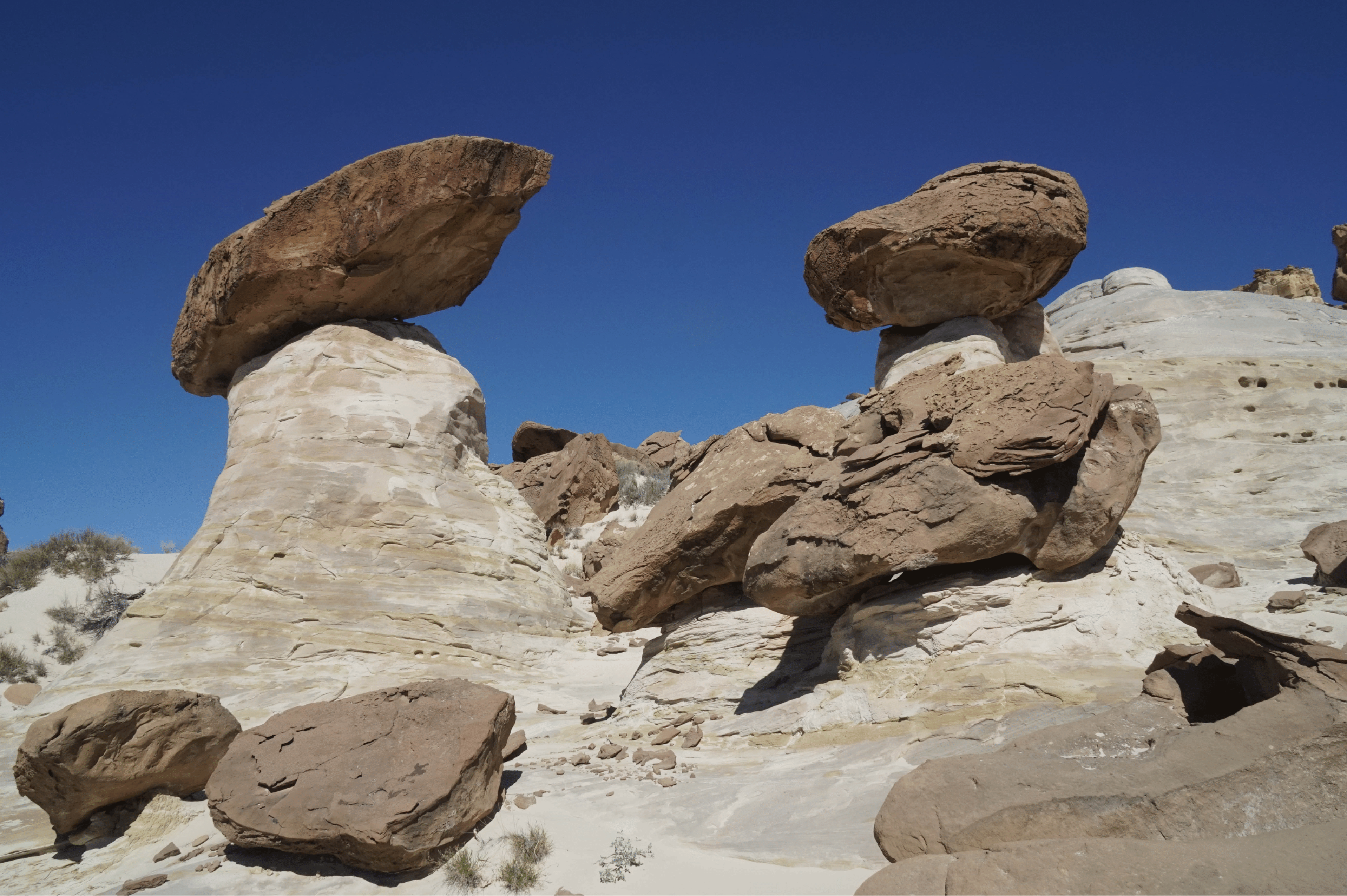
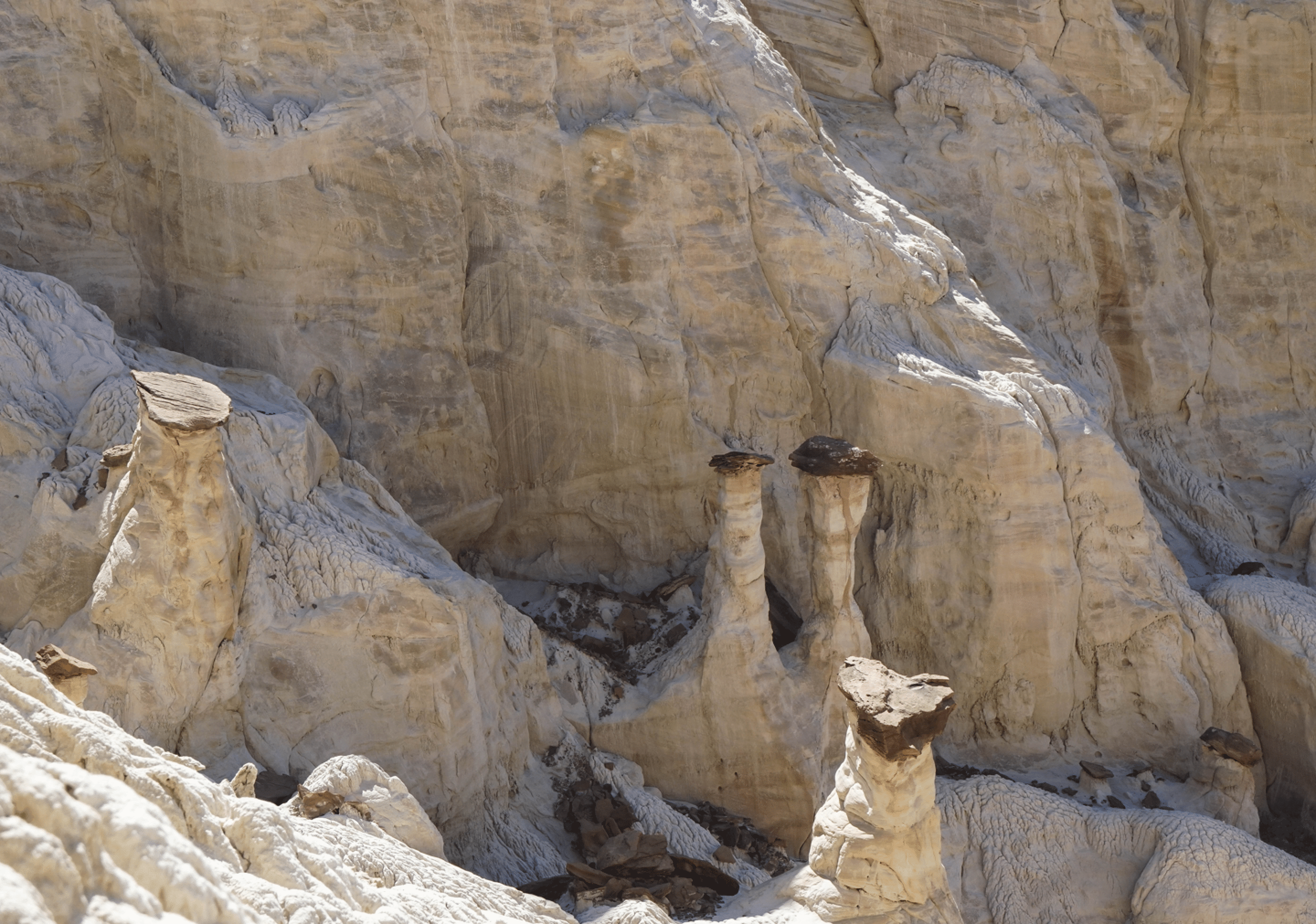
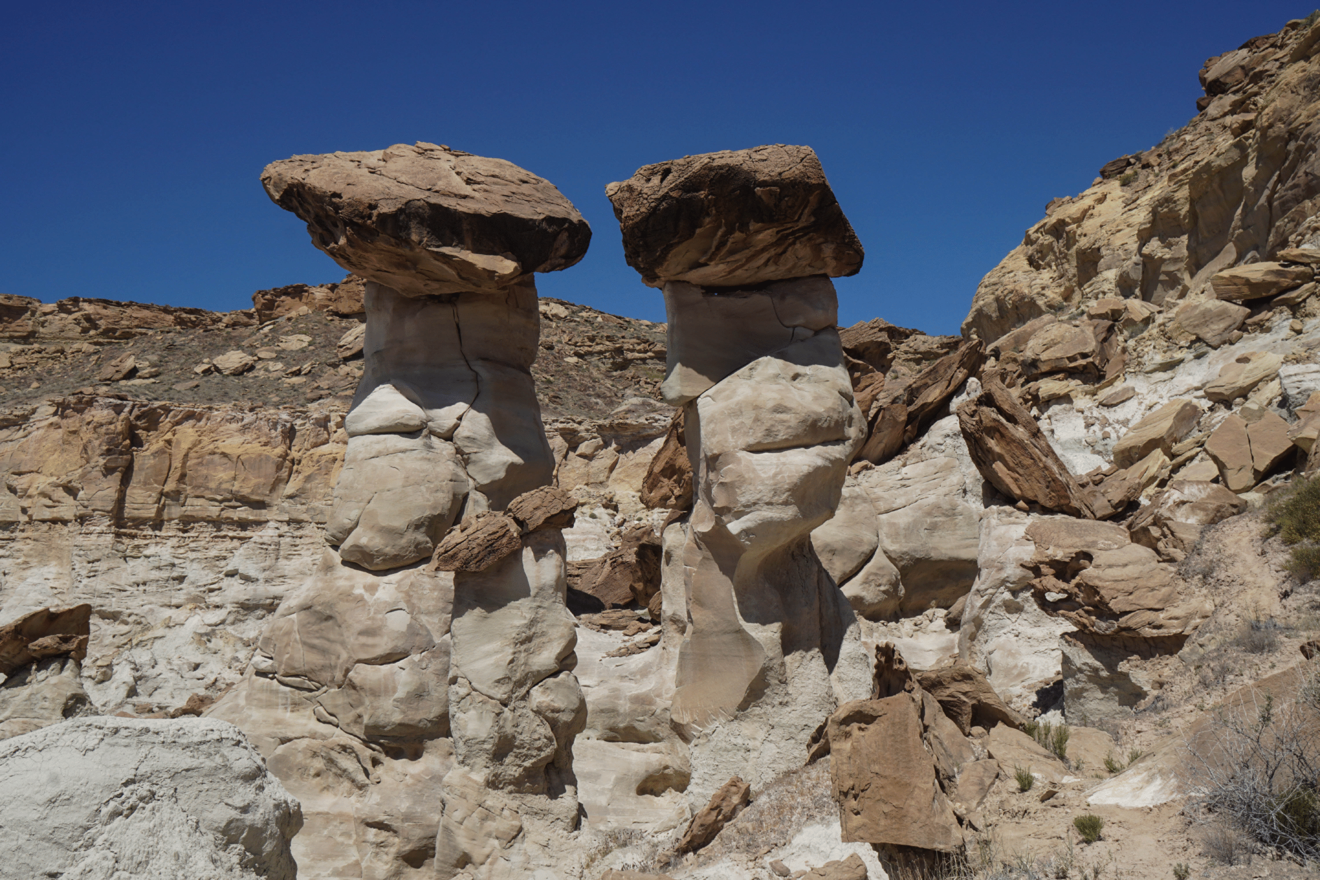
Toadstool Pair
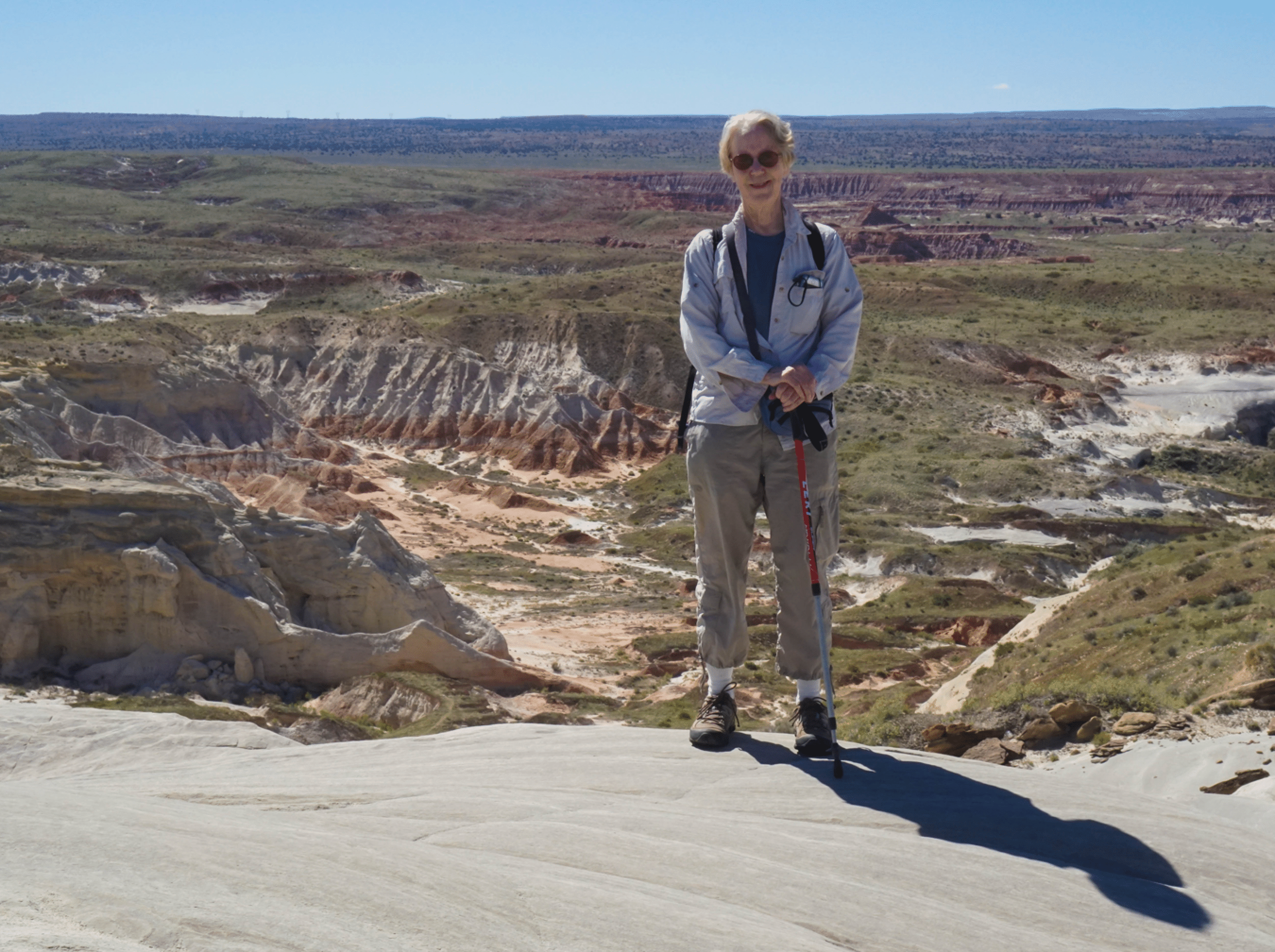
Joan at the edge. The area below is the popular trail to The Toadstools, off highway 89.
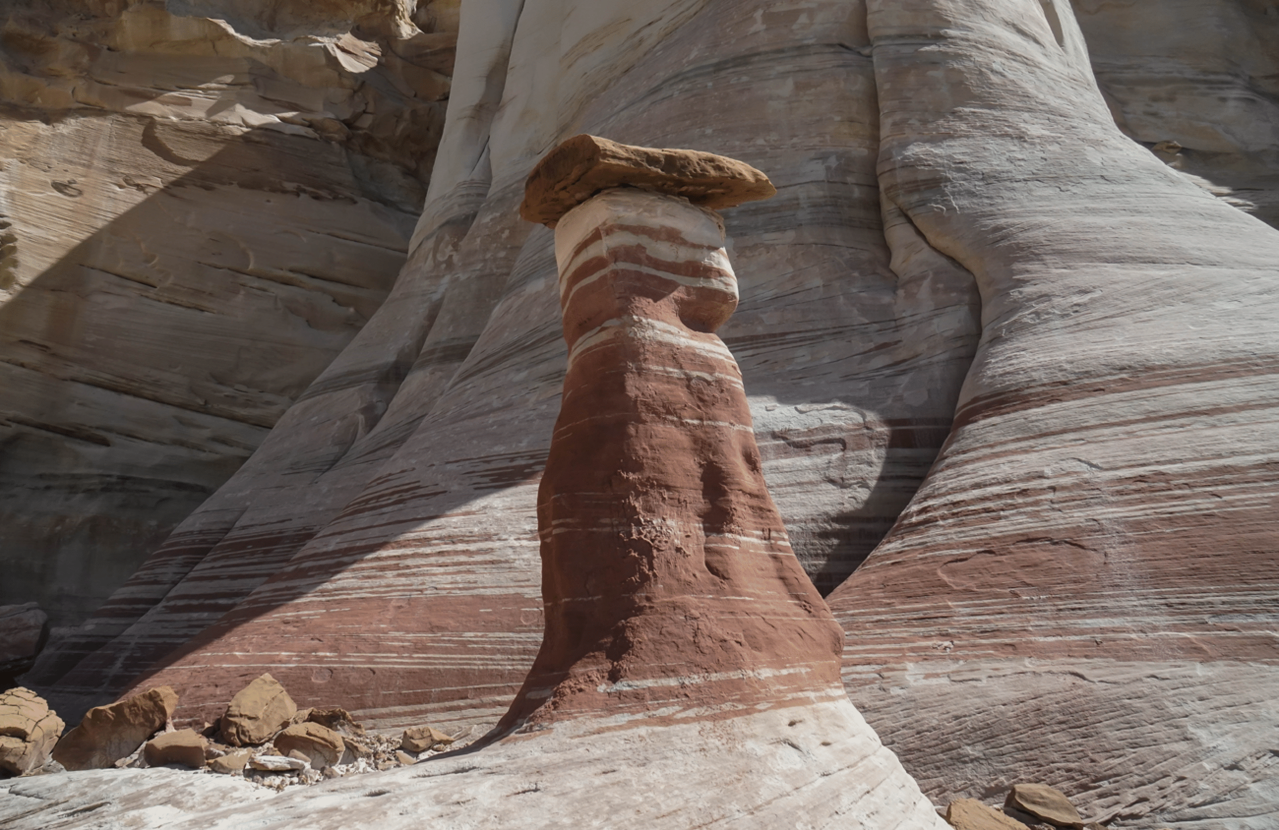
Toadstool Porcini
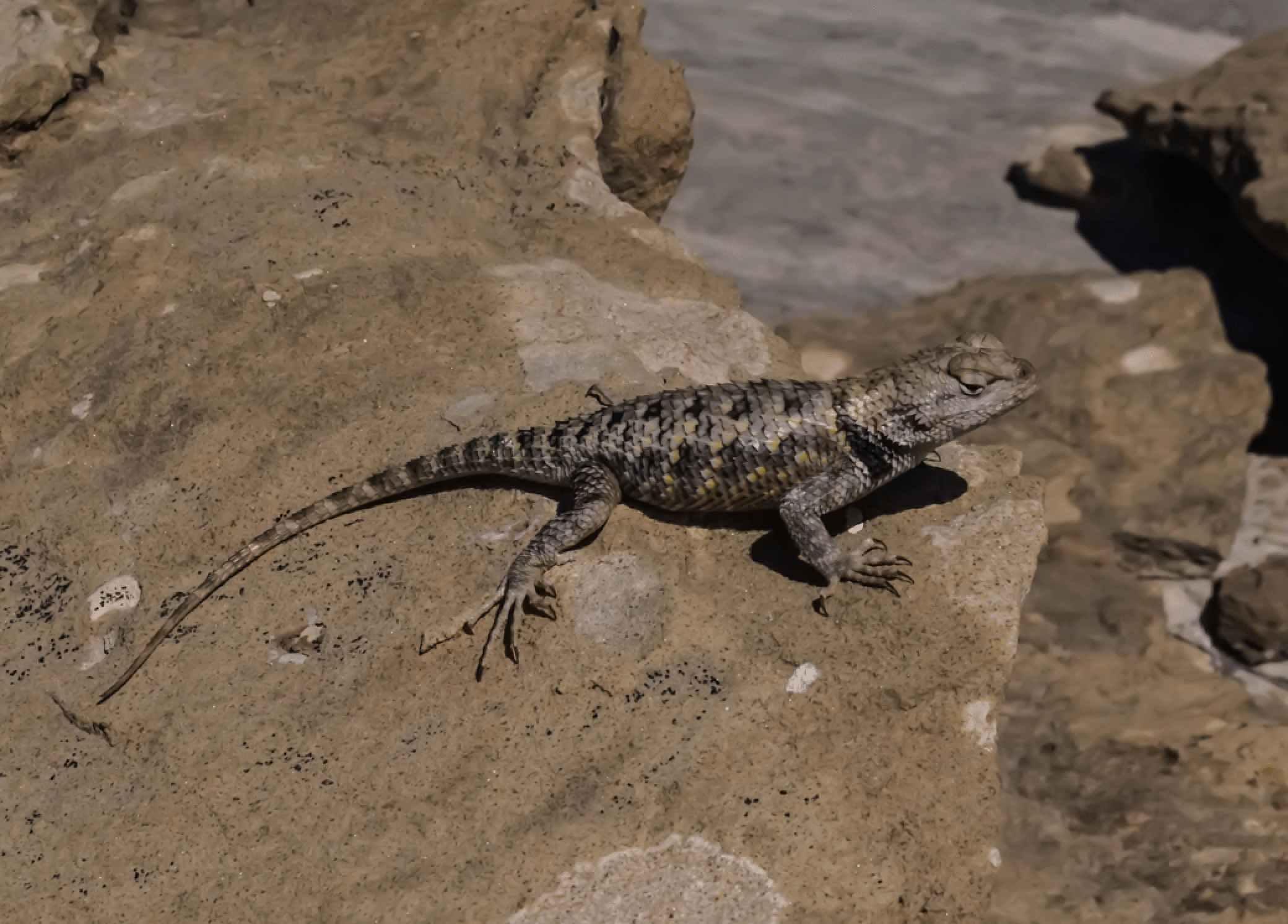
Lizard. There were a pair of them here.
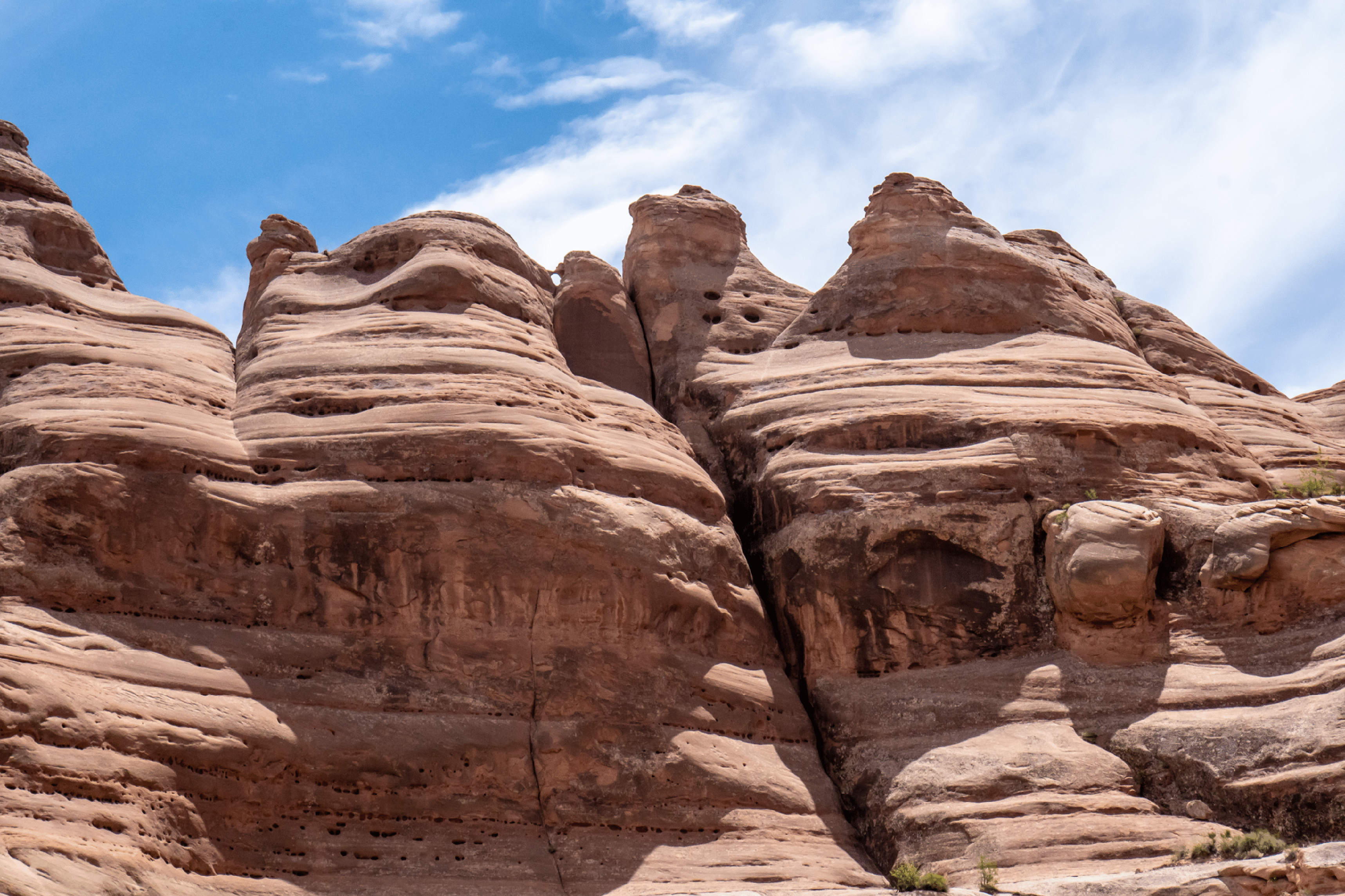
Steep Route From Rimrock Hoodoos to the Toadstool Forest and the Cottonwood Road
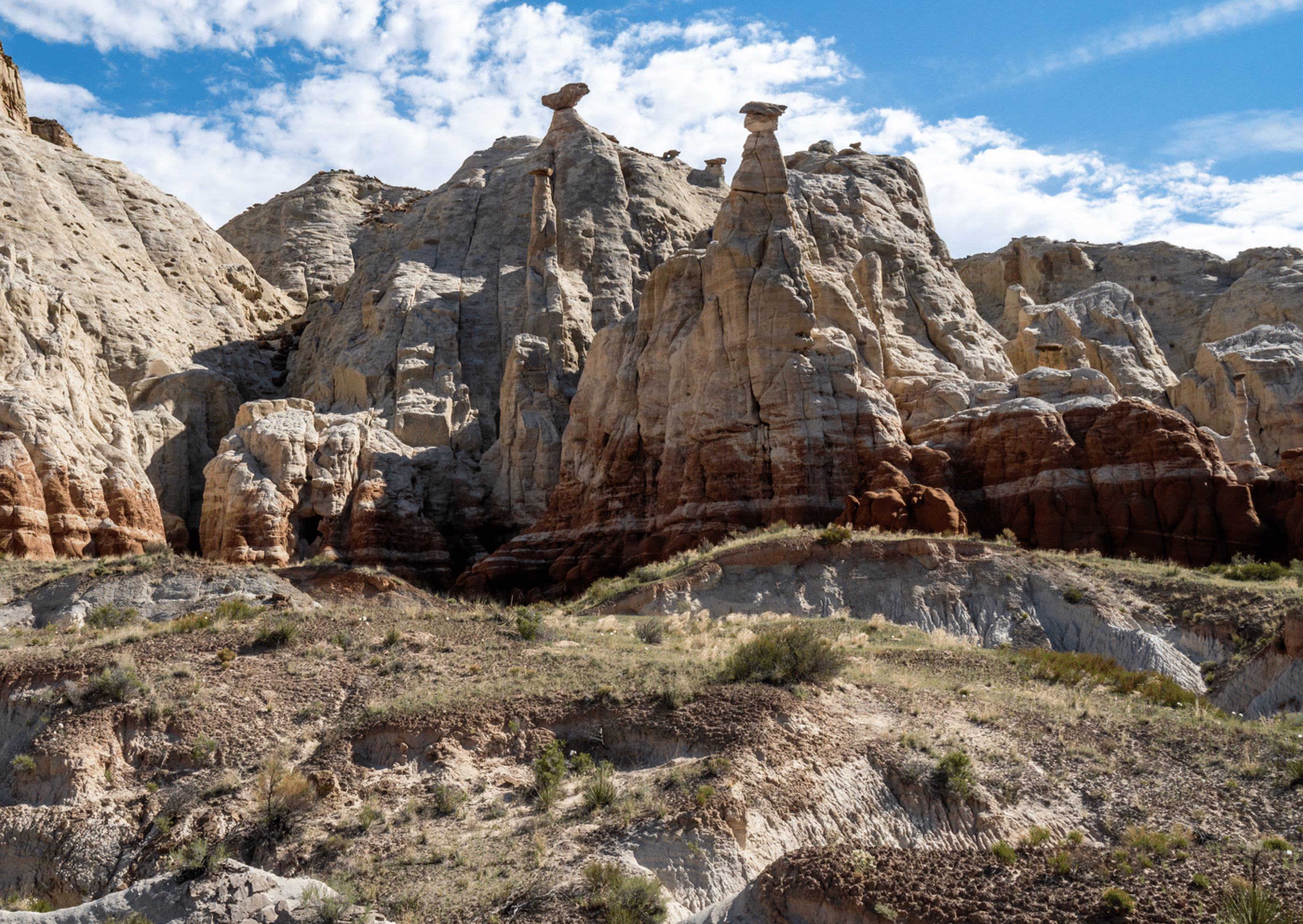
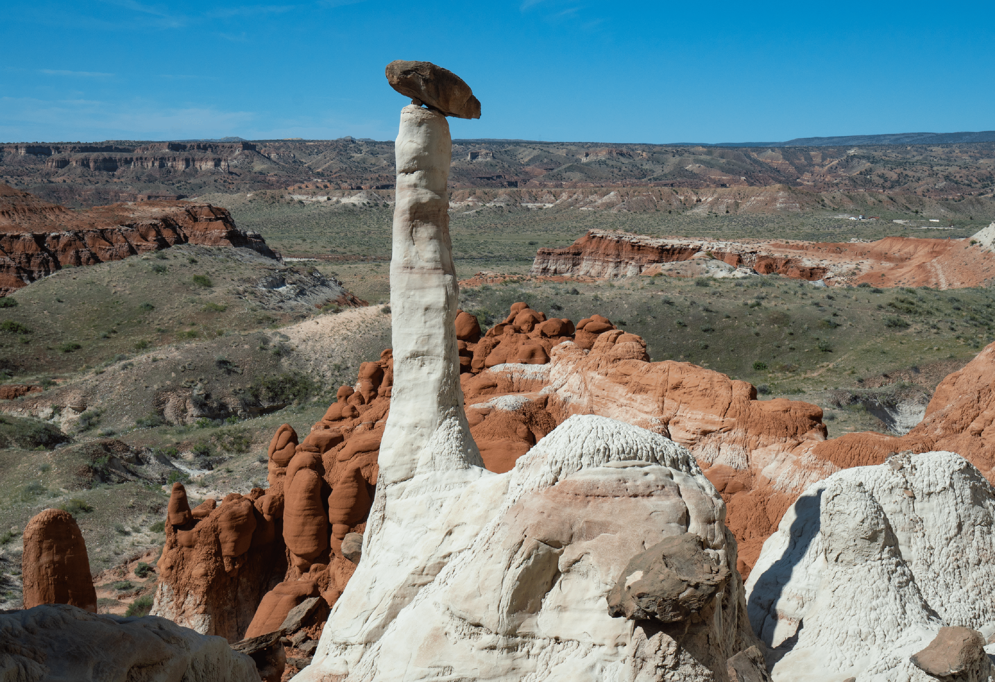
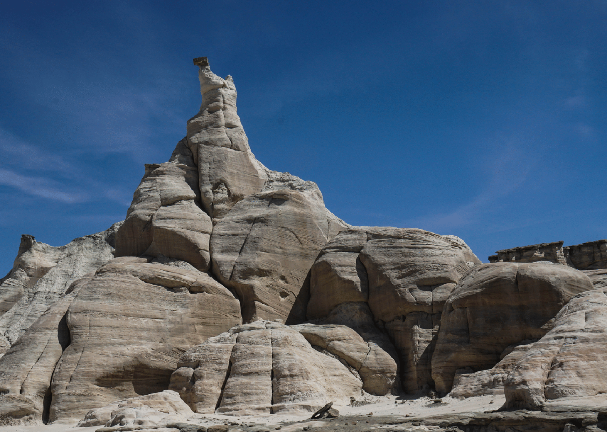
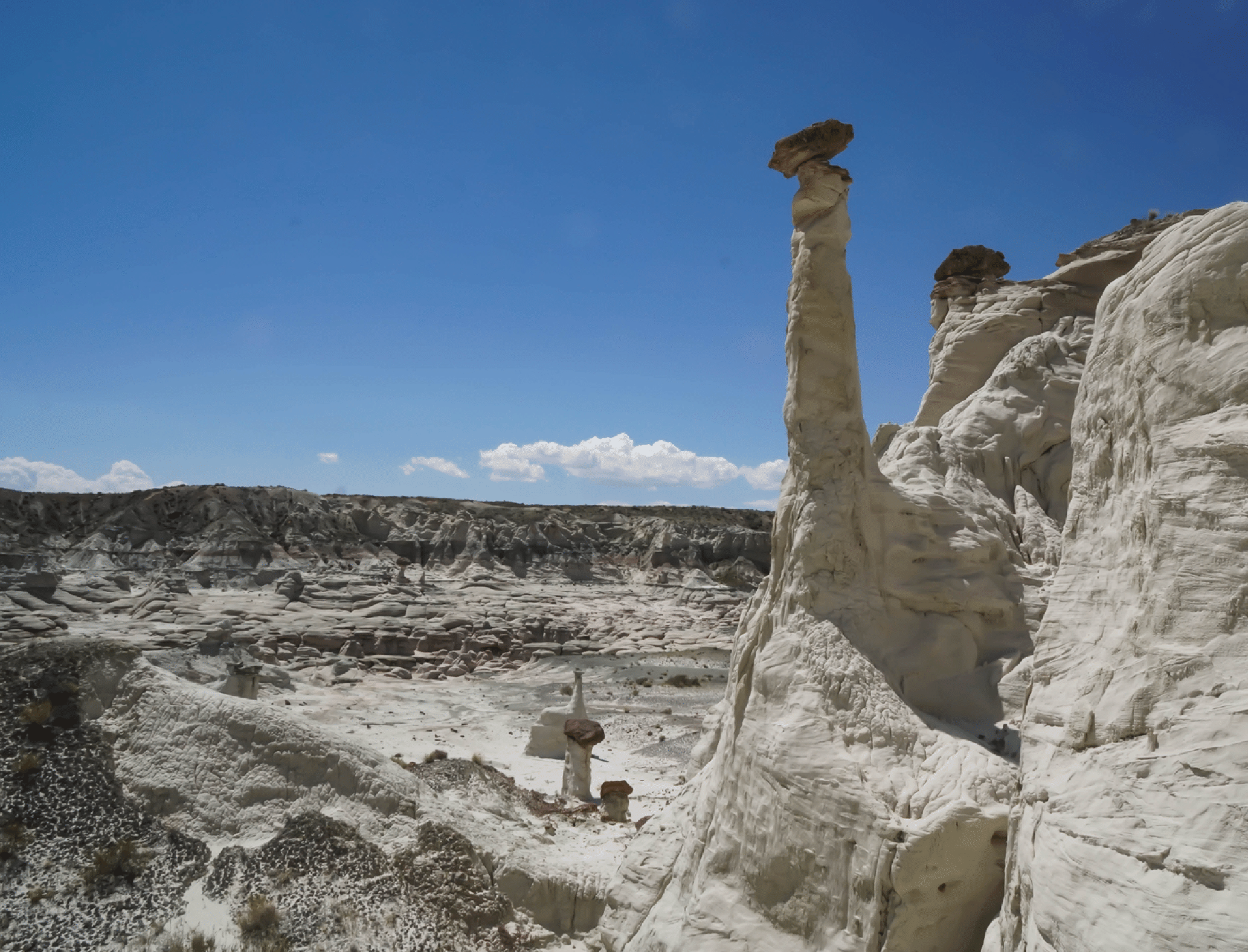
This is the big picture of the area known as the Rimrock Hoodoos. It is only about a mile or a little more to this spot. Note the elegant hoodoo at very far right. That is the subject of the next picture, and that marks the start of the route Joe and I took to the top, wherein lies the Toadstool Forest, and an easy route to the Cottonwood Road.
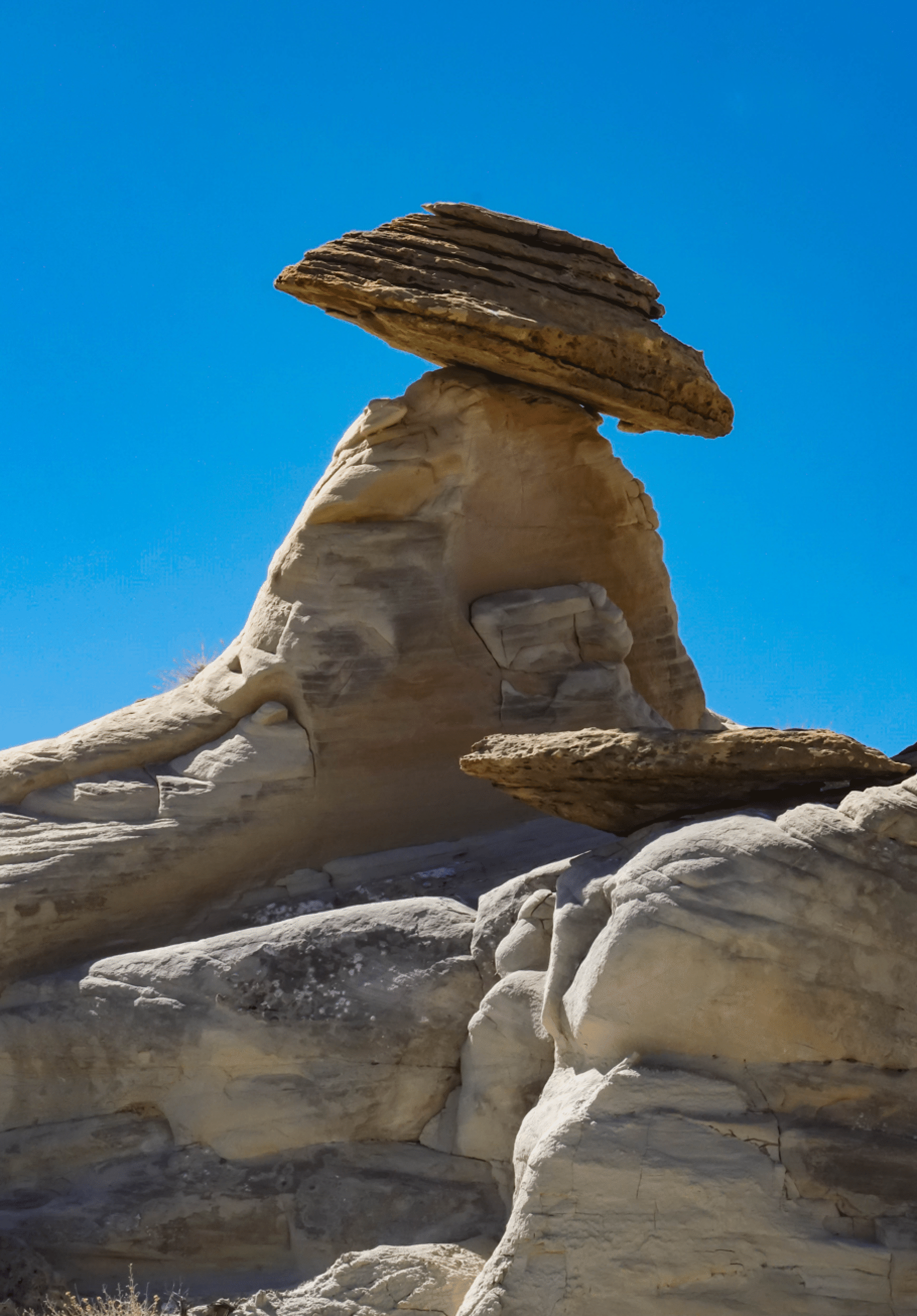
This is one of the most elegant hoodoos of the Rimrock Hoodoos area. It is not hard to get to this position behind it. But then getting to the rim requires a very steep gully climb.
The heart of the gully.
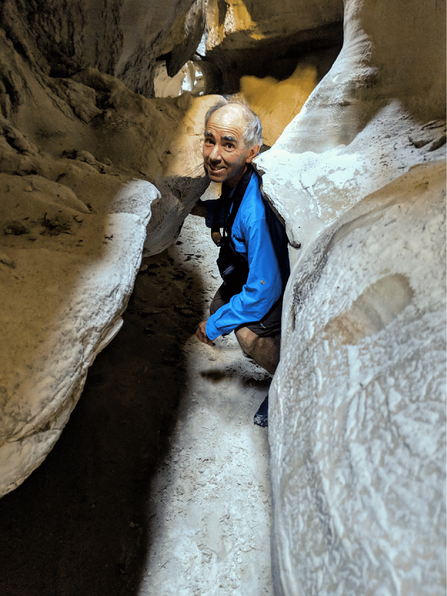
Joe Buhler in the heart of the steep route.
The view down the alternate gully.
From the top we wandered south to the rim and the nice view down to the red rocks and the highway.
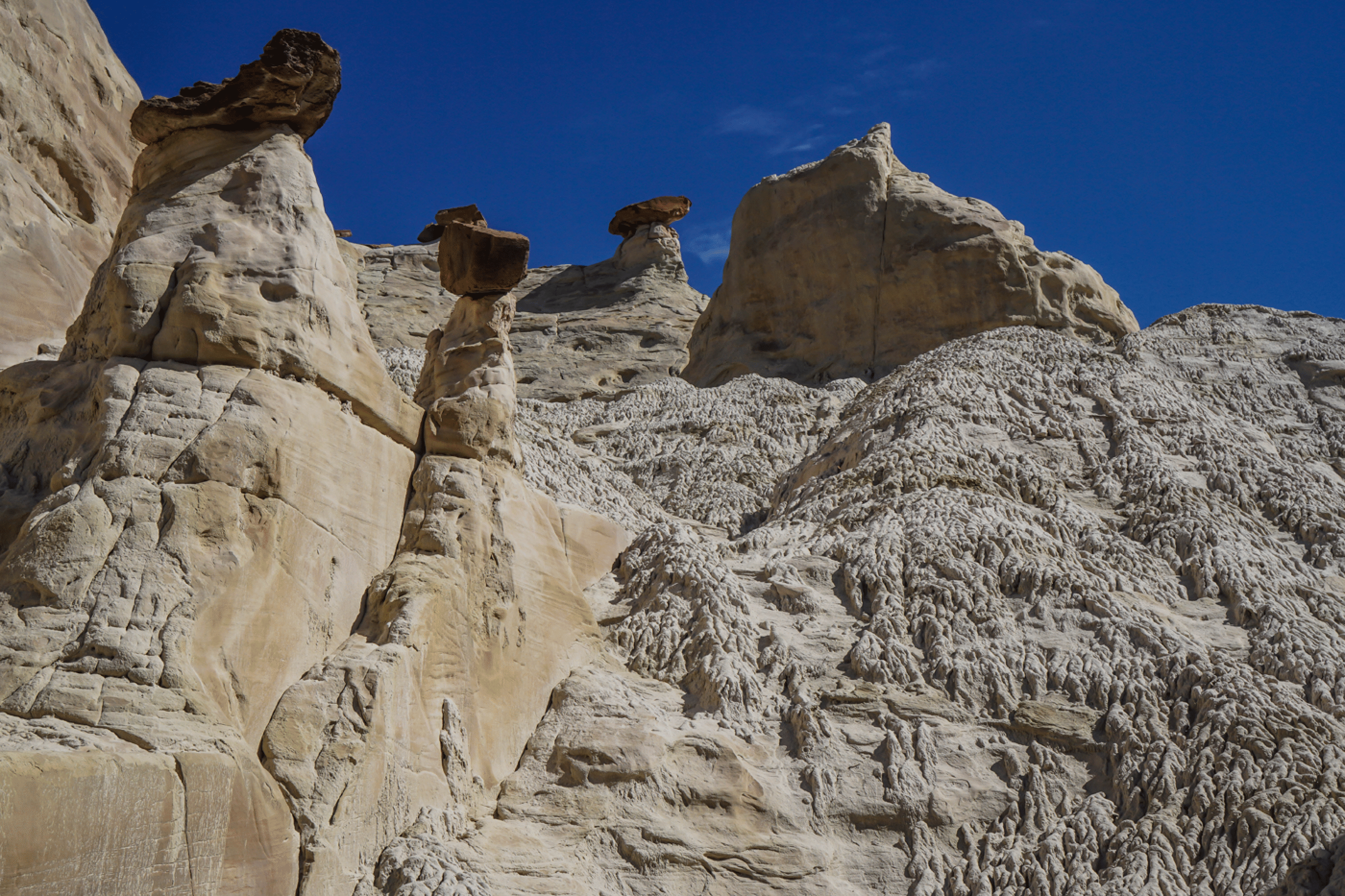
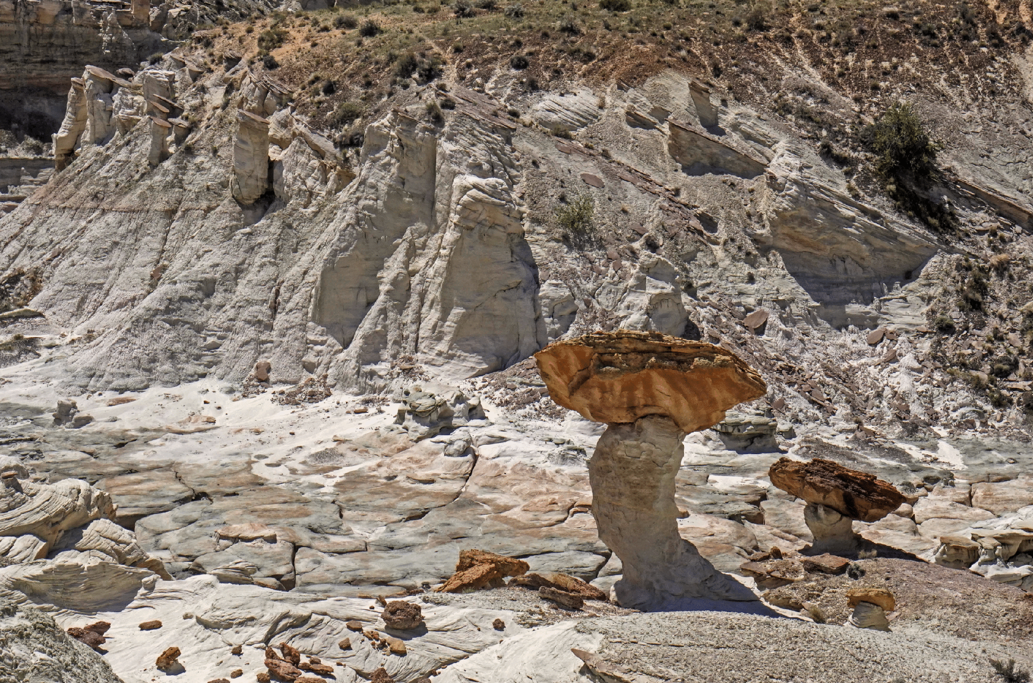
The Toadstool Forest has many gigantic toadstools. Here are some medium-sized ones. The route out is via the rim behind these towers.
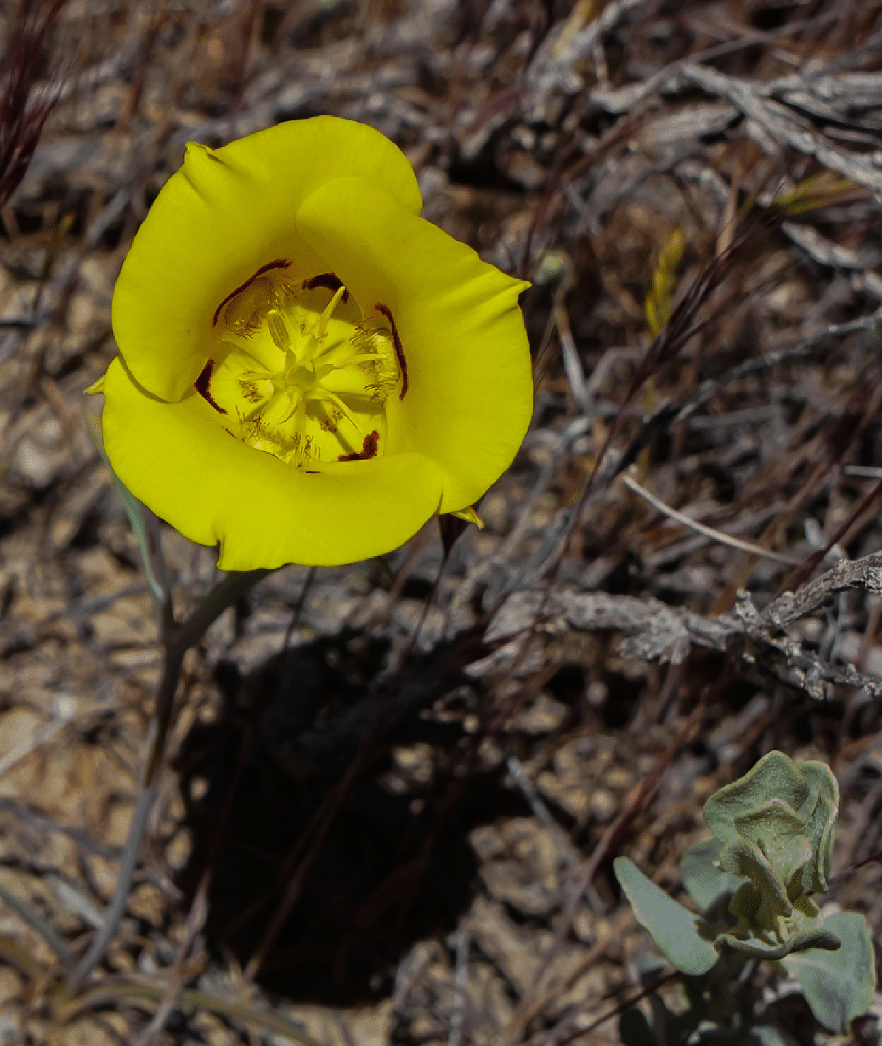
Just before reaching car we saw this Golden Bowl Mariposa, something I have never seen before, though the usual white Sego Lilies are very common here in Colorado.
Sidestep Canyon
The West Fork of Wahweap has great hoodoos, and this small red one is noteworthy.
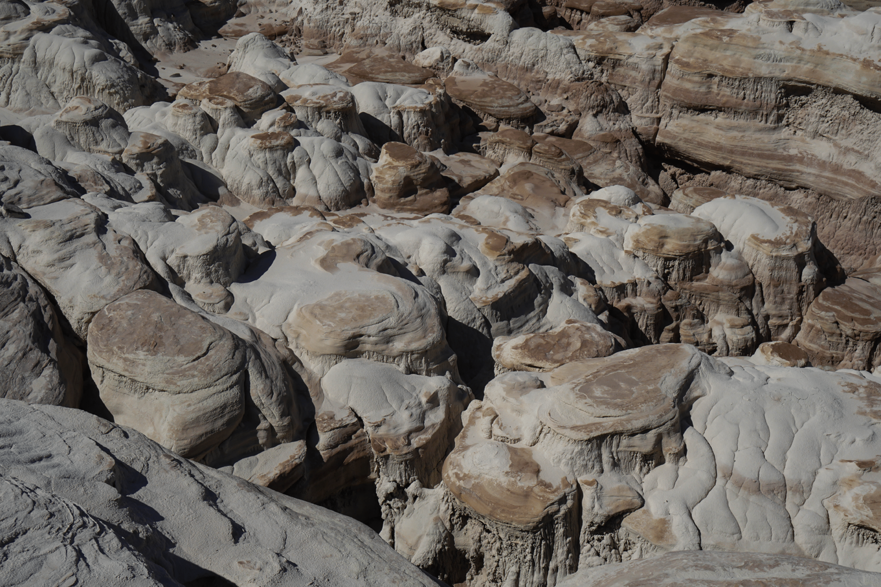
These lumps are of to the east side of the West Fork of Wahweap.
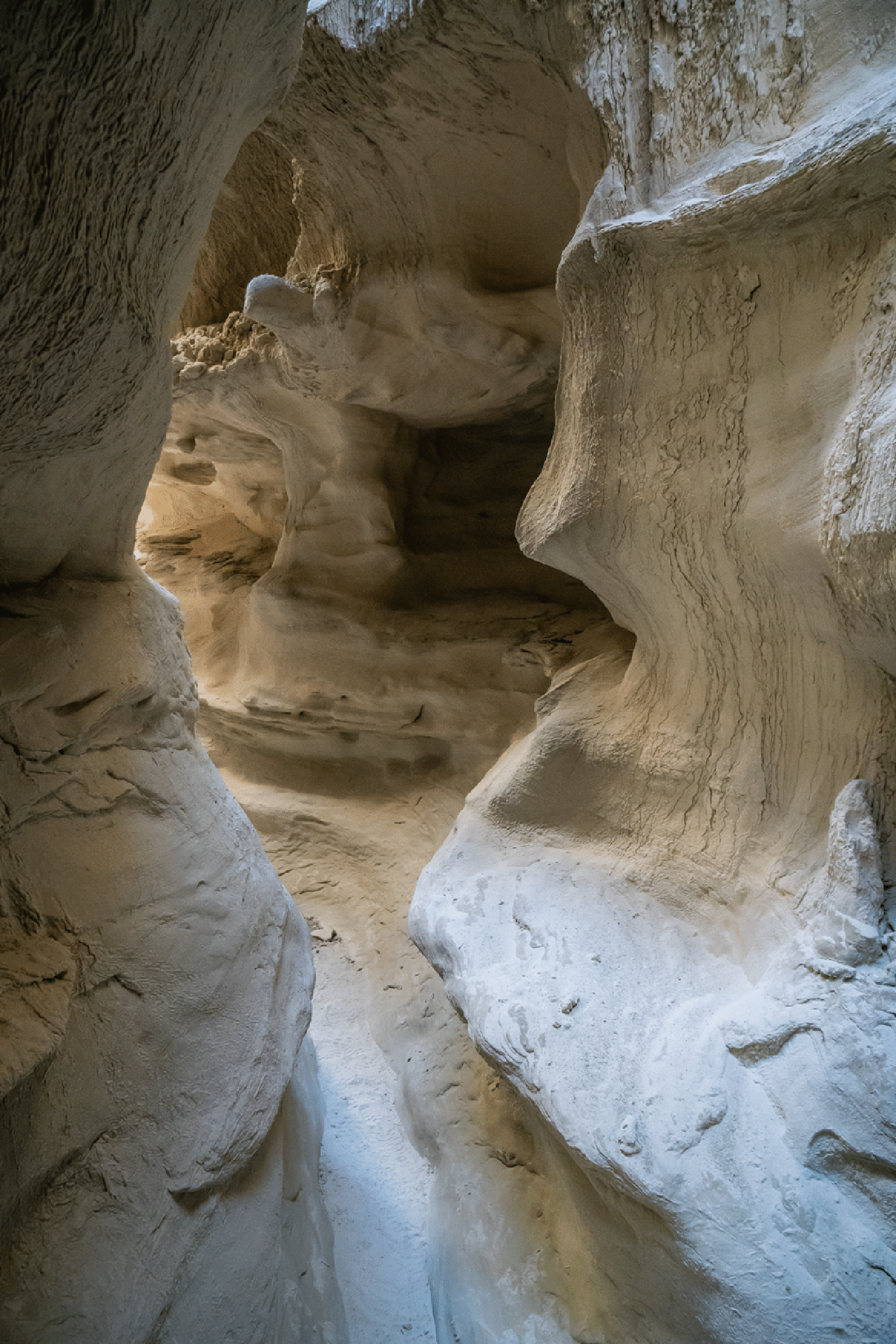
A slot canyon in Sidestep Canyon was pretty entertaining. Photo by Joe Buhler.
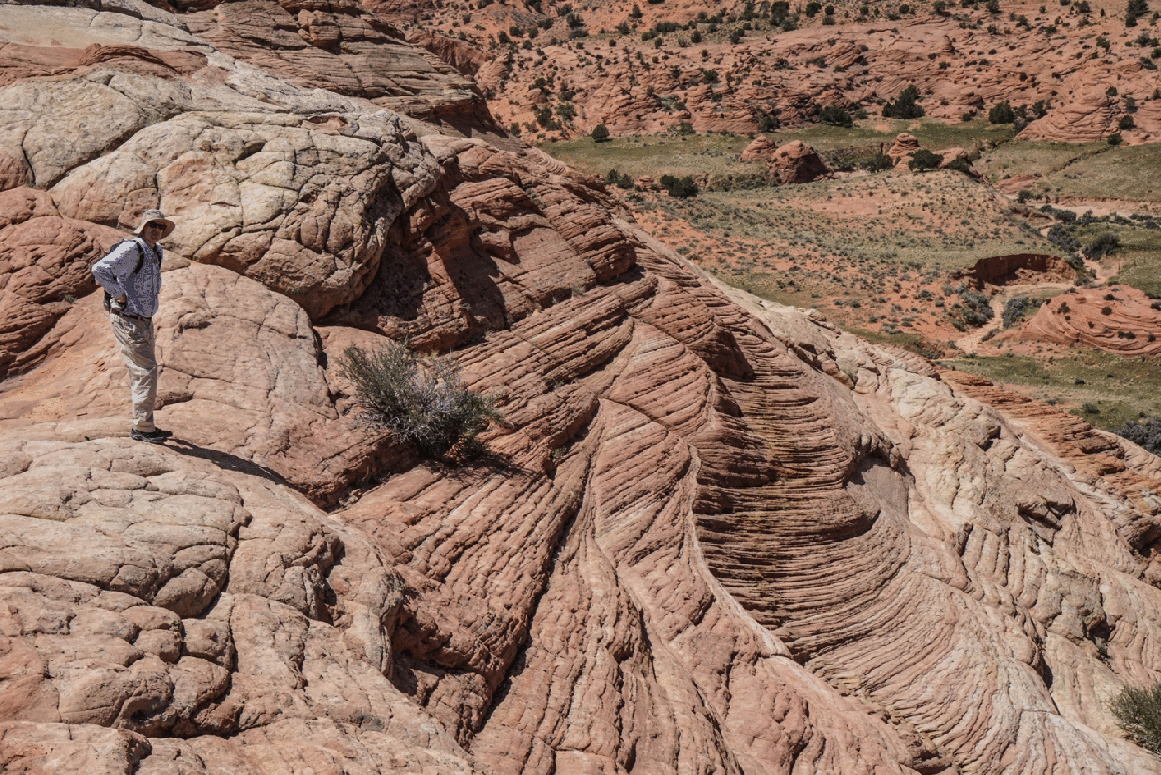
After exiting the slot by returning to our entrance we wandered up the north side of Sidestep Canyon, and it was excellent.
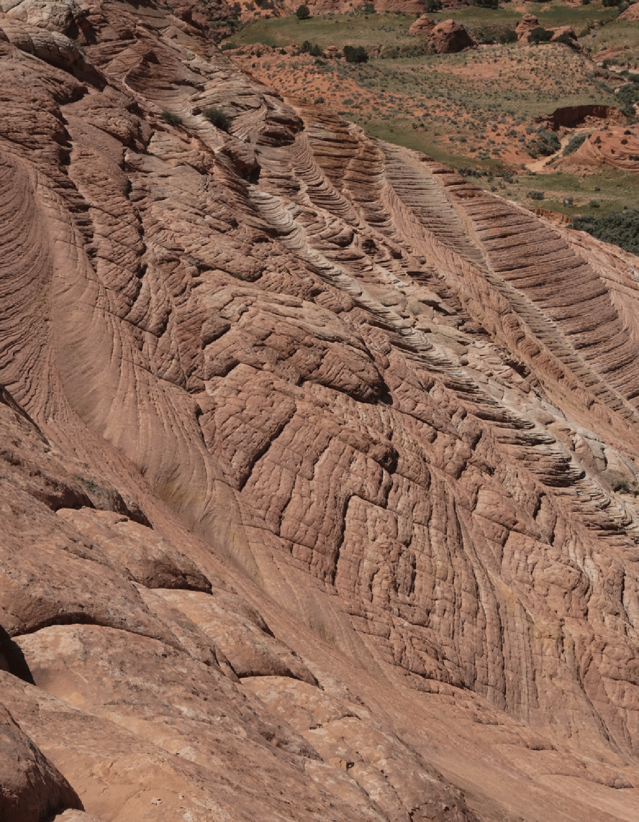
Note how in the photo below, the towers at upper left are coming out of the slope as the slope erodes. I need to return to this area!
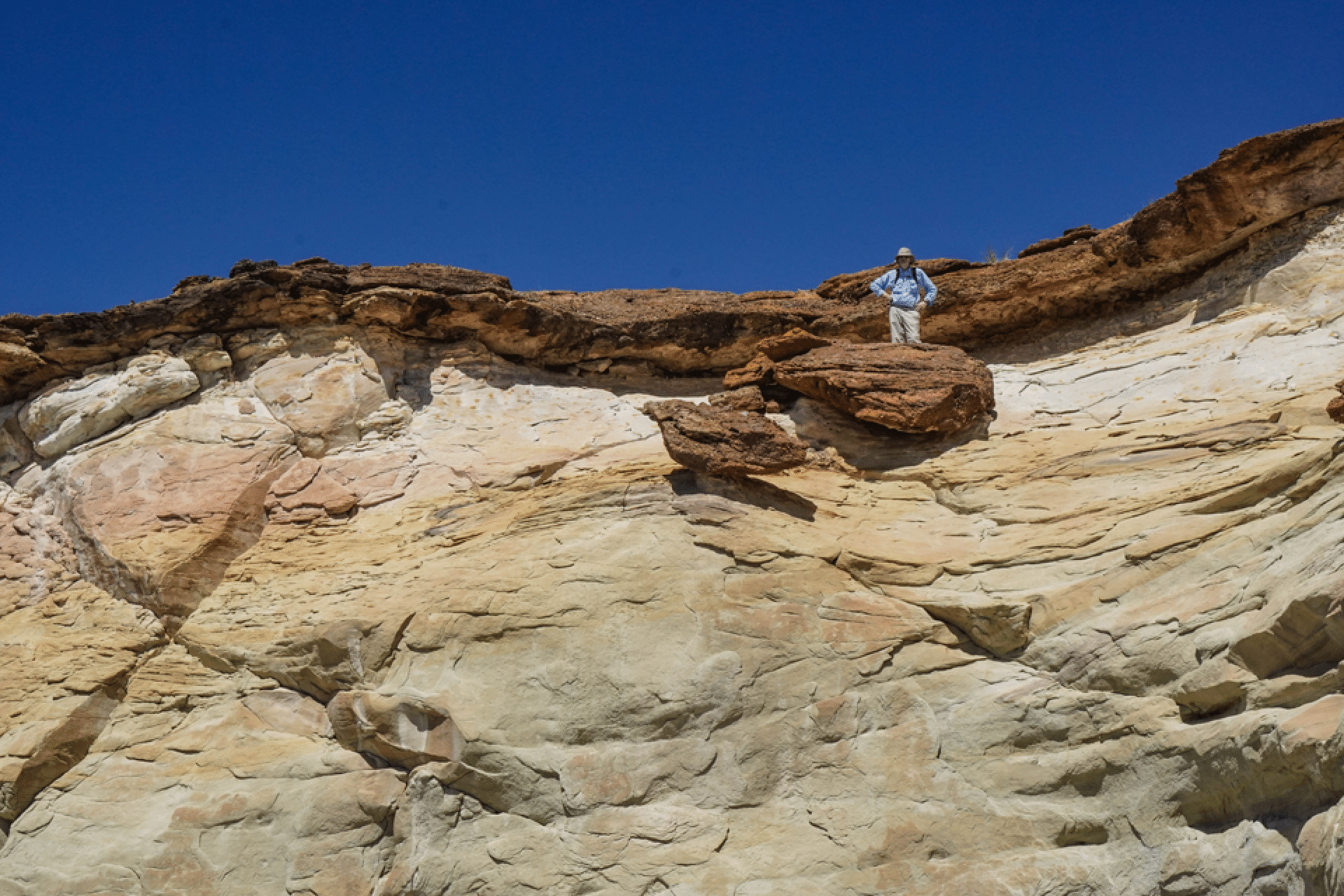
This was our exit to the rim. One short climbing move was needed to get over the top.
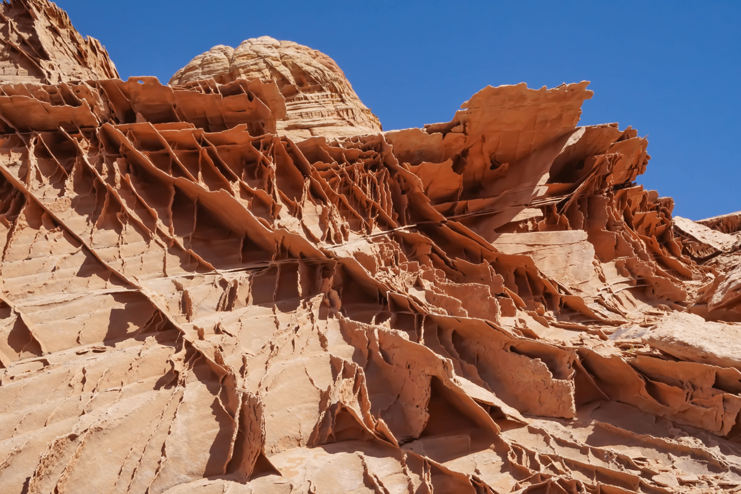
Edmaier’s Secret
The amazing lace rock near the top of the knoll. I have never seen anything like this anywhere else.
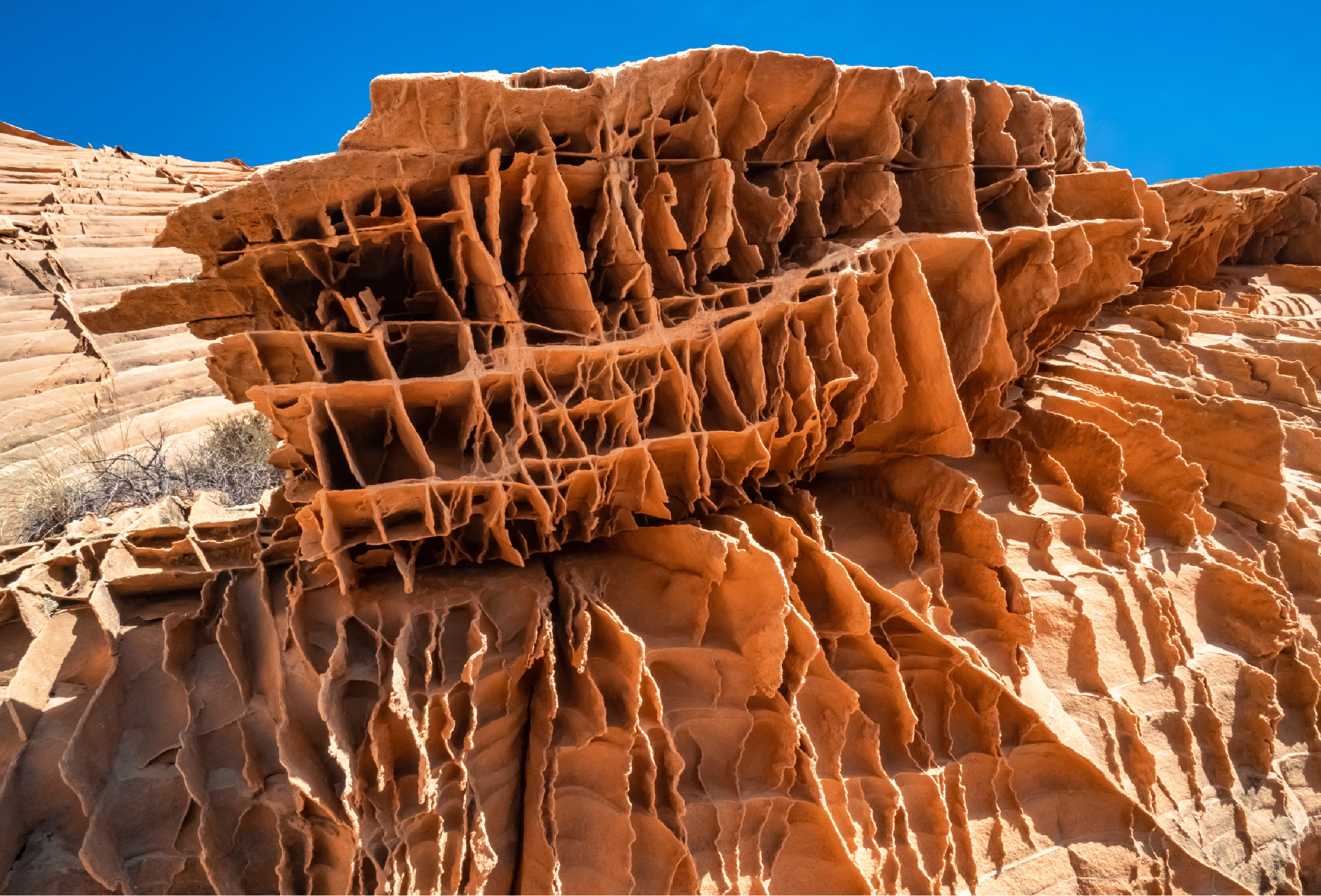
The lace rock is extensive.
The south side of the knoll.
Great sandstone formations on the south side as we descended to the Buckskin Gulch trail.
Natural Bridges National Monument
I had only my cell phone camera with me for the pleasant run from Sipapu Bridge to Kachina Bridge. All three of the gigantic bridges are spectacular. But Sipapu is the winner.
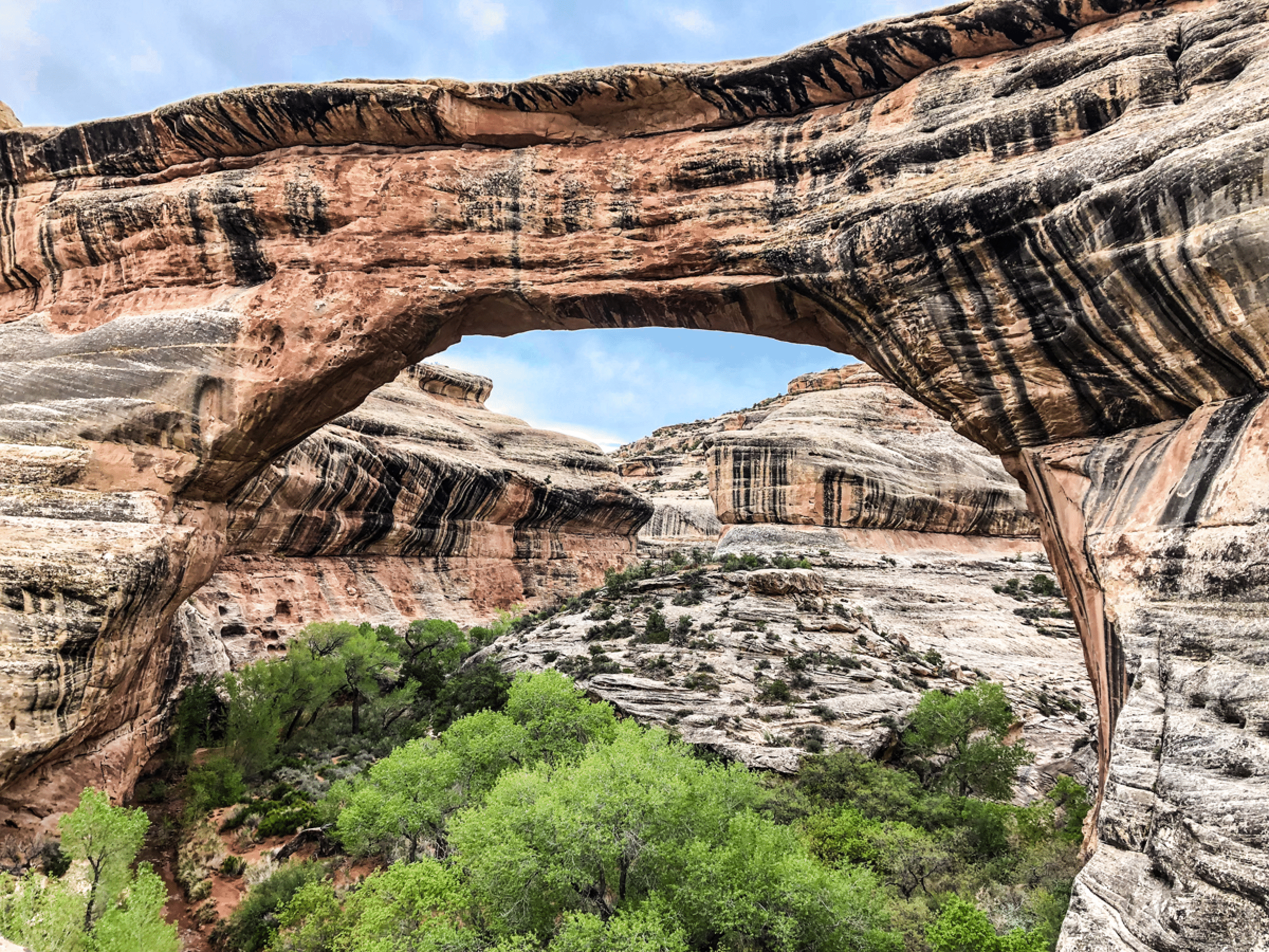
Lost Springs Canyon: Cavern Arch, Little Heart Arch
Cavern Arch:
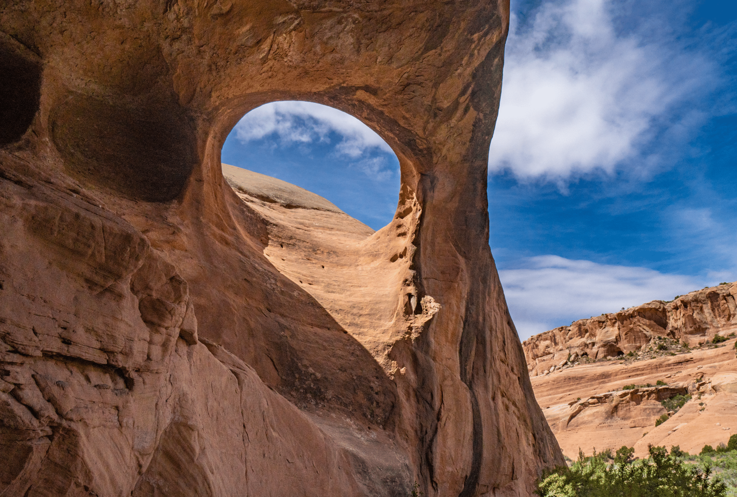
Around the corner from the cavern, we spotted this intriguing high arch. I now know that this is Little Heart Arch and is listed in the World Arch Database as four feet by two feet. Seems larger.