Page, Arizona (Rimrock Hoodoos, Edmaier’s Secret, Sidestep Canyon, Blue Wonder Slot, Yellow Rock, Red Top, Upheaval Dome)
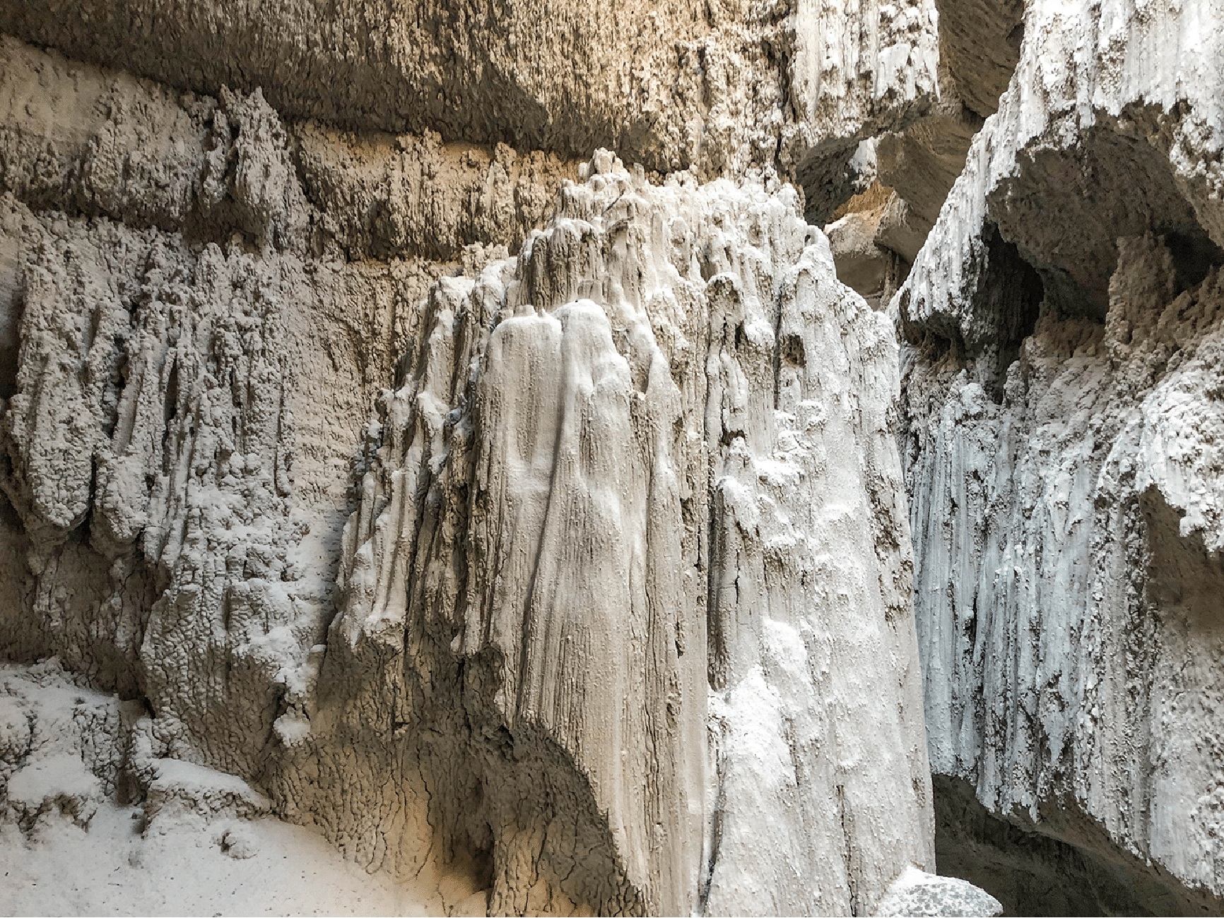
Above. The Blue Wonder Stalagmite (left); the Long-Necked Hoodoo at the Rimrock Hoodoos (right).
Trip Report
Personnel: David and Vicki Nebel (Portland, Oregon), Katie Larson (Montezuma, Colorado), Joan Hutchinson and Stan Wagon (Silverthorne, Colorado)
Nov. 8, 2019. Joan and I left Silverthorne at 11 am and reached Page, Arizona, at around 8 pm. David, Vicki, and Katie had arrived an hour earlier. We stayed in a VRBO house behind one of the dozen churches on Church Hill.
Nov. 9. Katie, David, Vicki, and I went to the Rimrock Hoodoos and up to the Toadstool Forest. We climbed up the steep canyon marked by the long-necked hoodoo (class 3). At the top we could view the Toadstool Forest from a distance, but we just turned around and descended an eastern canyon that was much easier than the steep ascent route. In the afternoon we went to Edmaier’s Secret and did a loop to the top of the knoll and then down the fantastic Navajo sandstone on the south side. Katie and I climbed the opposite slope as I wanted to try a panorama of the hillside in the late afternoon light.
Nov. 10. David, Vicki, and I climbed to Yellow Rock from the Cottonwood Road and took the trail route over towards the Paria River, with a side trip to Red Top. The area around Red Top was complicated and further exploration is needed, as the rock there was very beautiful. Then back and down to the Paria, which was a tedious and wet hike out to the car we left. The colors of Yellow Rock are well explained here.
Nov. 11. Sidestep Canyon with David and Katie. We left the rim on the S side of the canyon, which took a little looking around. We then descended and traversed on the mushroom-like bumps covering the intermediate level here, and descended down to the mouth of the slot canyon, which I had cursorily investigated last year. We entered the slot but David and Katie opted to wait while I explored it. We had no information as to what a through passage would entail.
The first step was not hard, and I went up and over and then carried on. The second also was not bad. The third step, however, was a jam up through a narrow spot and I had to leave my camera behind to get my body up and through. I suppose I could have tied it to my belt. It is possible that what I think of as the third step is really the second.
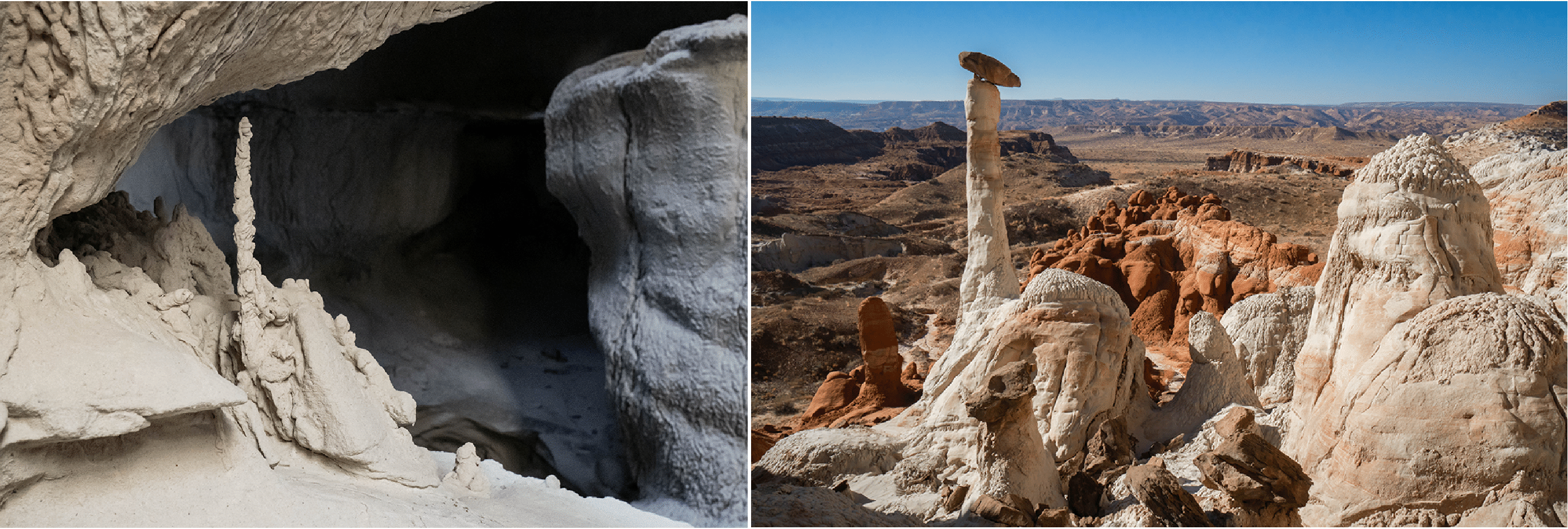
After that there was flat walking through the otherworldly shapes. One small delicate stalagmite was particularly beautiful, something I had never seen in similar canyons. Two more steps got me to the end and I went a bit farther to make sure I was fully through. I was. This was a very satisfying moment as the canyon was beautiful and, on entering, I had no idea what I would find. Returning was straightforward. I would say the hardest step was 5.6, and the four others were 5.2 to 5.5.
A few days later I learned that this canyon is guided by Nick Smith (Seldom Seen Adventures; https://seldomseenadventures.wordpress.com/slot-canyons-of-the-grand-saircase/) in Kanab; he calls it Blue Wonder Slot because of the blue light that reflects off the white walls in winter, when the sun is low.
We regrouped and wandered up and around the northern side, pausing for lunch at on overlook into the west fork of Waheap Canyon, and then down to the head of the slot canyon. First comes a side fork, and then we went right down to where I had just been. Katie and I entered the canyon and went down the uppermost two steps, and then back out. Of course I had my camera at that point, so could shoot some more, notably the stalagmite. We exited the head by a small narrow side slot, and then wandered up to the rim and out the path to the car. A most satisfying day!
Nov. 12. Joan, David, Vicki, and I drove out the Cottonwood Road and did the standard two-mile Cottonwood Narrows hike (S to N). At the N end the canyon continues and I think is quite good, but we explored only a short way.
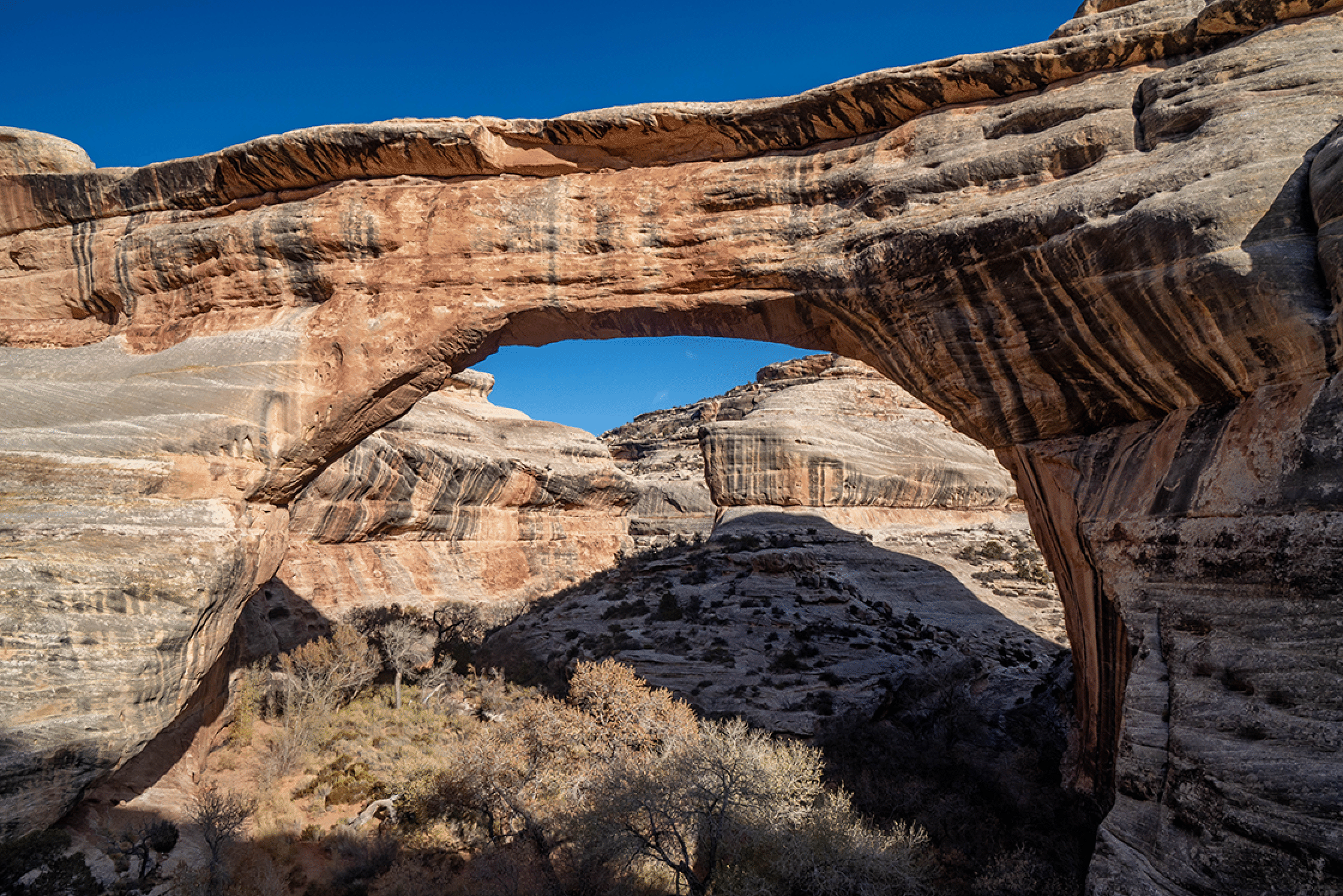
Nov. 13. Joan and I drove to Moab via the Moki Dugway and Natural Bridges. We hiked down to Sipapu Bridge and then a little bit upstream from the bridge.
Nov. 14. At Upheaval Dome I did an 11.2-mile circumnavigation and Joan wandered around on the trails.
Photos
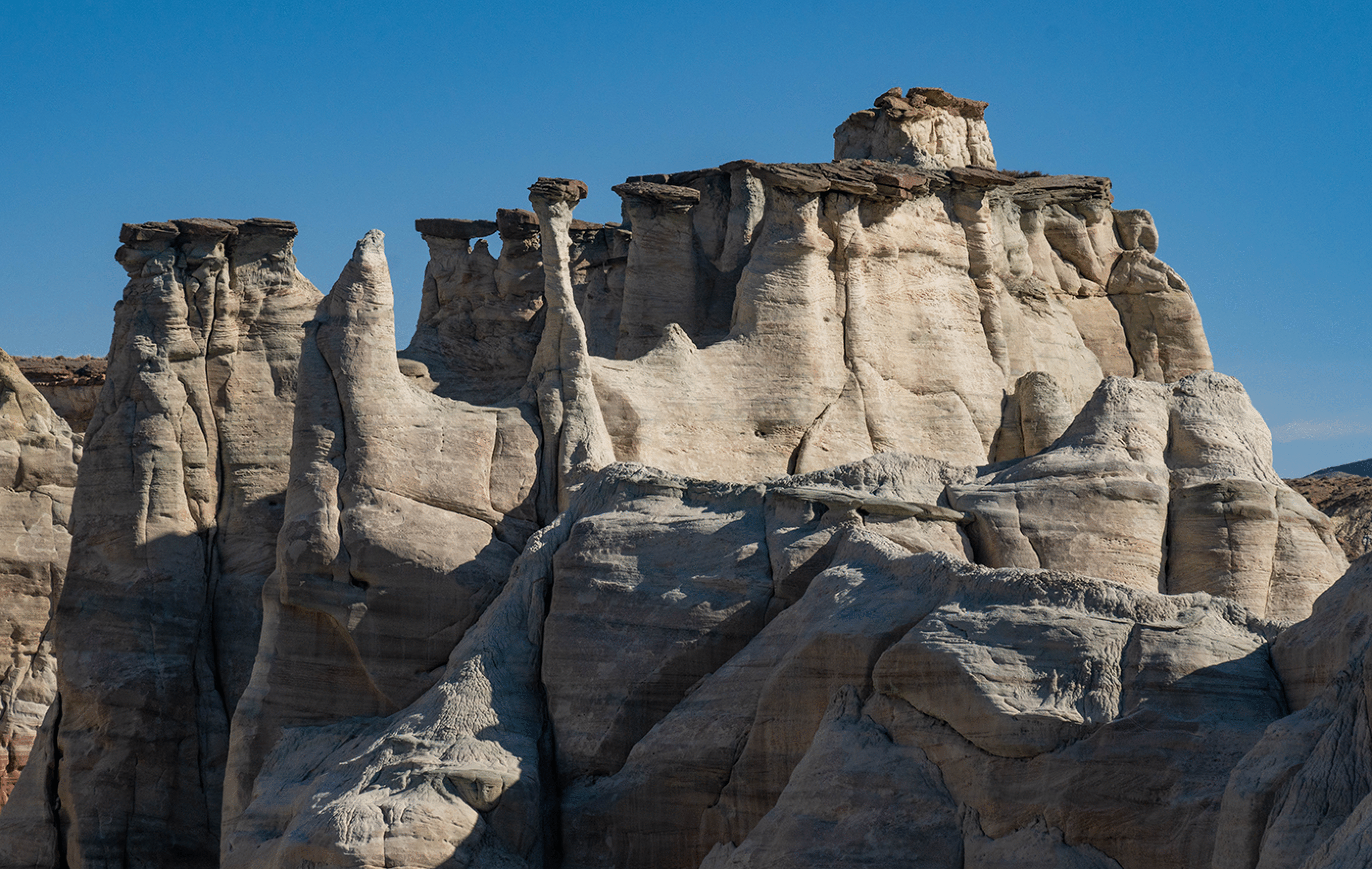
Rimrock Hoodoos
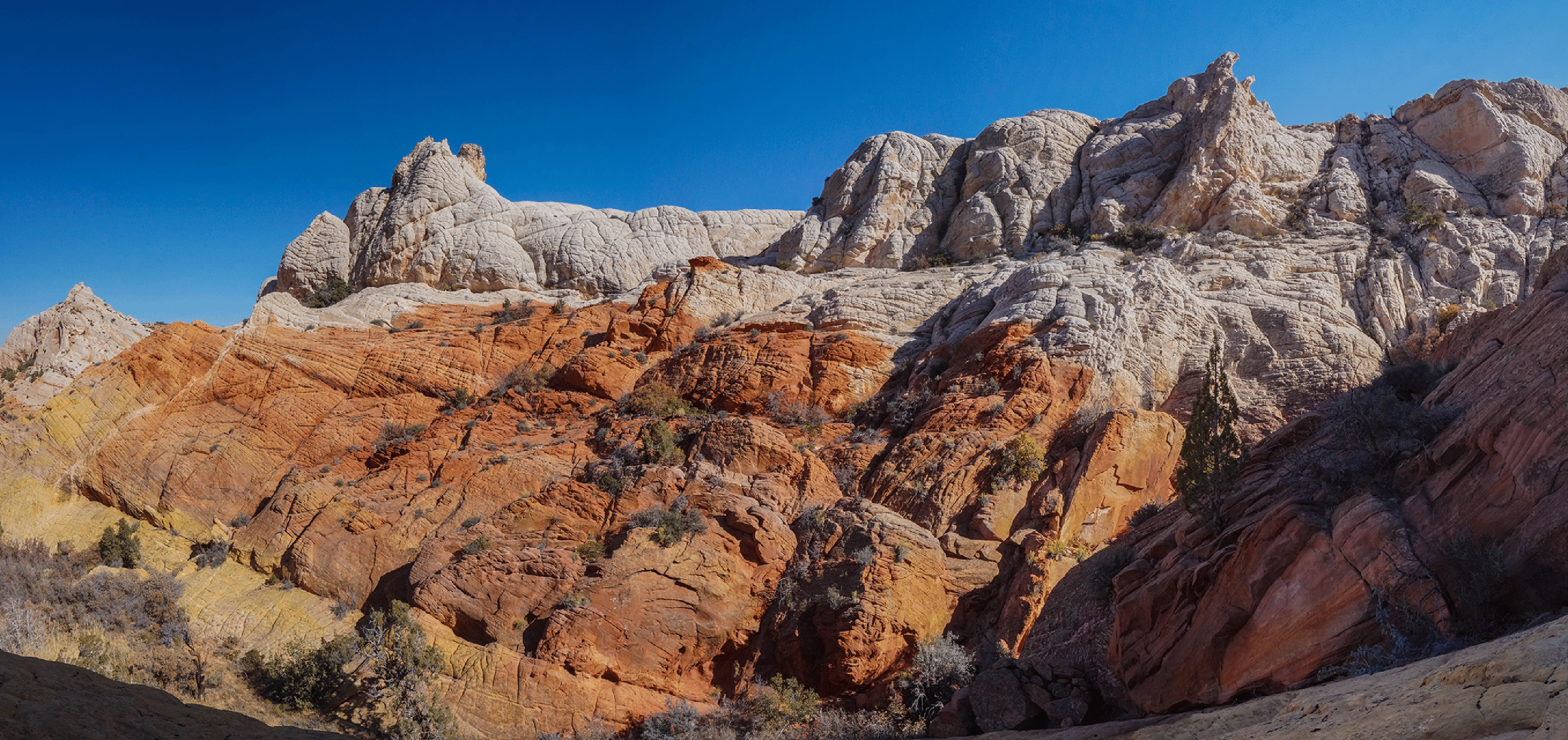
The tall hoodoo (known as the Long-Necked Hoodoo; see http://www.synnatschke.de/trr/trr.html) one passes when ascending a white canyon to the Toadstool Forest. The erosional patterns in the Entrada sandstone are very striking. Route 89 is in the valley. These towers form because the upper Dakota sandstone is more resistant to erosion. What is somewhat mysterious is that many millions of years are missing here: there is no Summerville or Morrison formation. That unconformity is what makes this area so rich in hoodoos. This image appeared in the Earth Science Picture of the Day program: https://epod.usra.edu. (to appear)
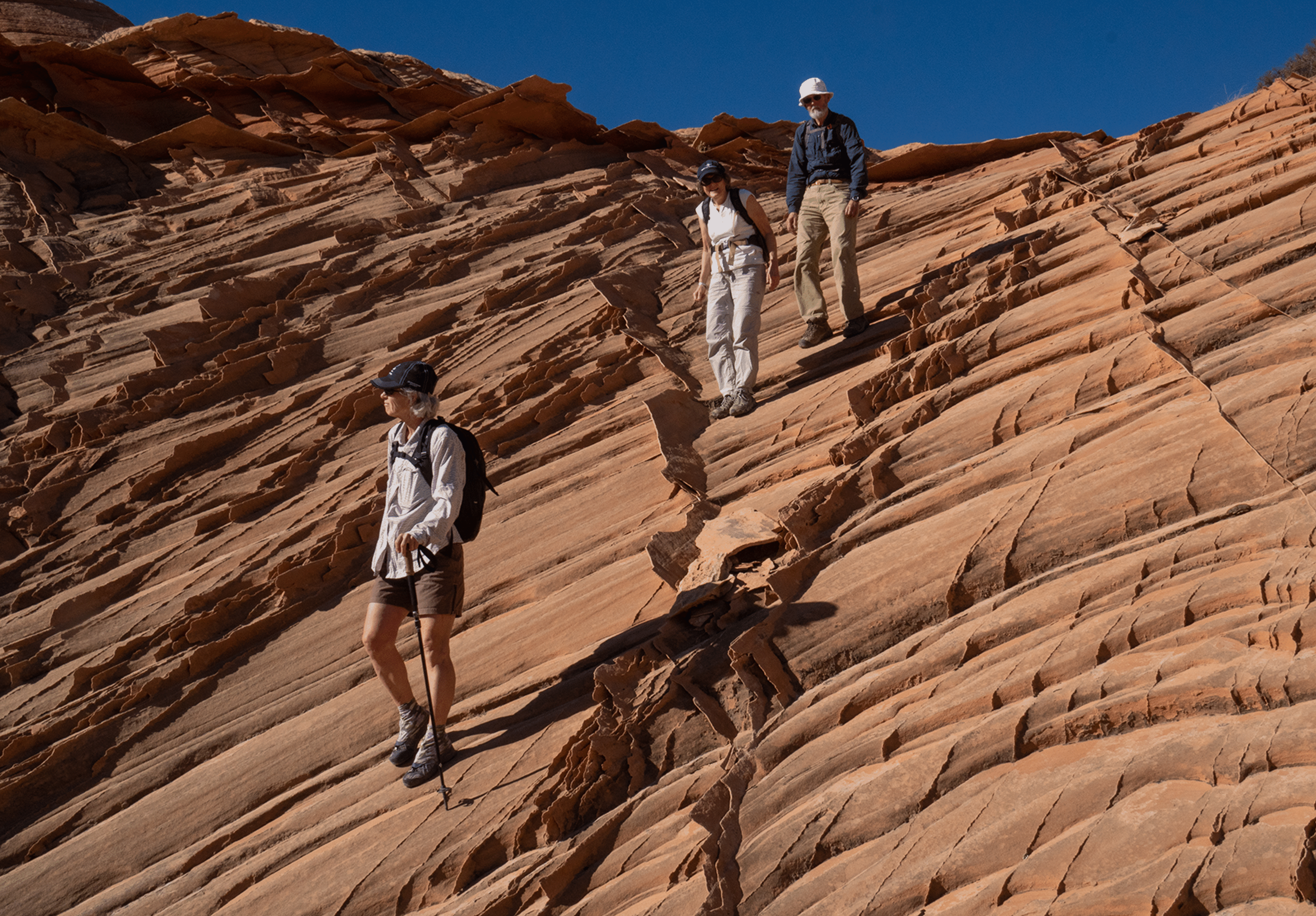
Katie, Vicki, and David in the ascent canyon.
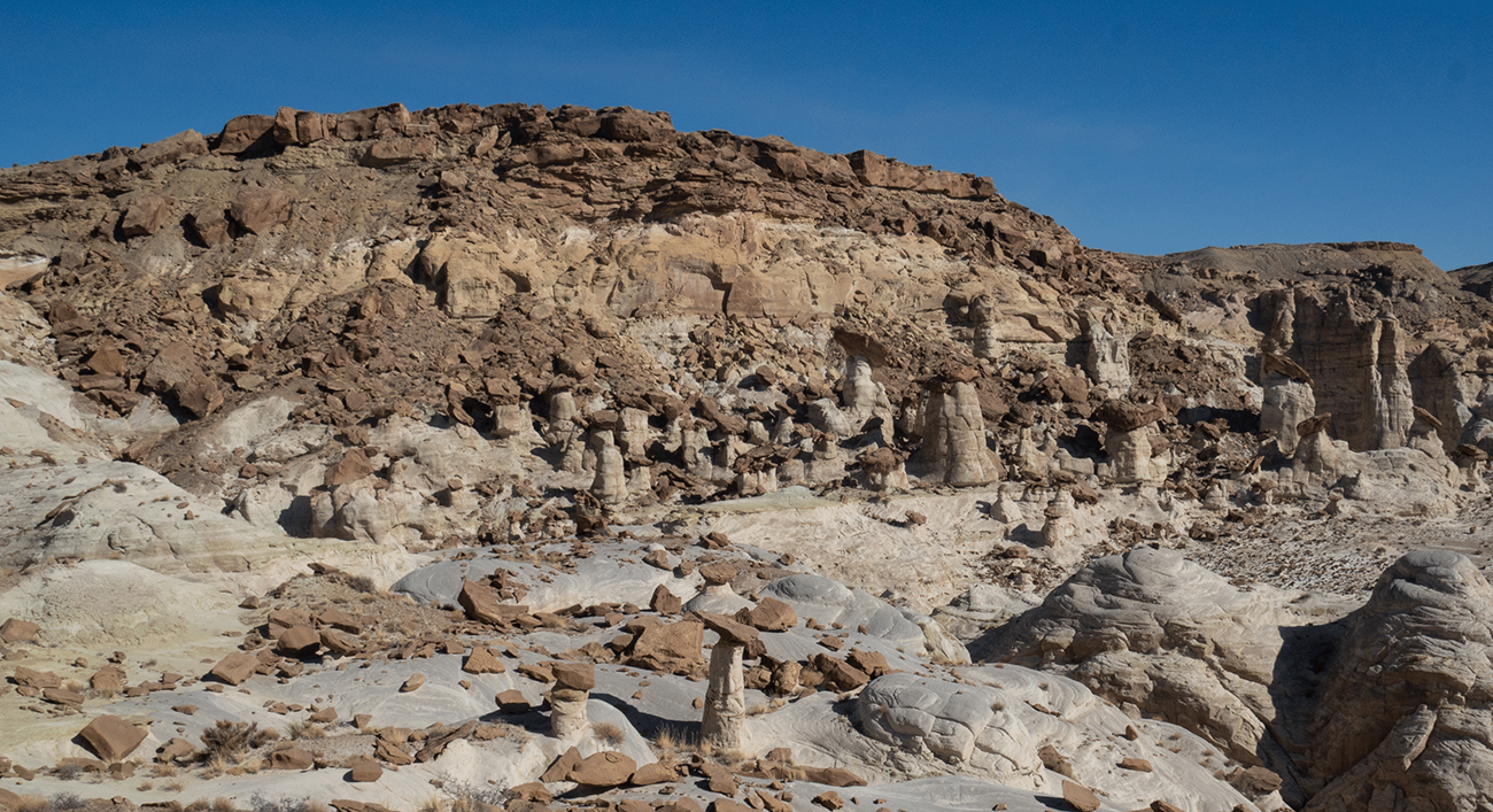
The view of the Toadstool Forest as one reaches the top of the canyon. One can also reach the area from the Cottonwood Road, descending into it from upper left out of frame.
We took a different descent canyon to return to the bottom. The terrain was easy to travel on and had, of course, many nice hoodoos.
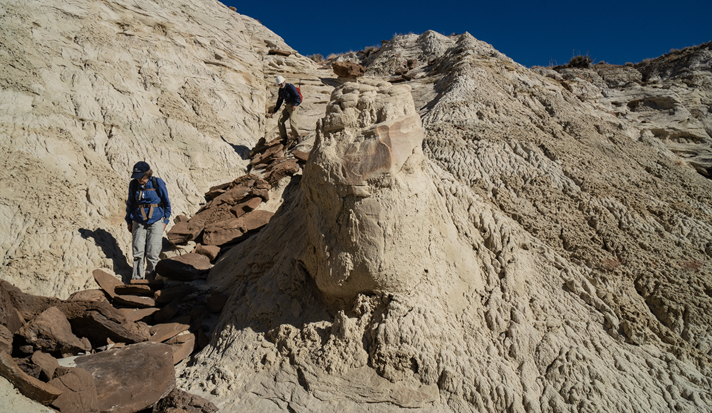
Vicki and David descending a Dakota caprock staircase.
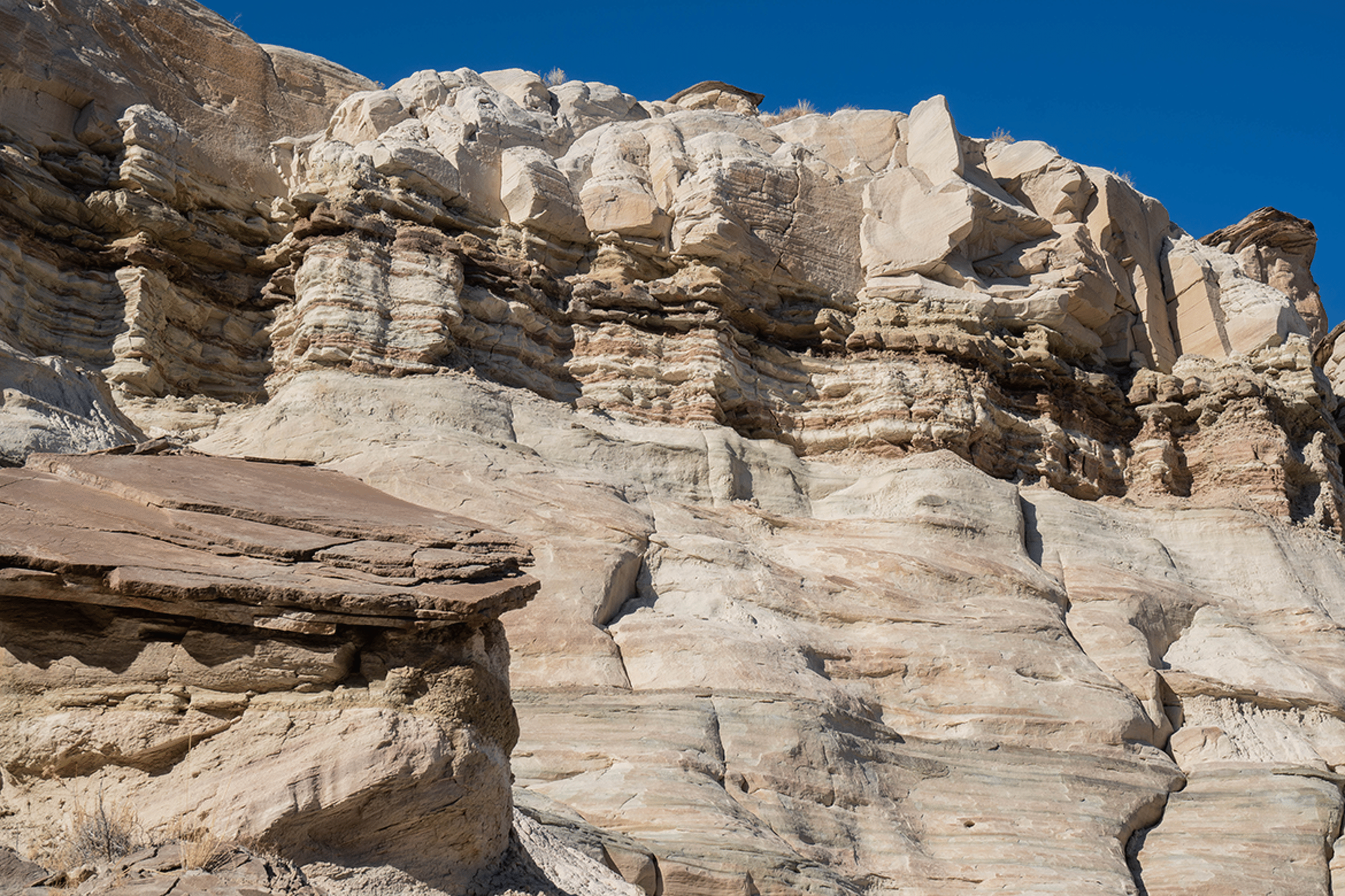
Edmaier’s Secret
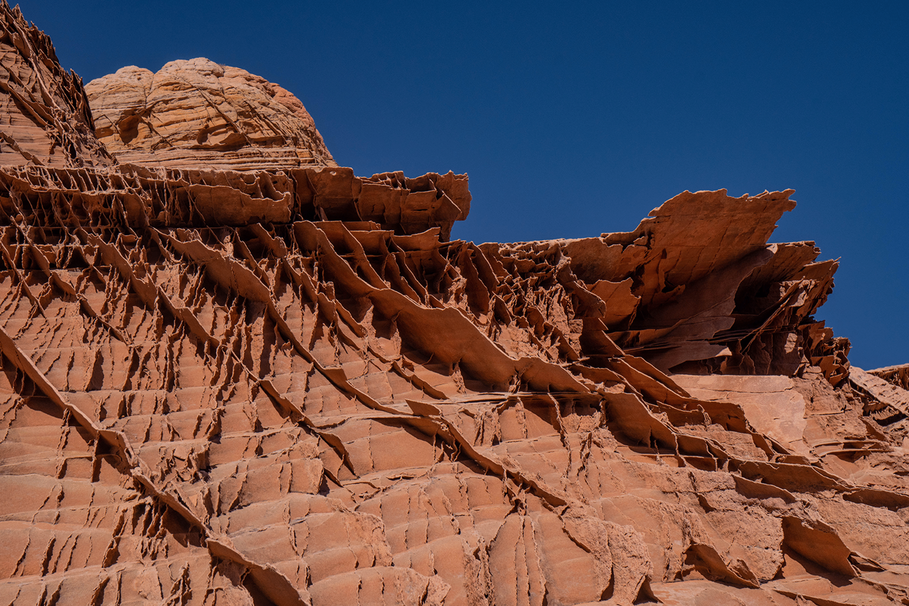
The lace rock near the top of the Edmaier’s Secret knoll is unlike any I have ever seen.
Descending the knoll.
Descending the south slopes of the knoll, back to Buckskin Gulch.
A panorama of the south end. We descended the wall at left.
Closer view of the wall.
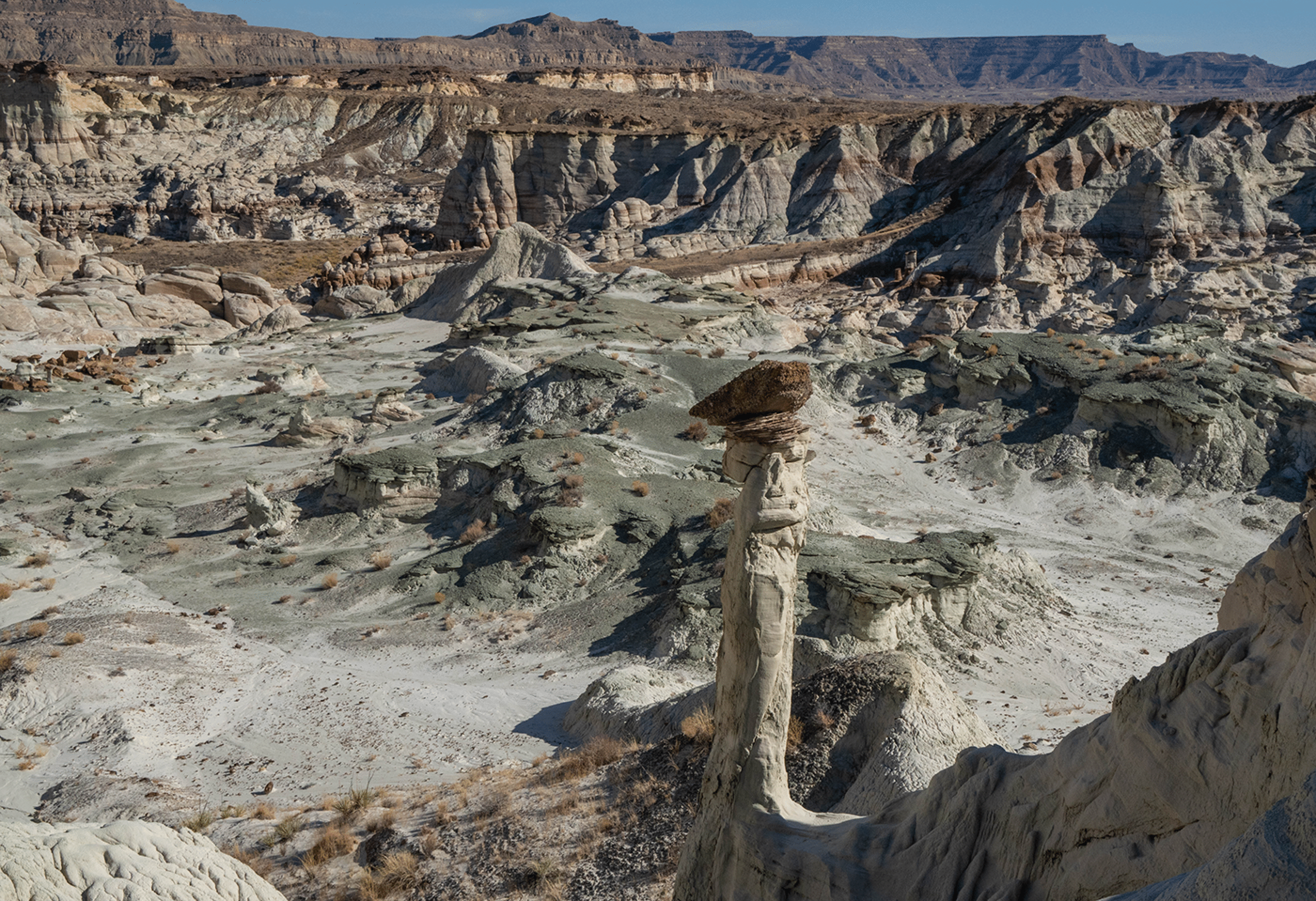
Yellow Rock and Red Top
https://epod.usra.edu/blog/2011/10/yellow-rock-cottonwood-canyon-road-utah.html has a great discussion of the geology and chemistry of the Navajo sandstone in this area.
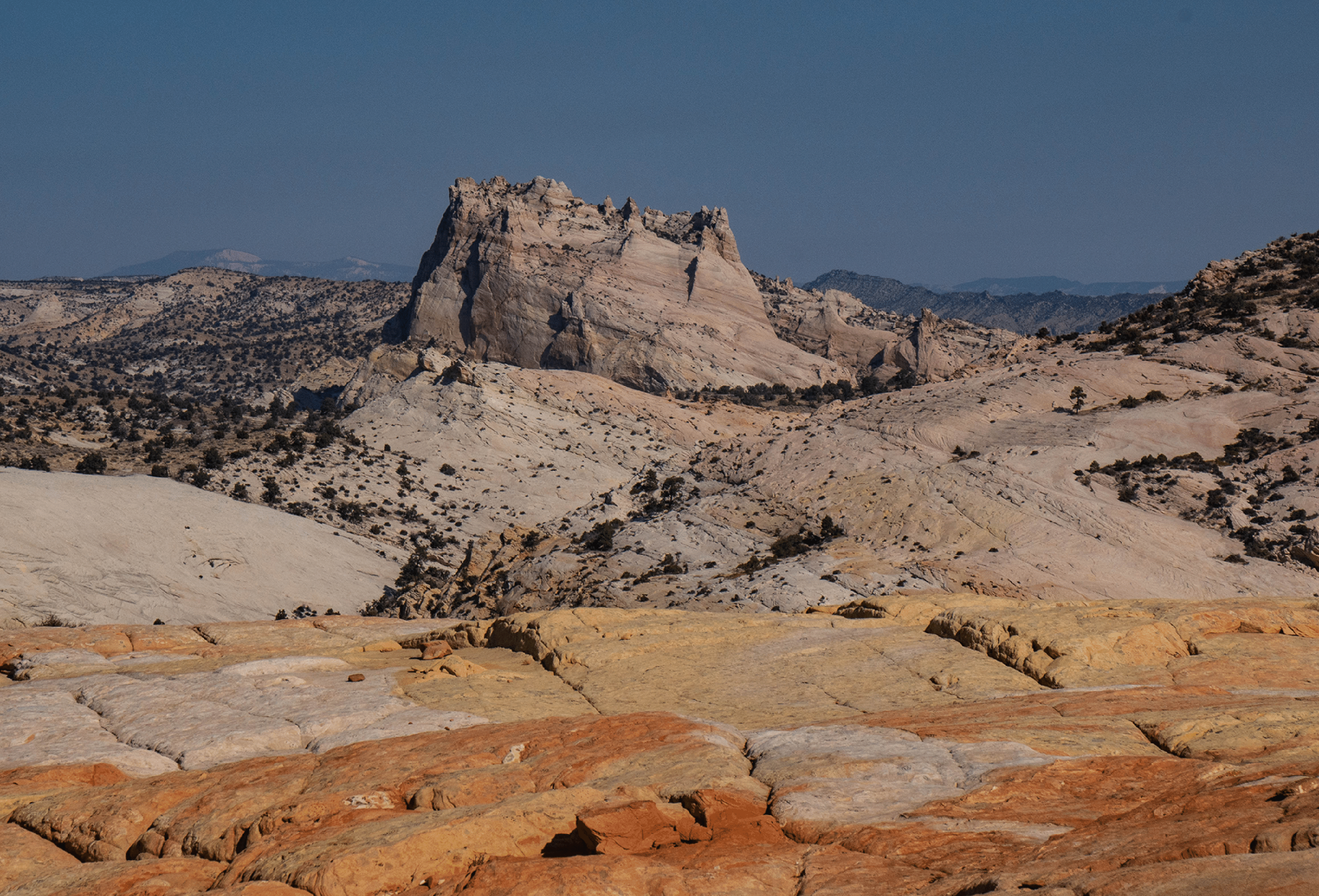
The view north from the top of Yellow Rock. The Big Cottonwood Hoodoo is just visible in center (I visited that a couple years ago). The yellow here is Limonite (see link above). It is derived from iron, as is the red.
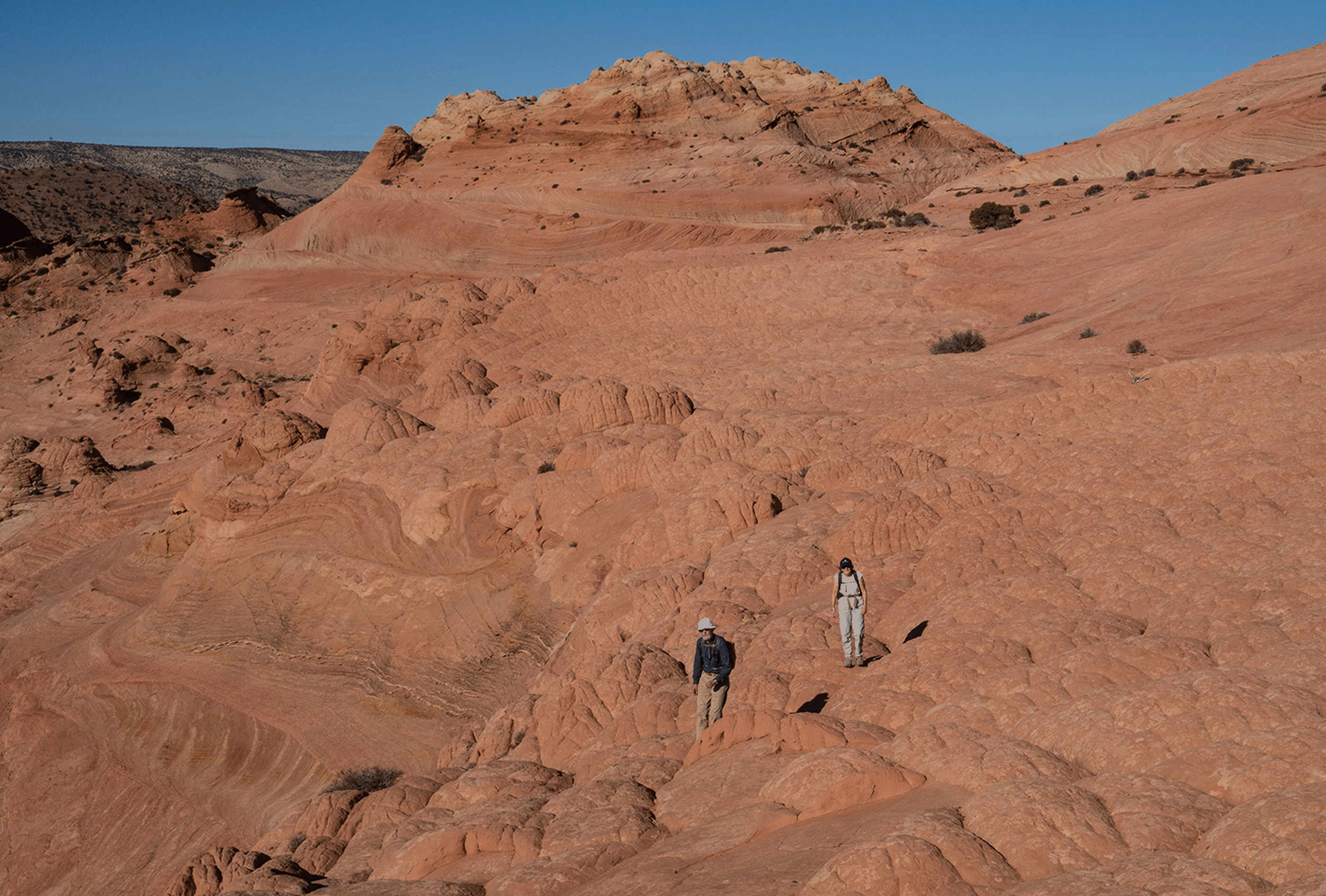
David and Vicki descending Yellow Rock. From here we took a long and pleasant cairned trail to near Red Top.
The SE side of Yellow Rock.
The navigation to Red Top was tricky. This shows the final climb to a great plateau.
The view east from near Red Top; this is an 11-frame panorama.
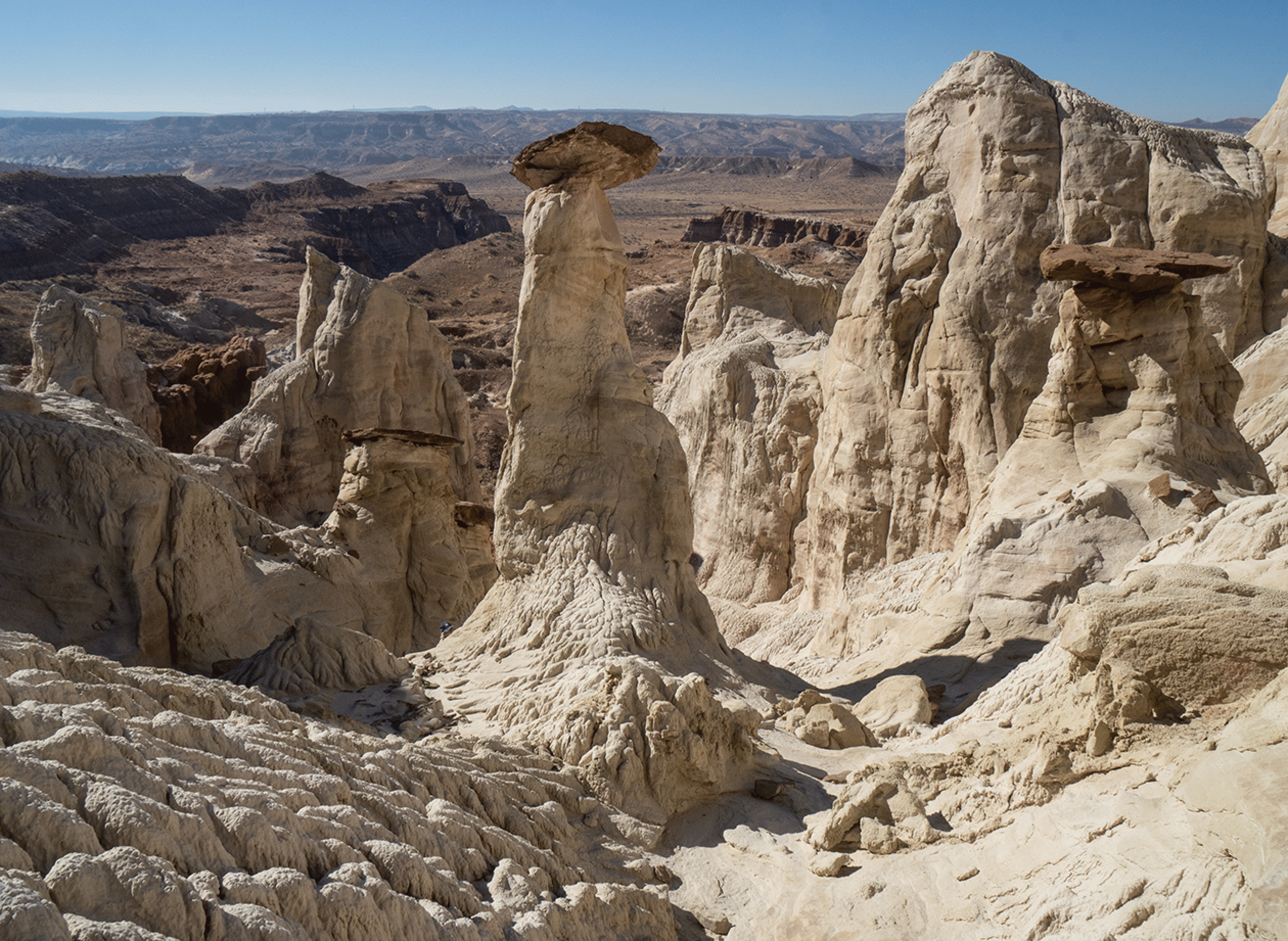
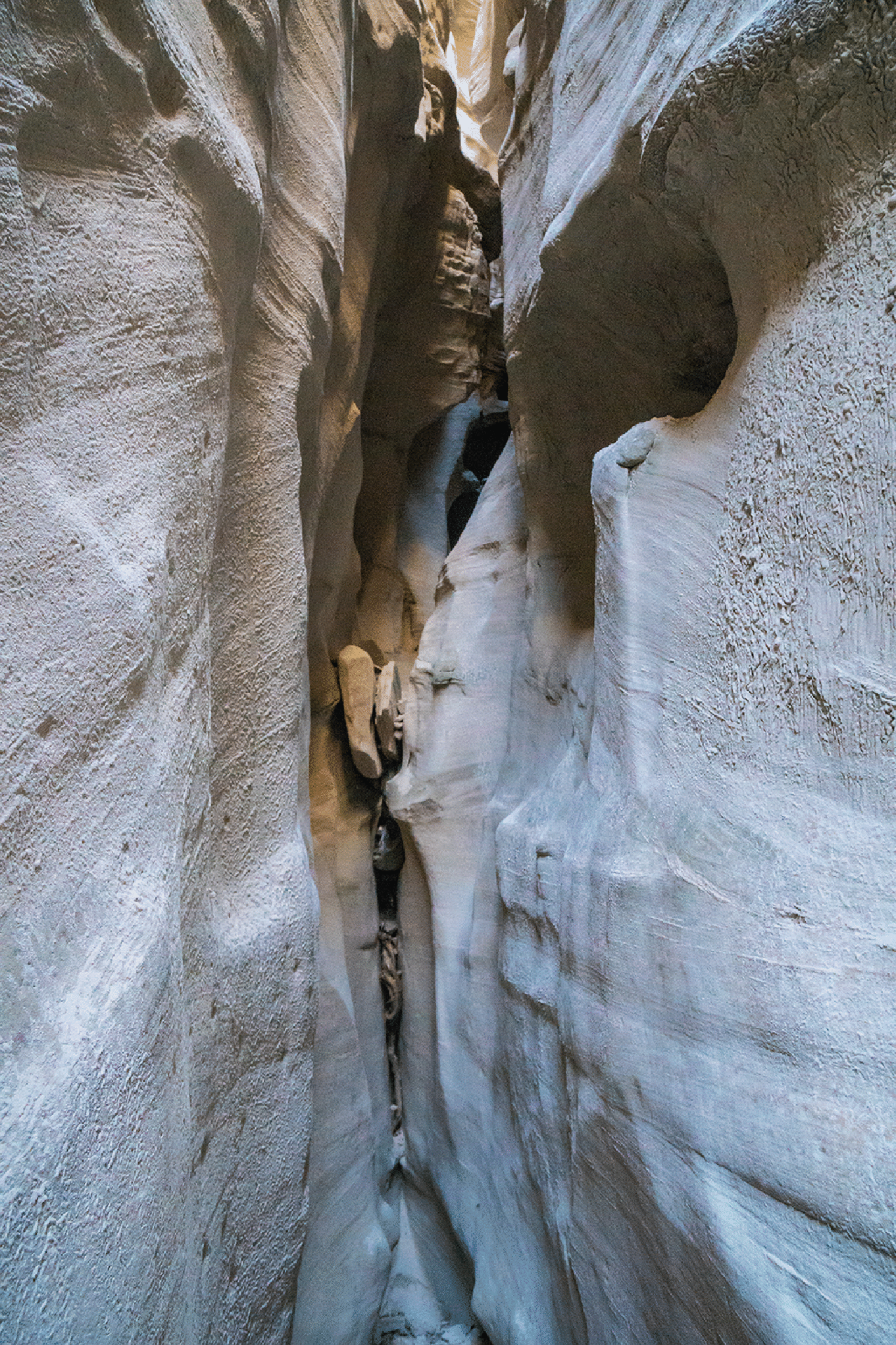
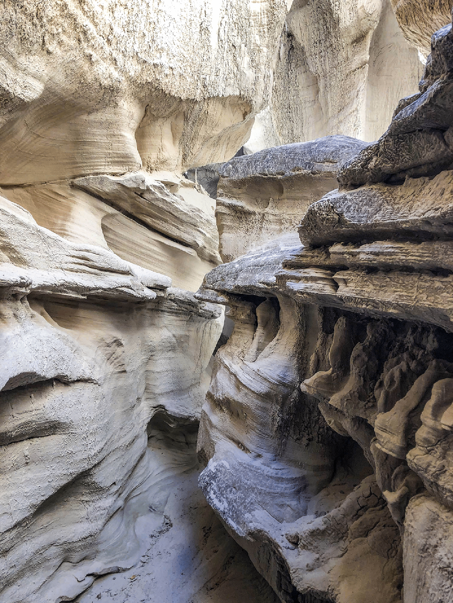
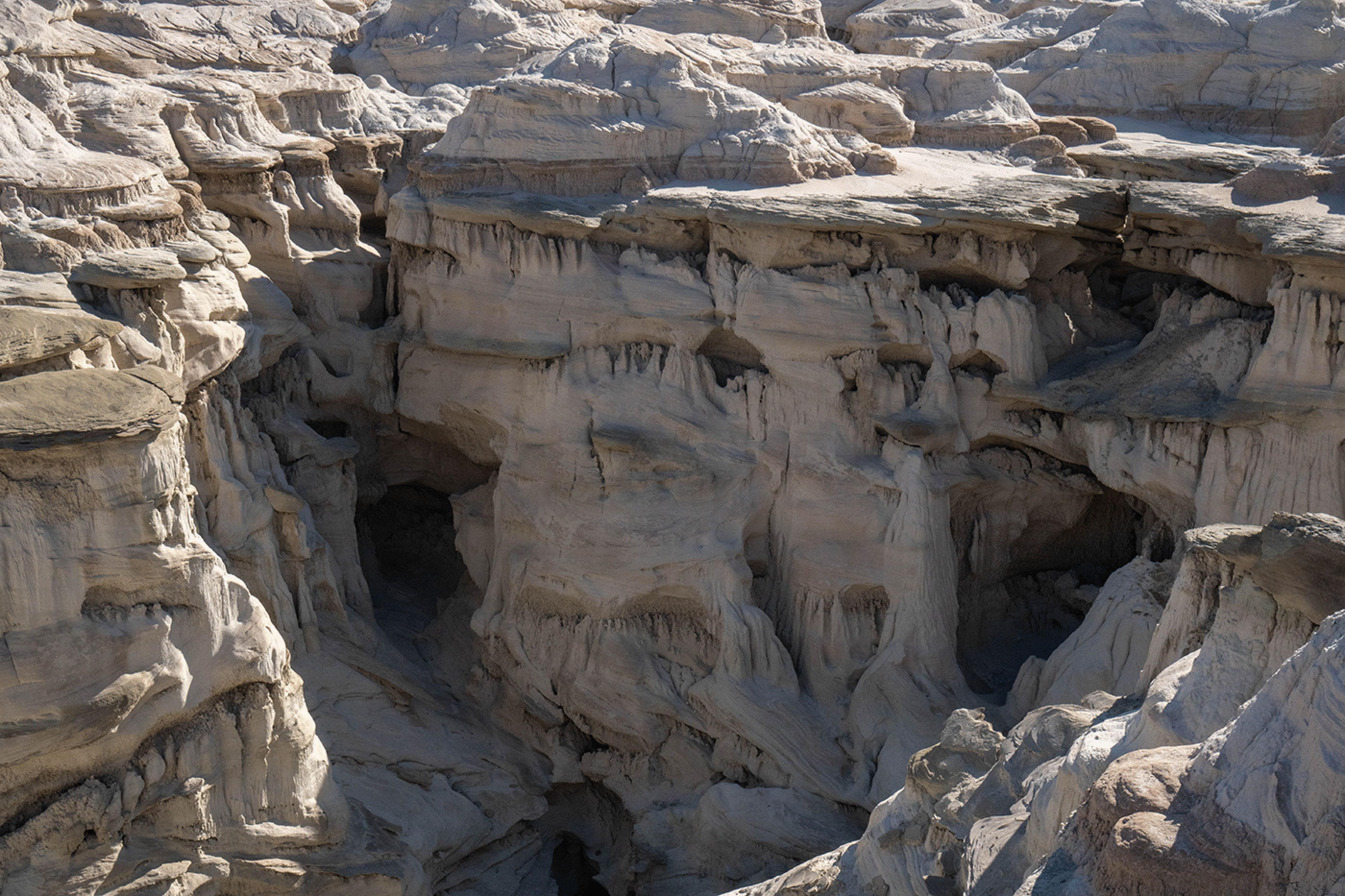
Blue Wonder Slot in Sidestep Canyon
Our entrance into Sidestep was by the grassy slope just left of center, and then the exposed traverse above the cliff at left.
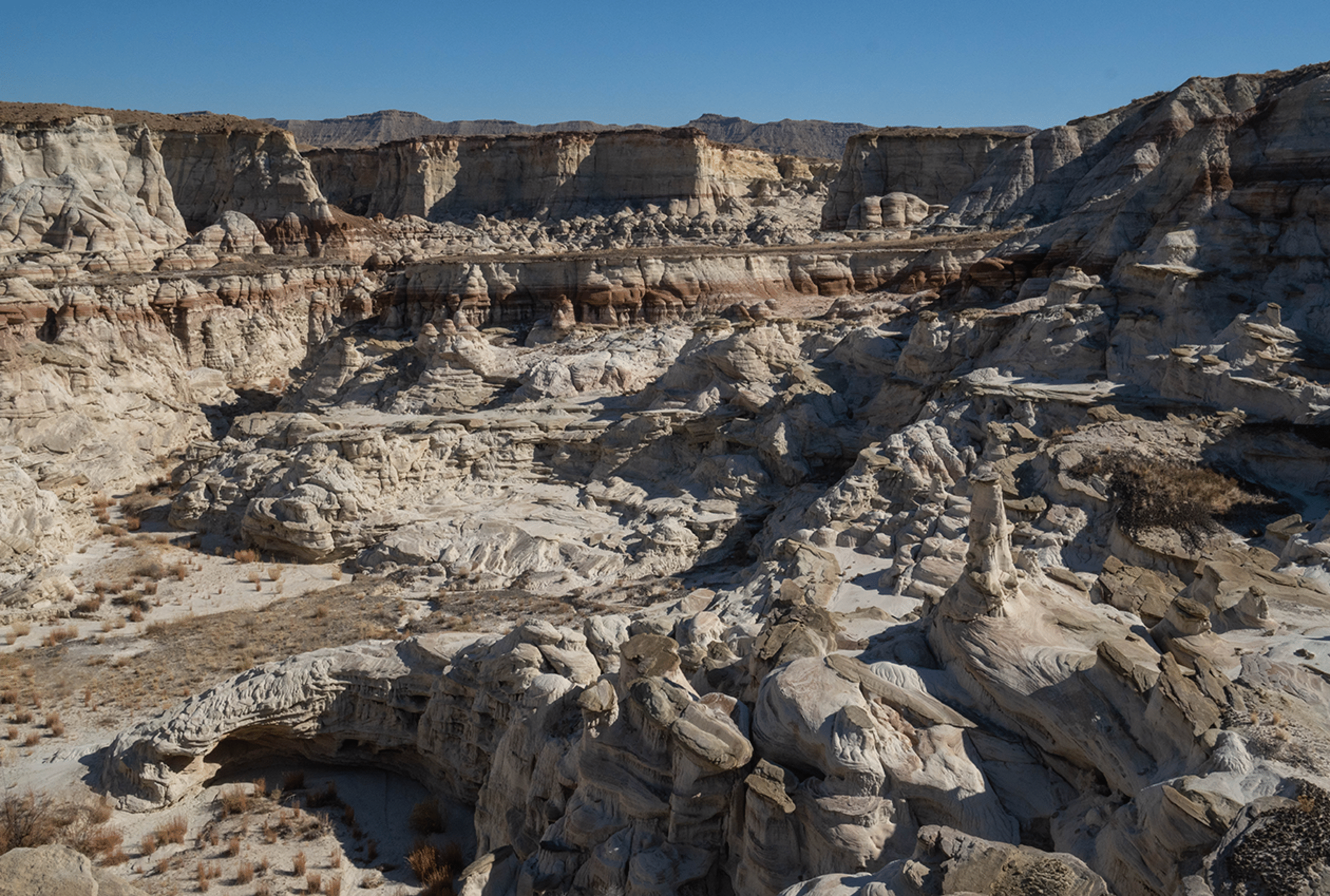
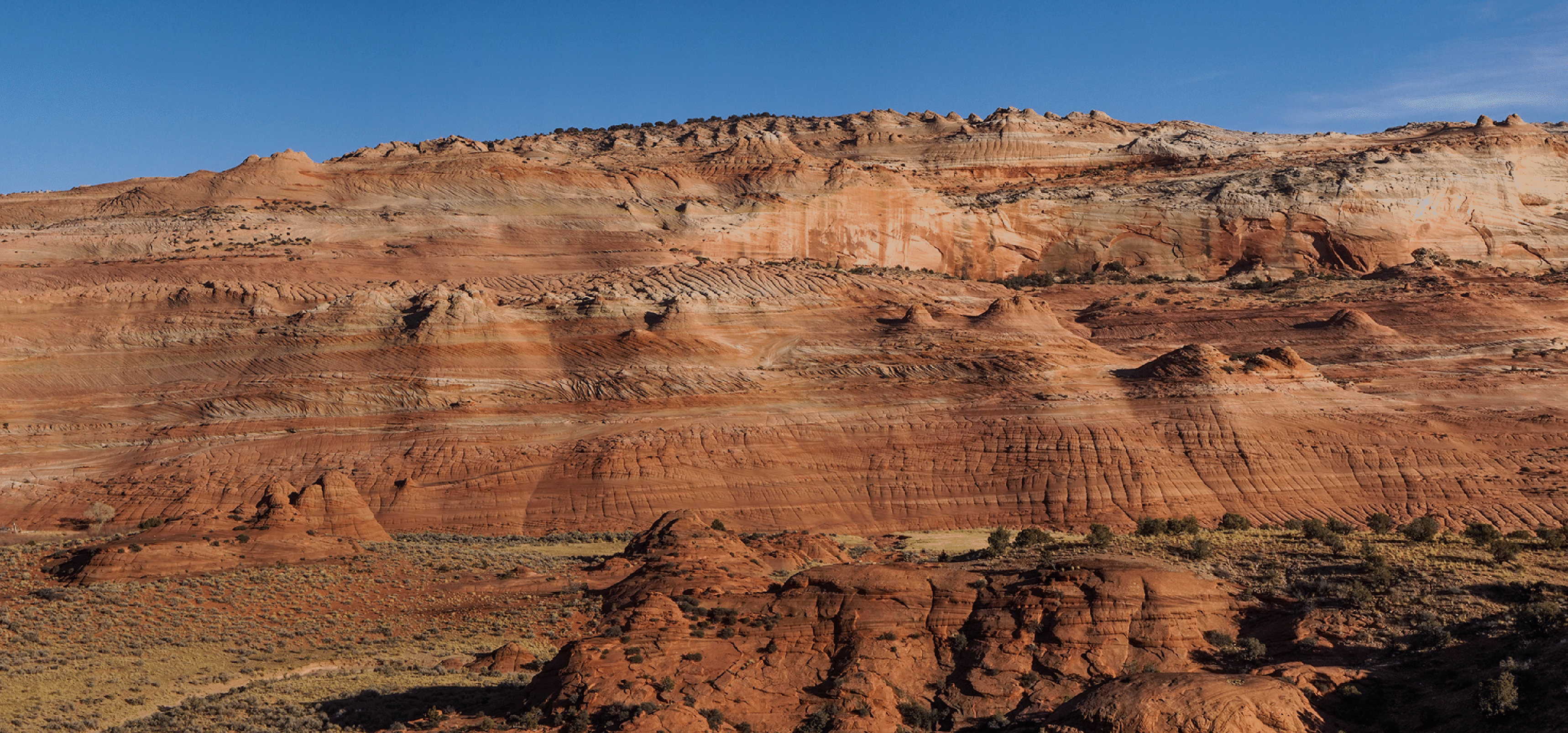
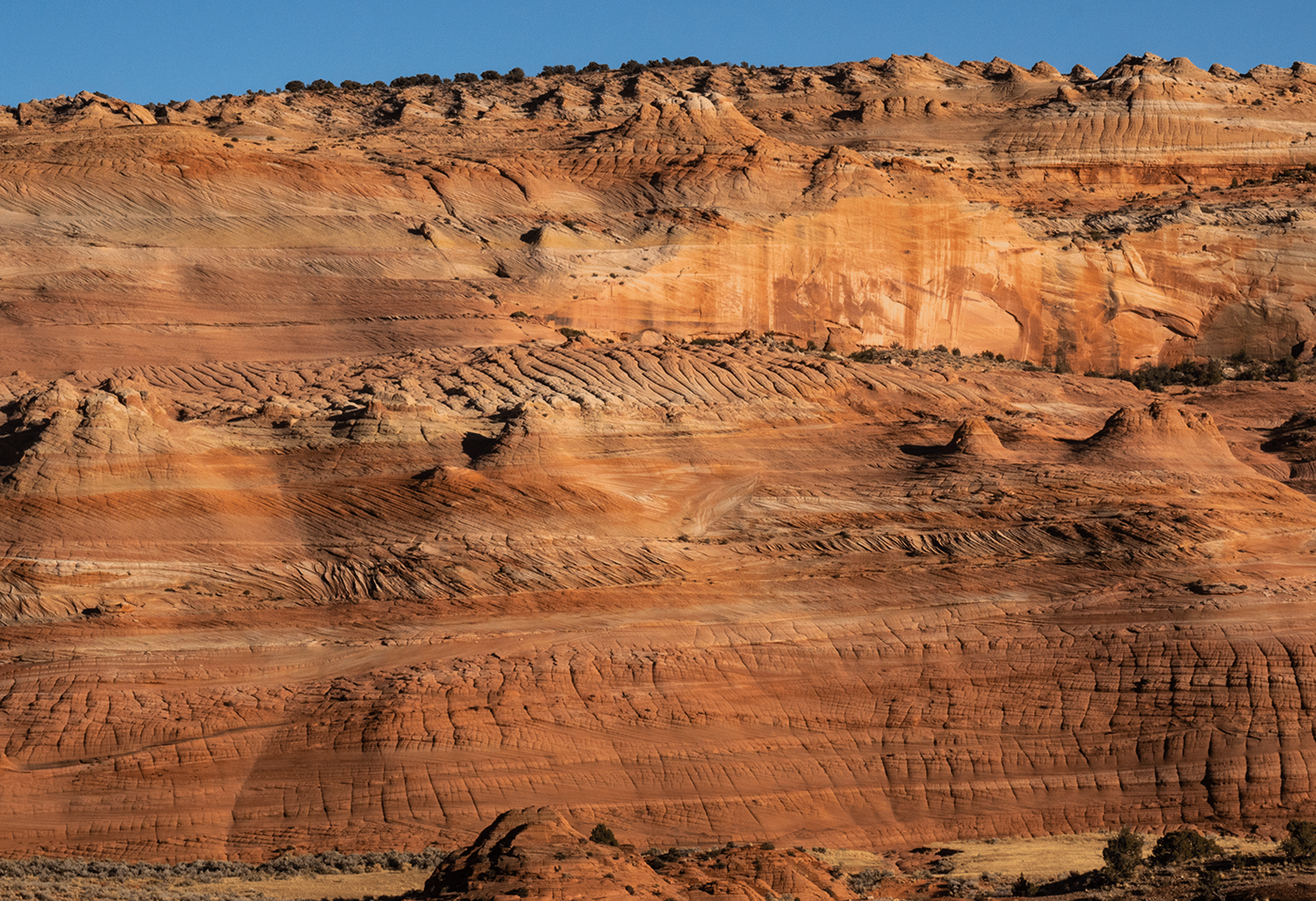
Our first view of the interior of Sidestep Canyon, which contains Blue Wonder Slot. The large wall in rear is a wall of the large canyon that is the West Fork of Wahweap Canyon.
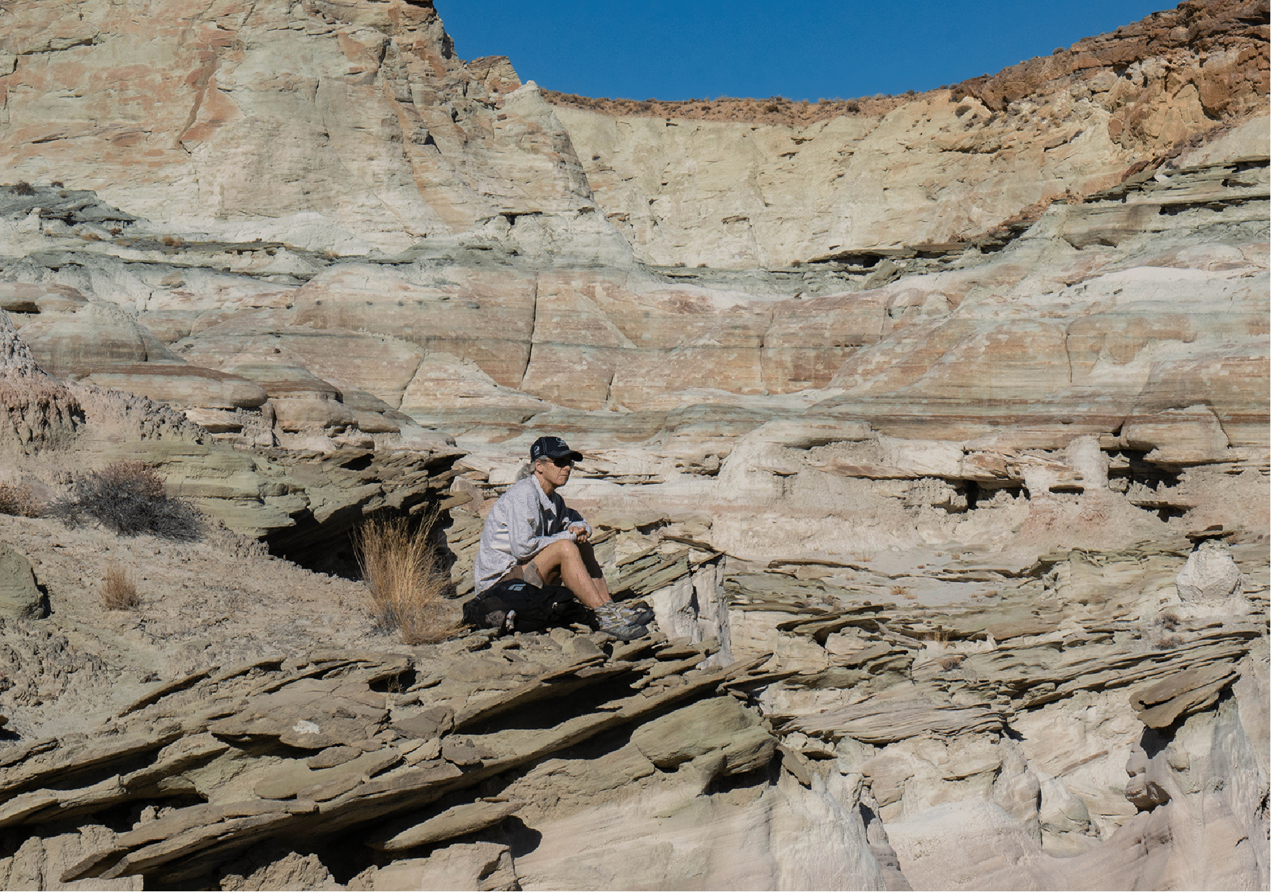
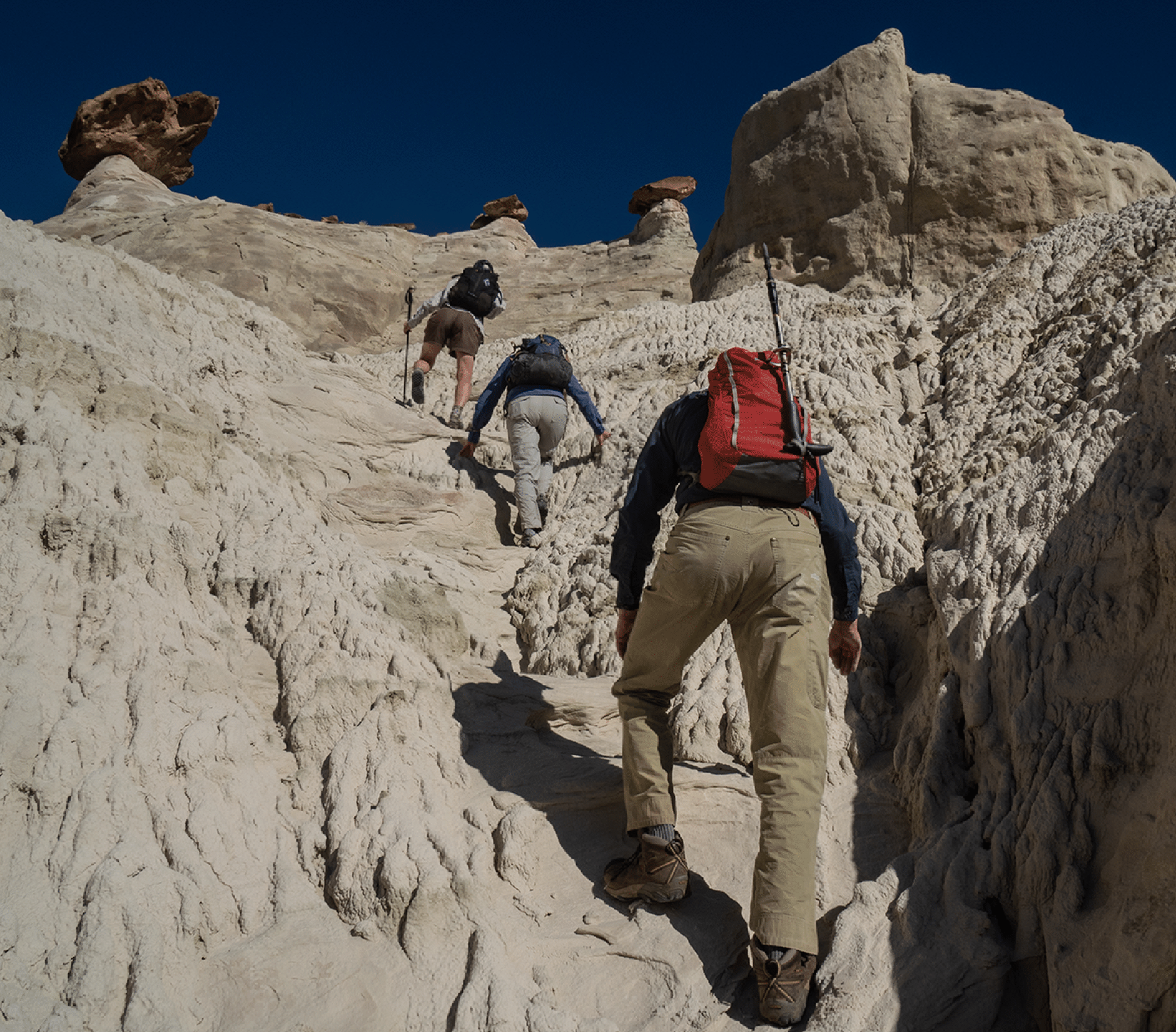
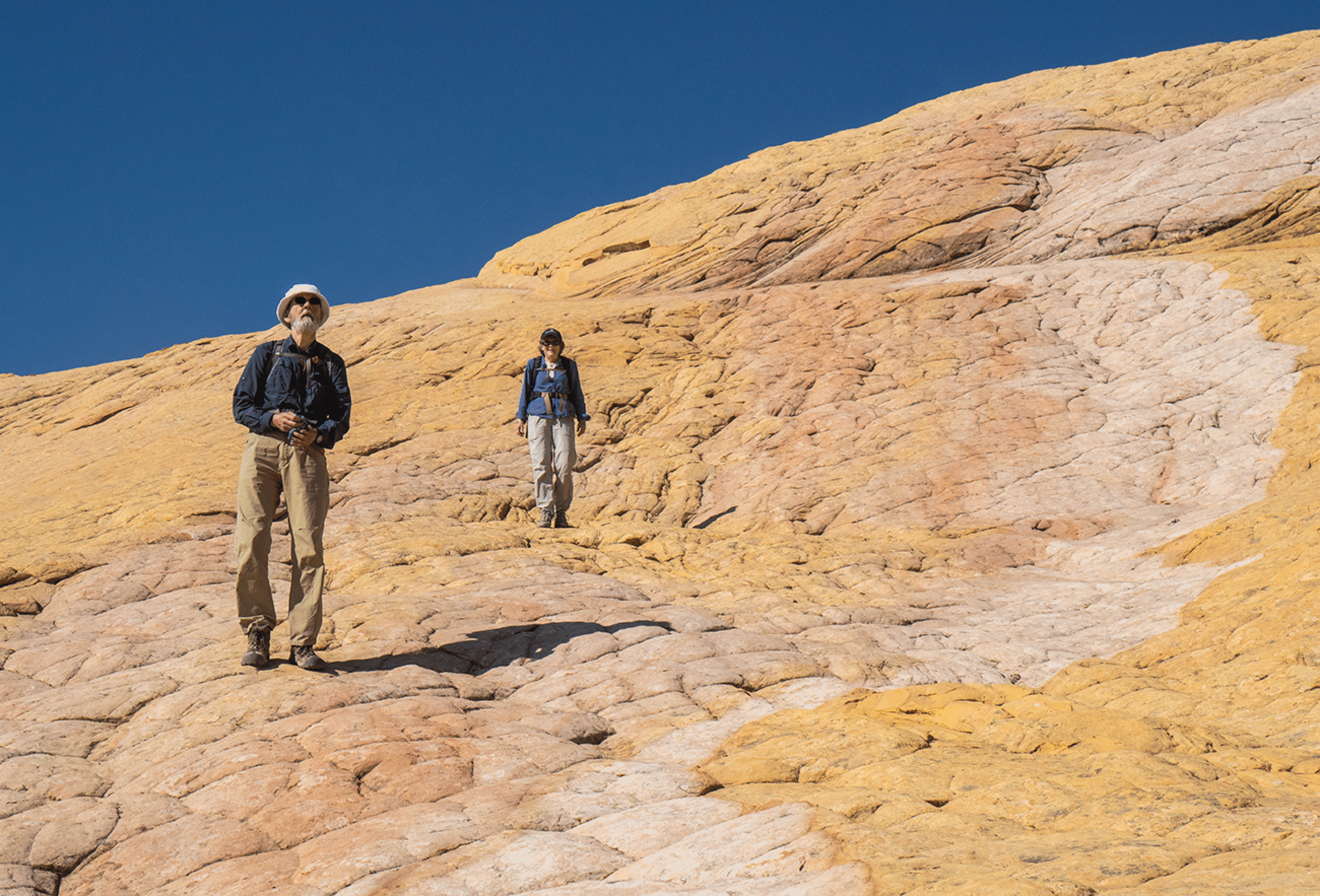
Katie takes a break as we wander along the spectacular southern midlevel plateau.
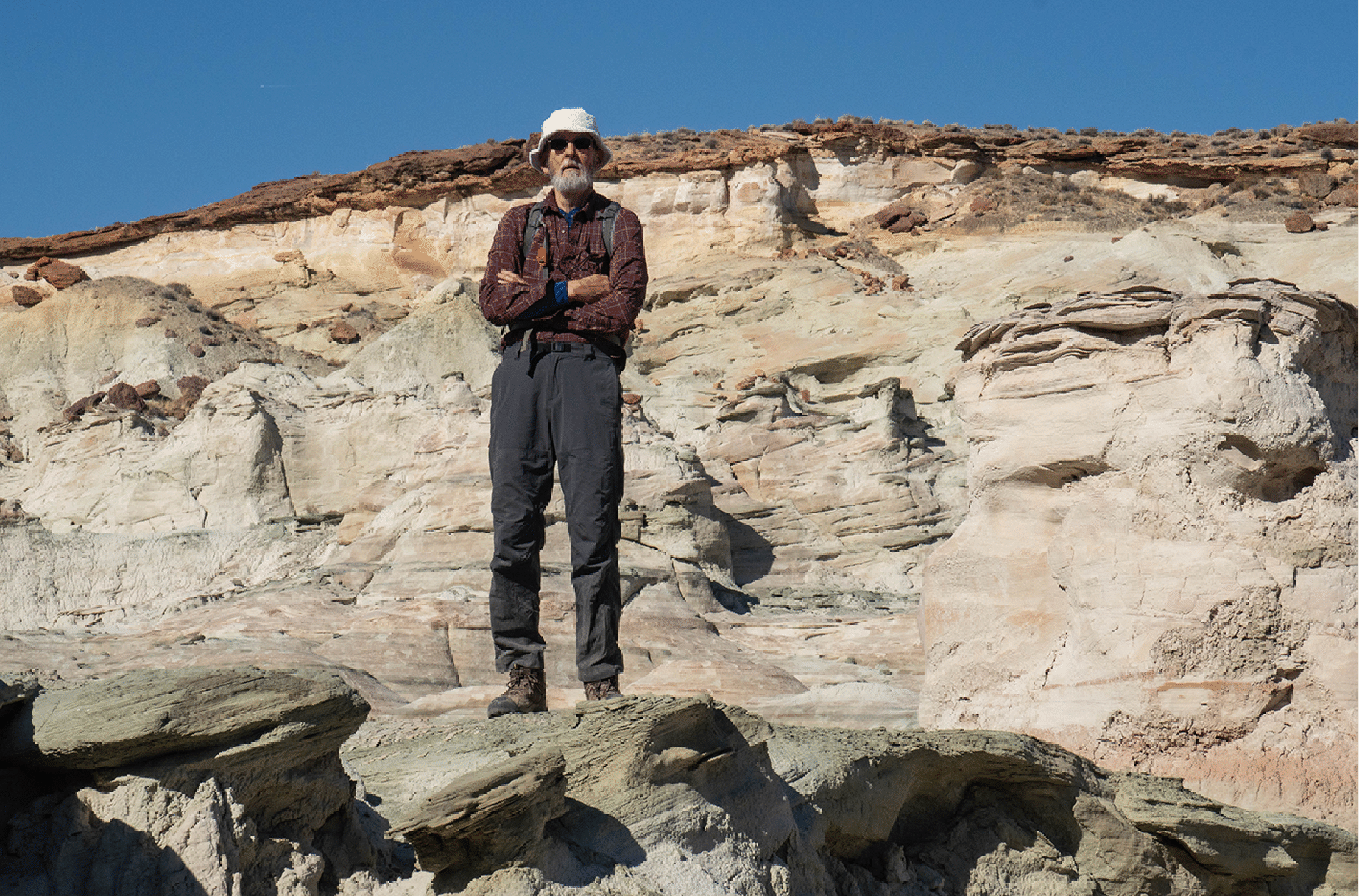
David surveys the plateau.
Entering Blue Wonder.
Katie near the mouth of Blue Wonder (Photo by David Nebel.)
The first move involves stemming the walls to surmount the small chockstone. This one was not too difficult; later moves were harder.
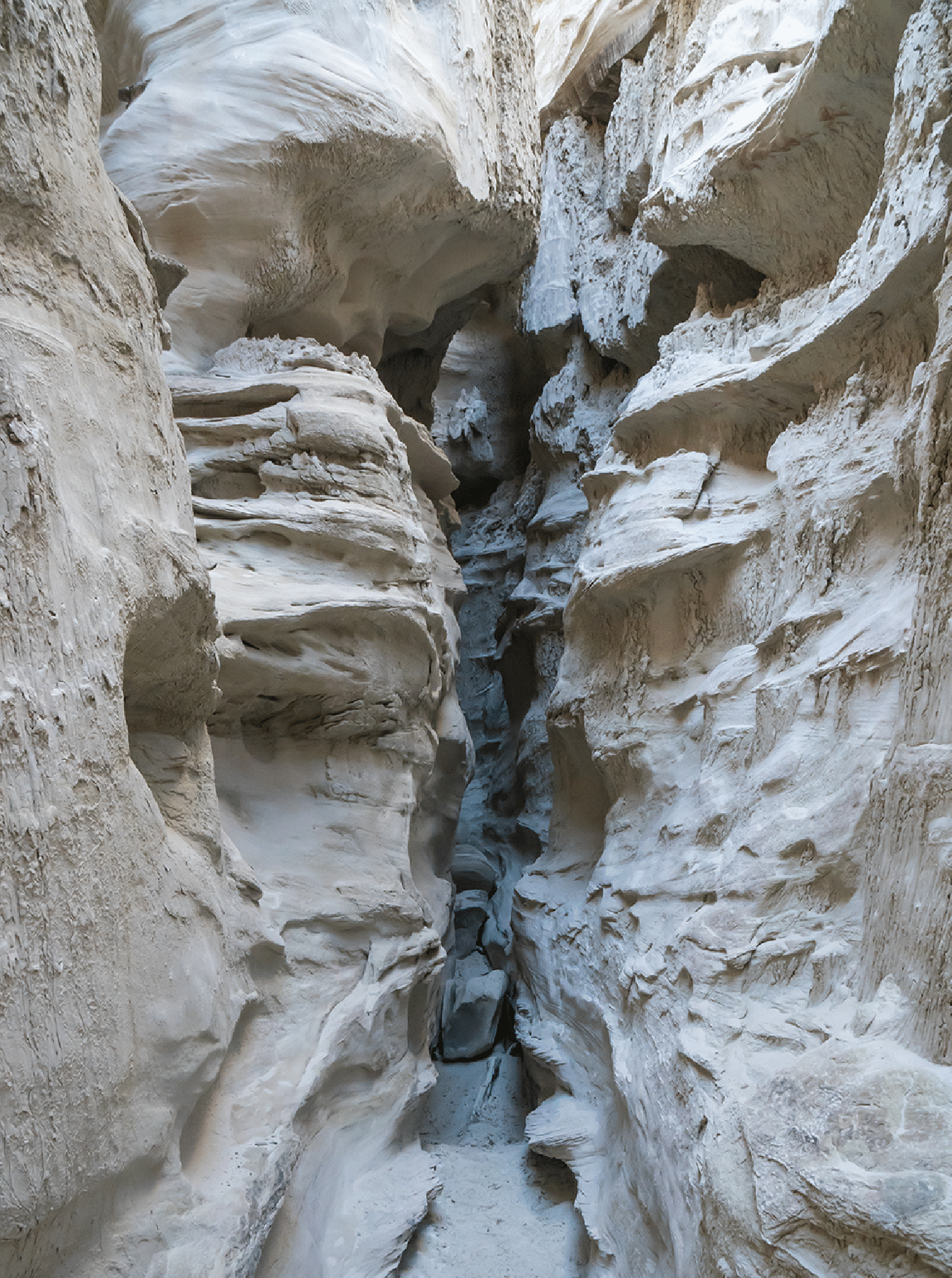
Typical slot canyon scene.
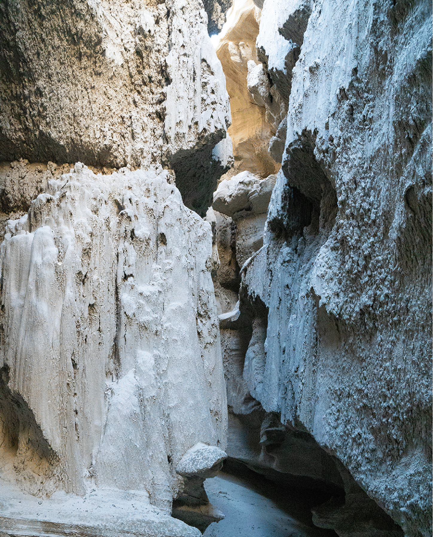
The blue light filters straight down into the slot.
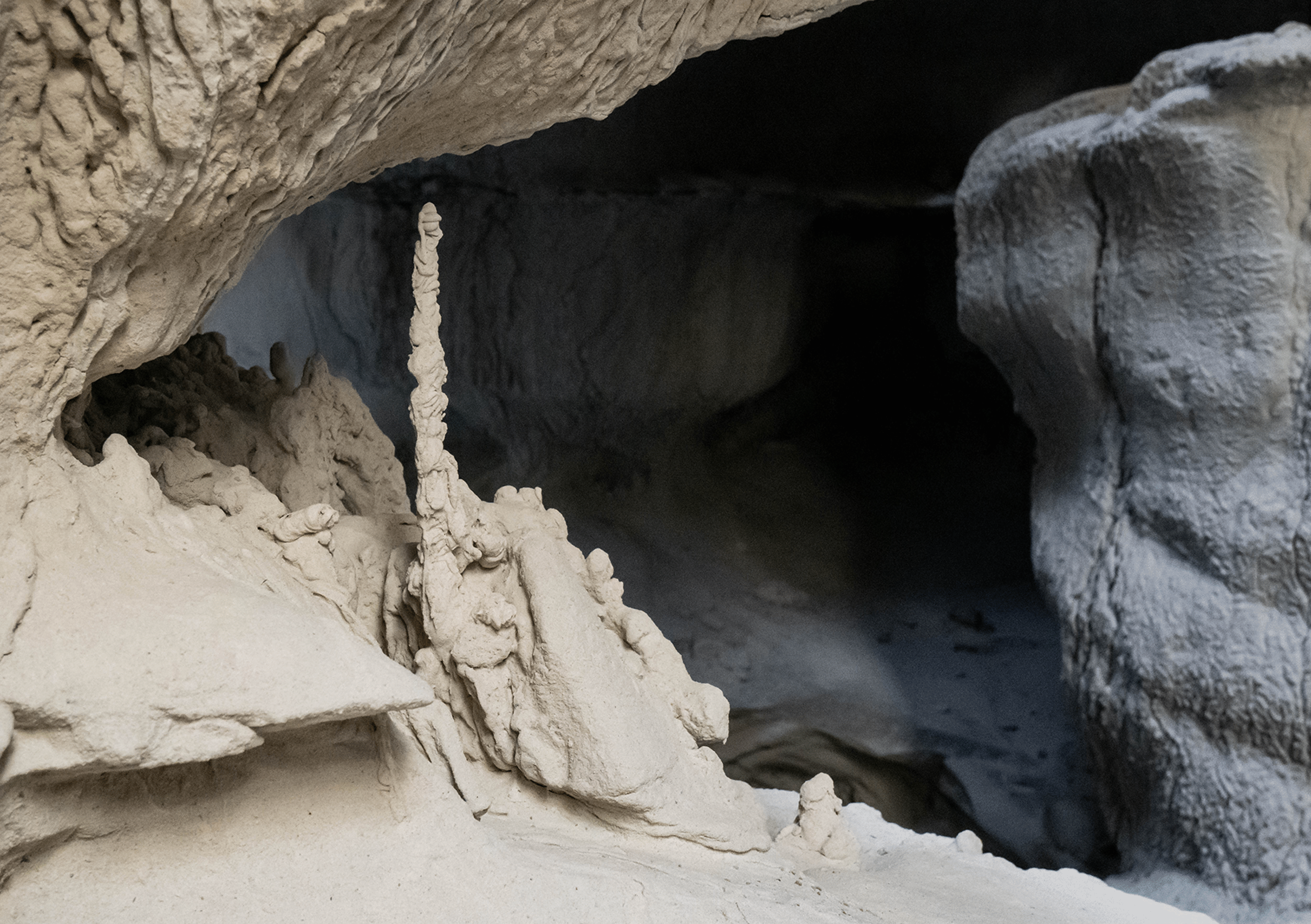
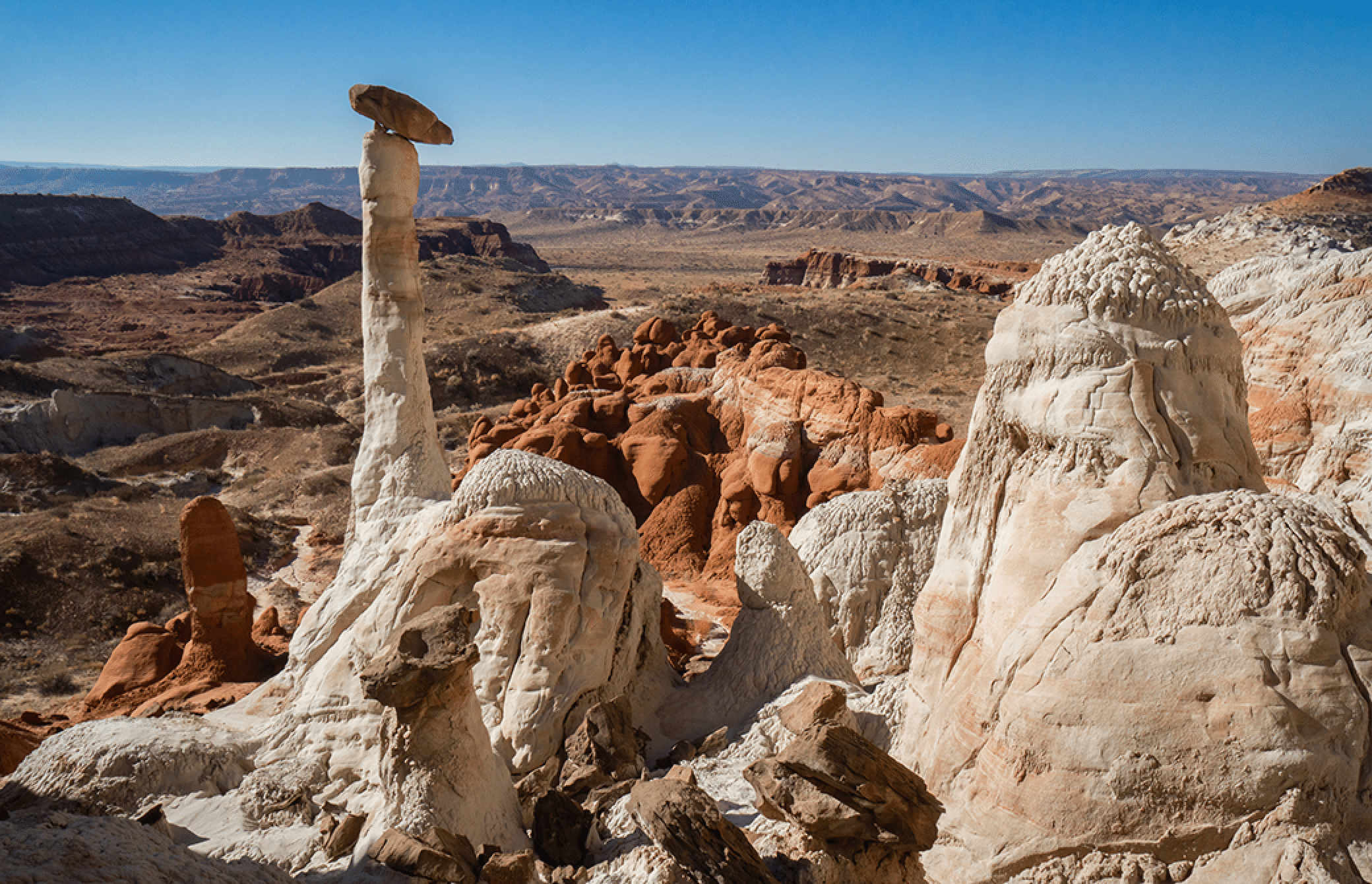
Near the end of canyon is a remarkable stalagmite.
The view of the top end of Blue Wonder.
Looking across the side canyon from high on the north side.
Hoodoo formation.
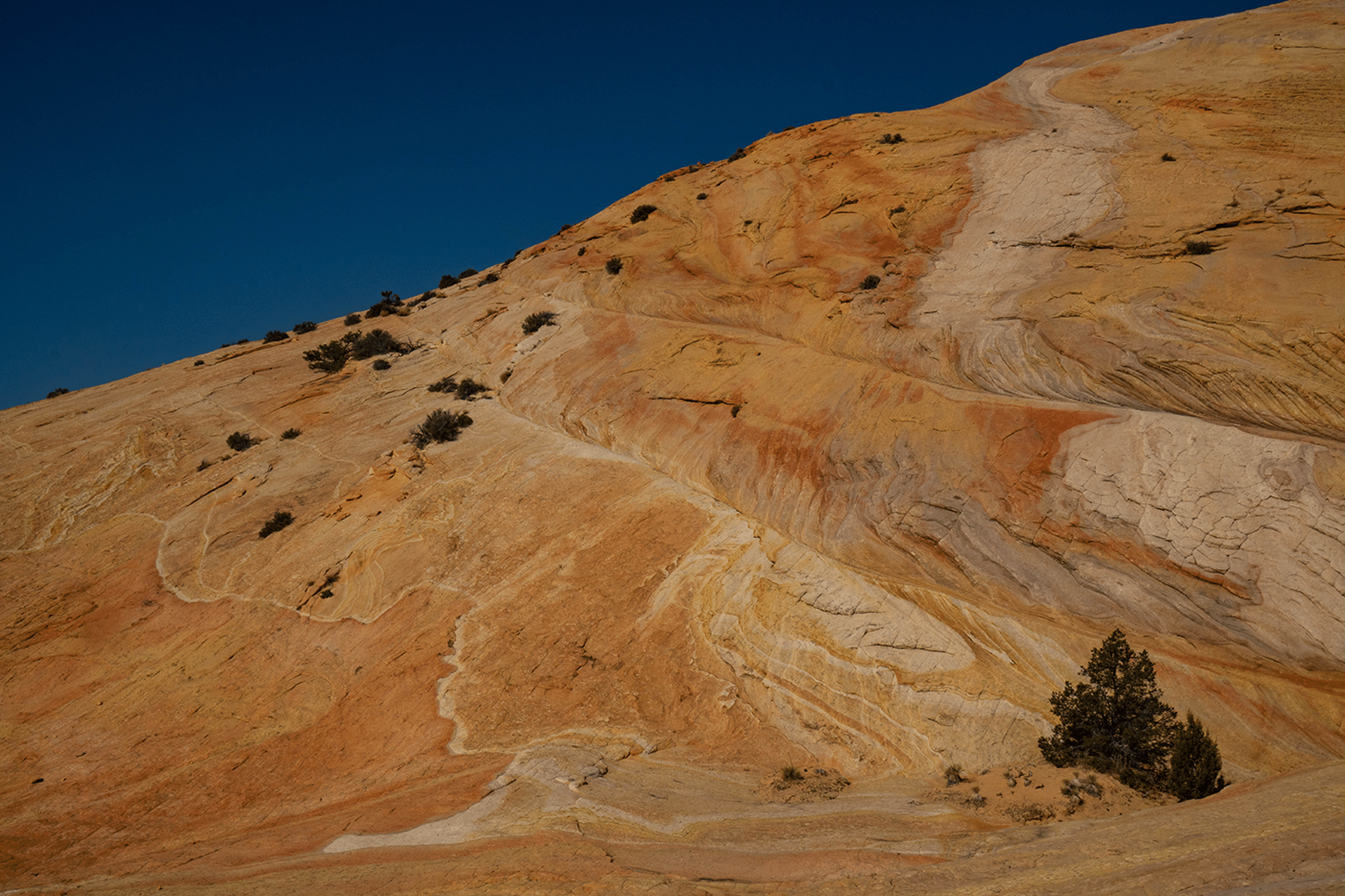
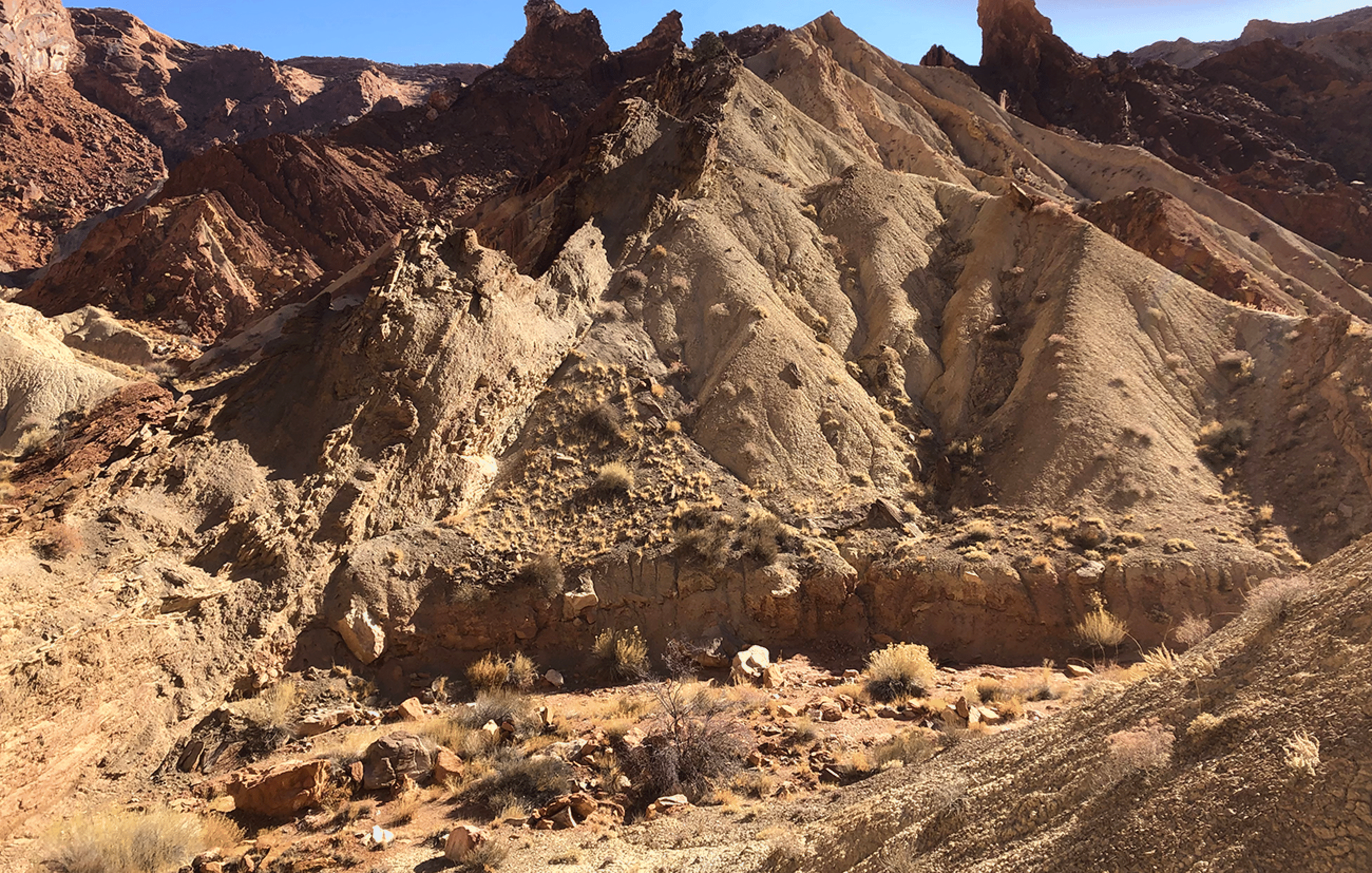
As we exited we saw a section of layered rock that might be another formation, but I think it is just varied color in the Entrada.
Cottonwood Narrows
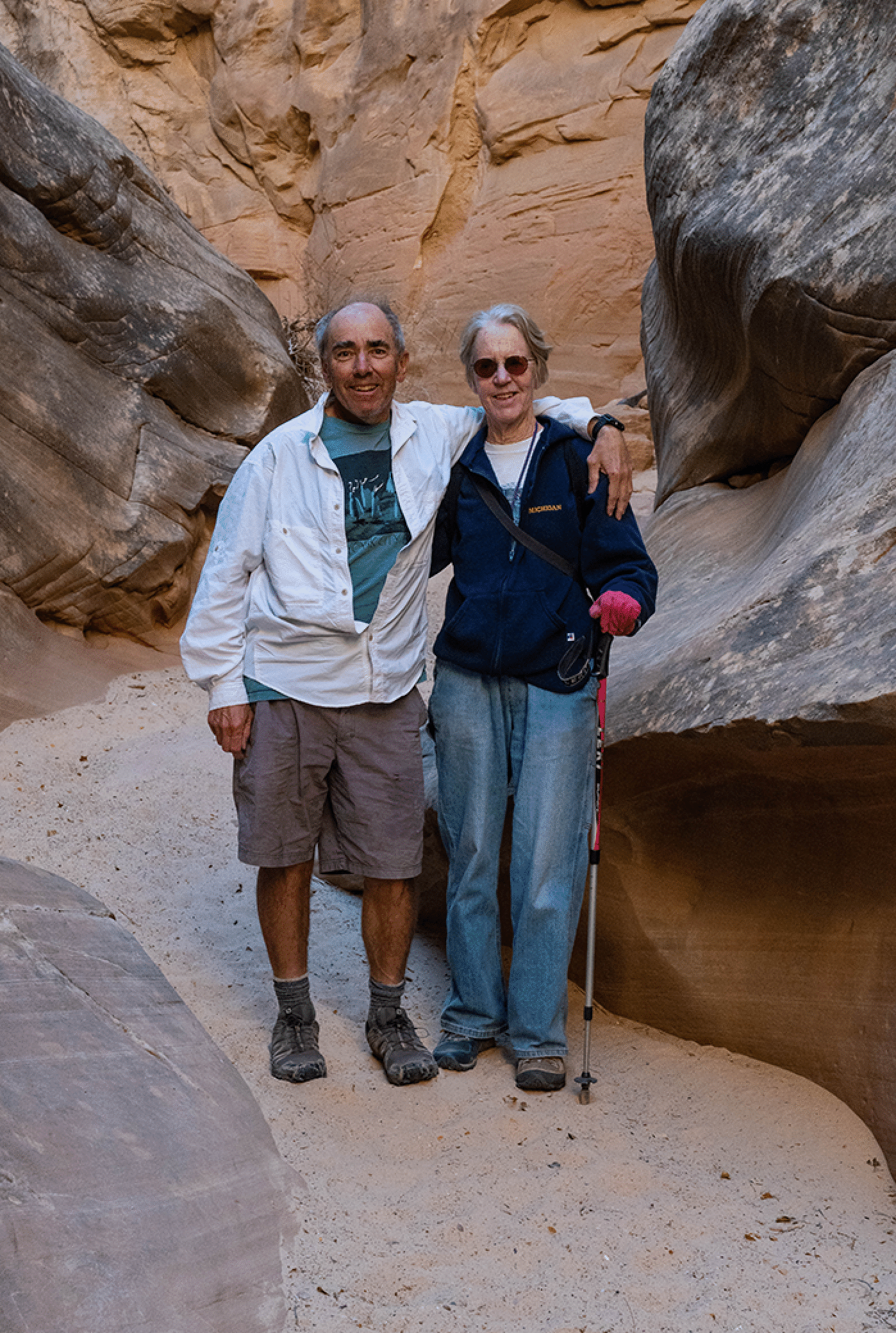
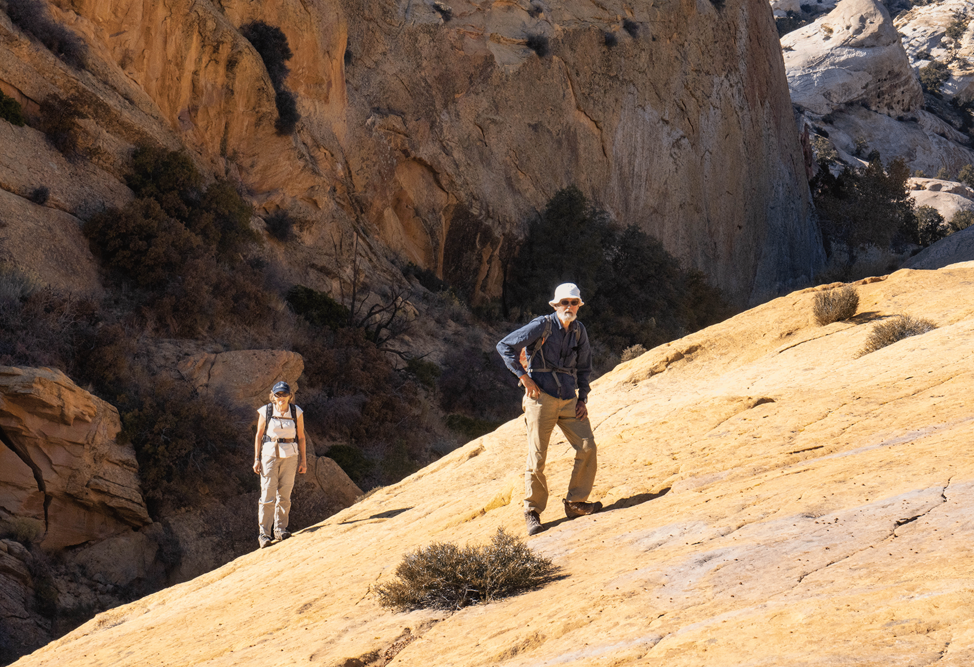
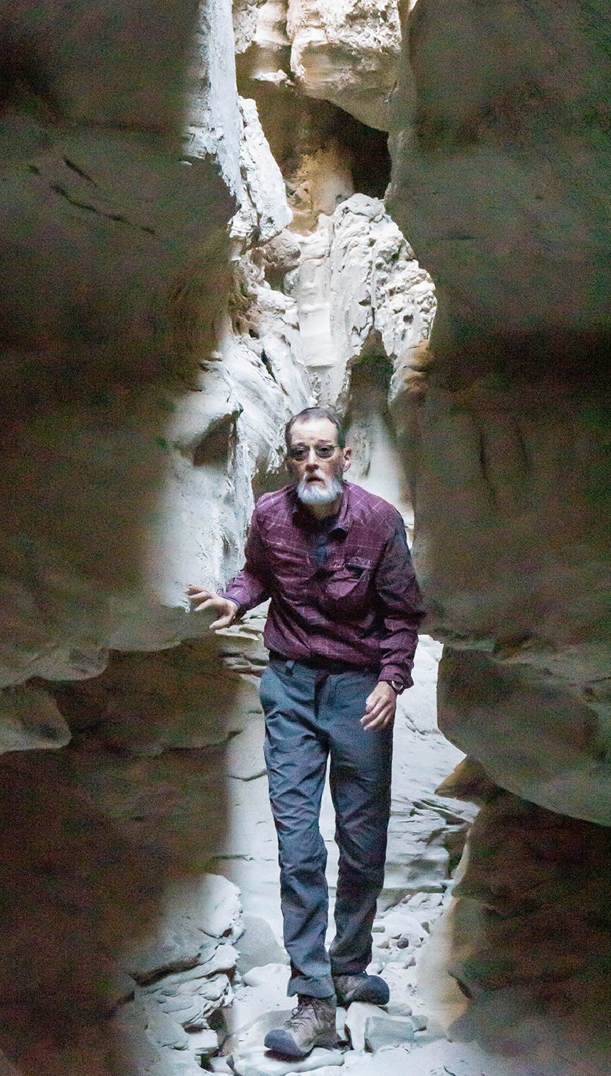
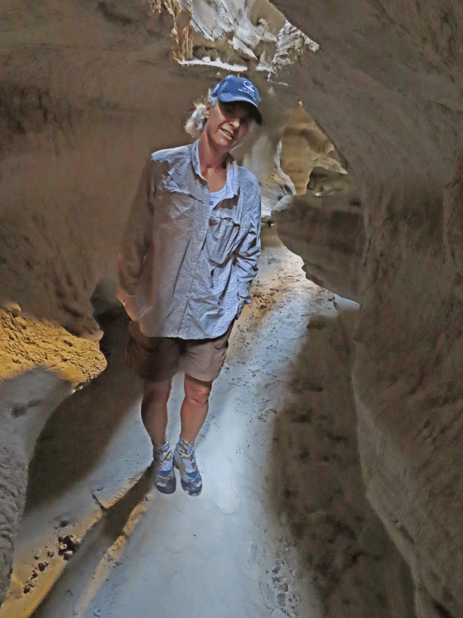
Joan and Stan
Sipapu Bridge and Upheaval Dome
We visited this wonderful bridge on the drive to Moab.
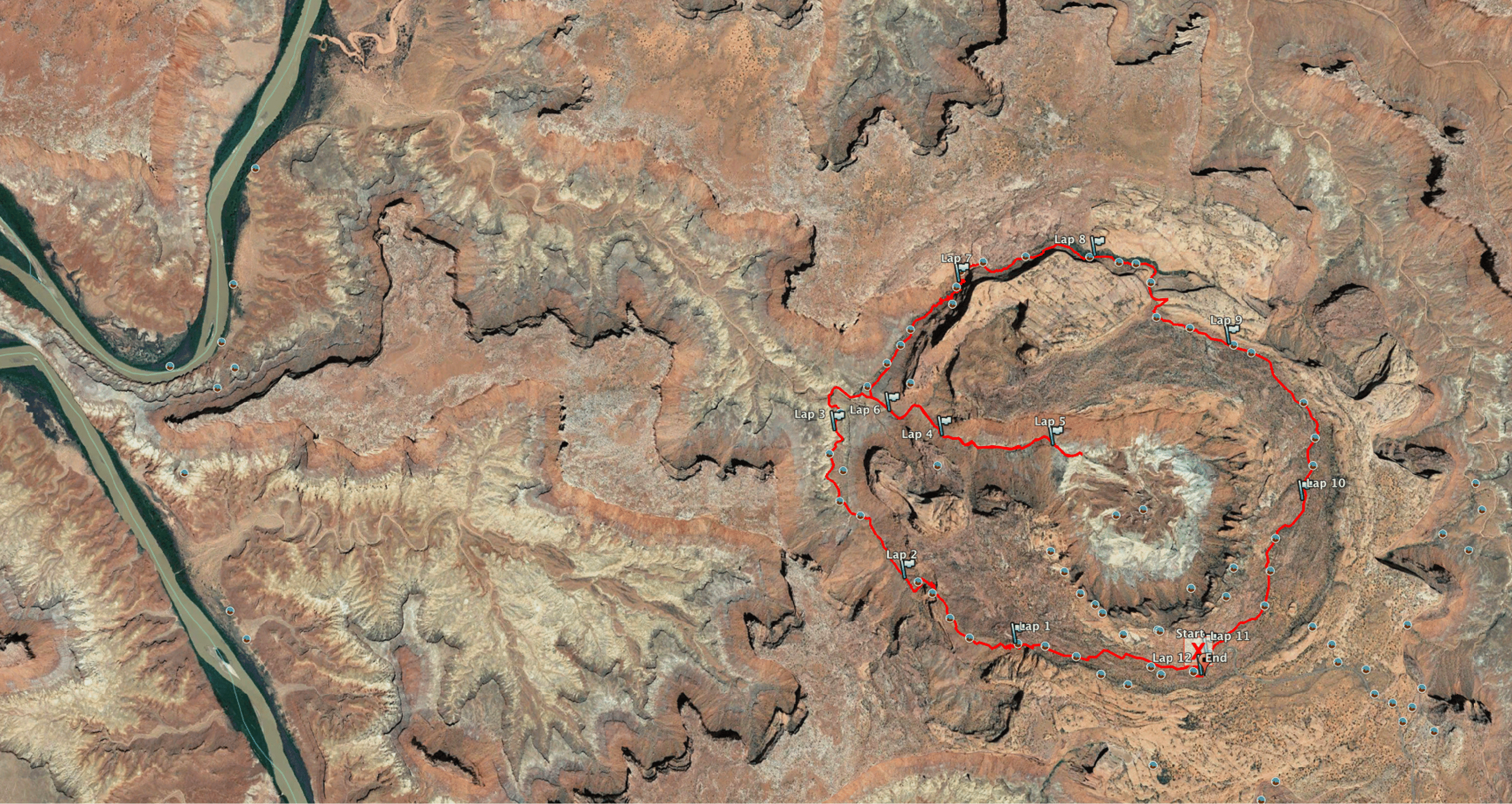
I did a nice solo run to the outlet of Upheaval Dome and took the spur trail into the crater. Interesting terrain.
The track of my 11.2-mile clockwise run is a pretty inverted lollipop. Green River on left. It appears that one could descend directly into the crater, but some research would be needed to find a good spot.