Oct. 22-28, 2017. Oct. 22, 2017. Drive to Grand Junction, Colorado.
Oct. 23, 2017. Grand Junction to Page, Arizona, Best Western View Motel. Internet service throughout Page is really awful, making map downloading, etc., almost impossible. Bill and Elaine Belvin and I did a short afternoon hike along the N Rim of Waterholes Canyon. We got to what Bill calls "The Great Wall", an interesting feature. This area requires an easily obtained Navajo permit.
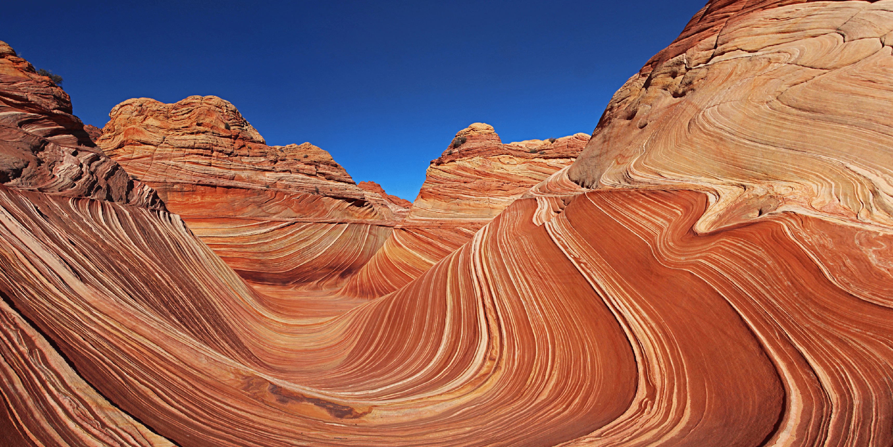
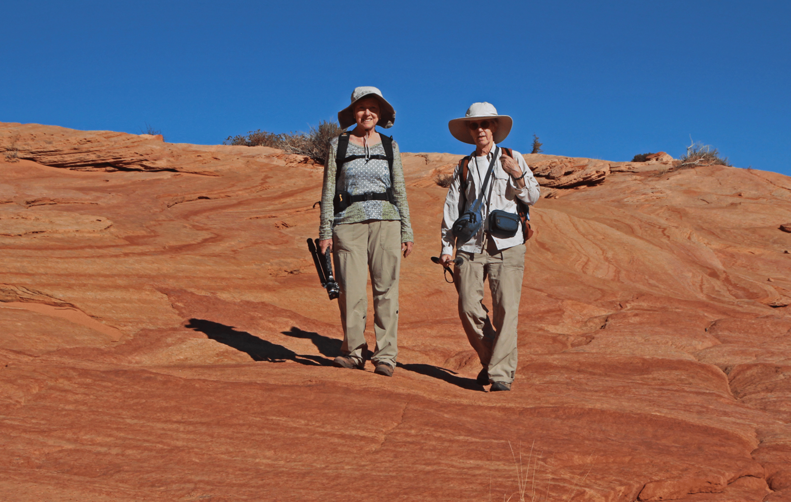
Oct. 24, 2017. The Wave, 7 miles. 6 hours. Bill, Elaine, Stan, Joan. Superb hike, as expected, with great photography. My best shot is a panorama made from eight frames. We wandered a bit south of the Wave to see the Second Wave. On return we spent time photographing some domes just before the first steep descent. There is so much to see here at N Coyote Buttes that I hope to return.
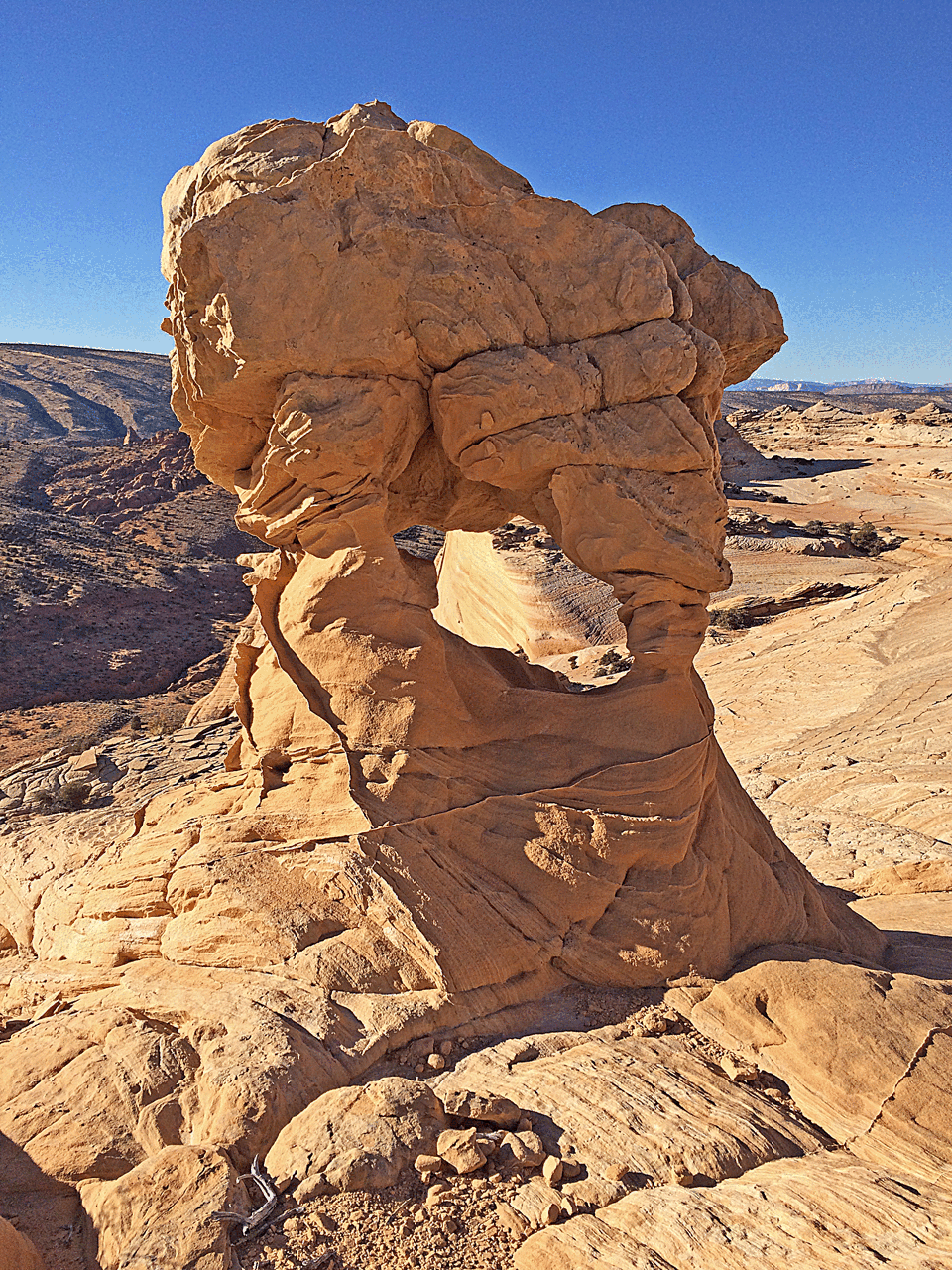
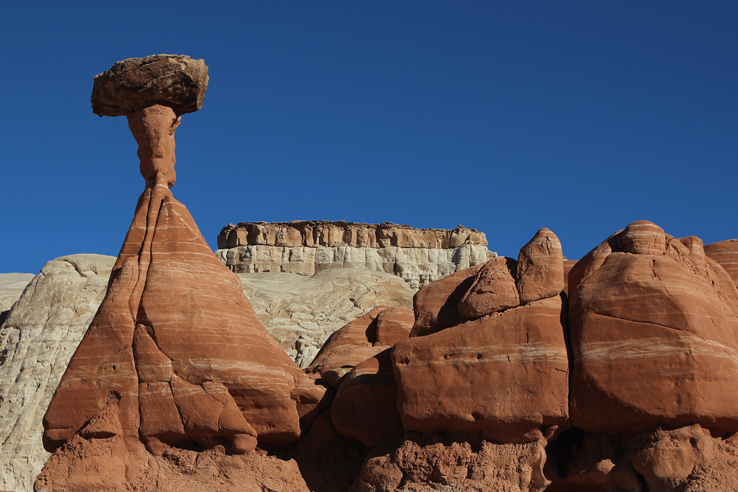
Oct. 25, 2017. Toadstools with Joan in the morning, then West Clark Bench with Bill and Elaine in the afternoon until sunset. Sadly I forgot my spare camera battery and ran out of power. There was lots of worthy photography up there, so I was disappointed with the day because of my power loss. There were some intriguing hoodoos high above the Toadstools and I believe one can hike there from the Cottonwood Road. More research needed!
Oct. 26, 2017. We left Page early and visited the hoodoos in Recapture Pocket east of Bluff (guided by Martres’s book Photographing the Southwest Vol.1: Southern Utah, 3rd ed). Then to Blanding. We stayed at the Stone Lizard Inn, which was excellent (the breakfast and also the knowledgeable owners). The restaurants in town are quite poor, though a burrito at Pop's was fine. I enjoyed chatting with old-timer Henry Lyman at the visitor center about history, farming, etc. The Recapture Hoodoos were not really very exciting, because of the nature of the sandstone (different than the Toadstools).
Oct. 27, 2017. To Mule Canyon for House on Fire and then Road Canyon for Fallen Roof Ruin. The first was a 2-mile round trip and we had it to ourselves. The second was a 2.5-mile round trip, and again, we had it to ourselves. These small ruins are superb, and likely among the best in the region for photography. At Fallen Roof I made a 17-frame panorama that captures the whole scene, including the three black hands at the left, and it came out well.
Oct. 28, 2017. Interesting and long day. Started with a search for Honeycomb Ruin in Montezuma Canyon, which we finally found after some work. It was excellent. As a bonus, the yellow cottonwoods in this area were really spectacular. Then we made our way to Hovenweep Mational Monument, following various confusing roads, and did the standard two-mile walk there. The visitor center is good and rangers were knowledgeable. At the center I purchased the spectacular new book "Ancient Landscapes of the Colorado Plateau" by Blakey and Ranney. Then we headed to Grand Junction the scenic (and long) way via Pleasant View, Dove Creek, Naturita, Dolores Canyon, and Gateway. This drive was spectacular, through farmland, valleys, and canyons. Dinner at MX in GJ (excellent), and then the drive home, arriving 10:30 pm. Two days later I came down with a slight cold.
A paper by Seiler and Chan describes the geologic history leading the coloration in this area:
Seiler, W., and Chan, M.A., Coloration and diagenetic history of the Jurassic Navajo sandstone at Coyote Buttes, Paria Canyon-Vermilion Cliffs Wilderness, Utah and Arizona, in MacLean, J.S., Biek, R. F., and Huntoon, J.E., Utah’s Far South: Utah Geological Association Publication 43, p. 237-257. Published, 09/2014.
See also Winston Seiler’s masters thesis:
https://web.archive.org/web/20120305144515/http://content.lib.utah.edu/cgi-bin/showfile.exe?CISOROOT=/us-etd2&CISOPTR=109657&CISOMODE=print
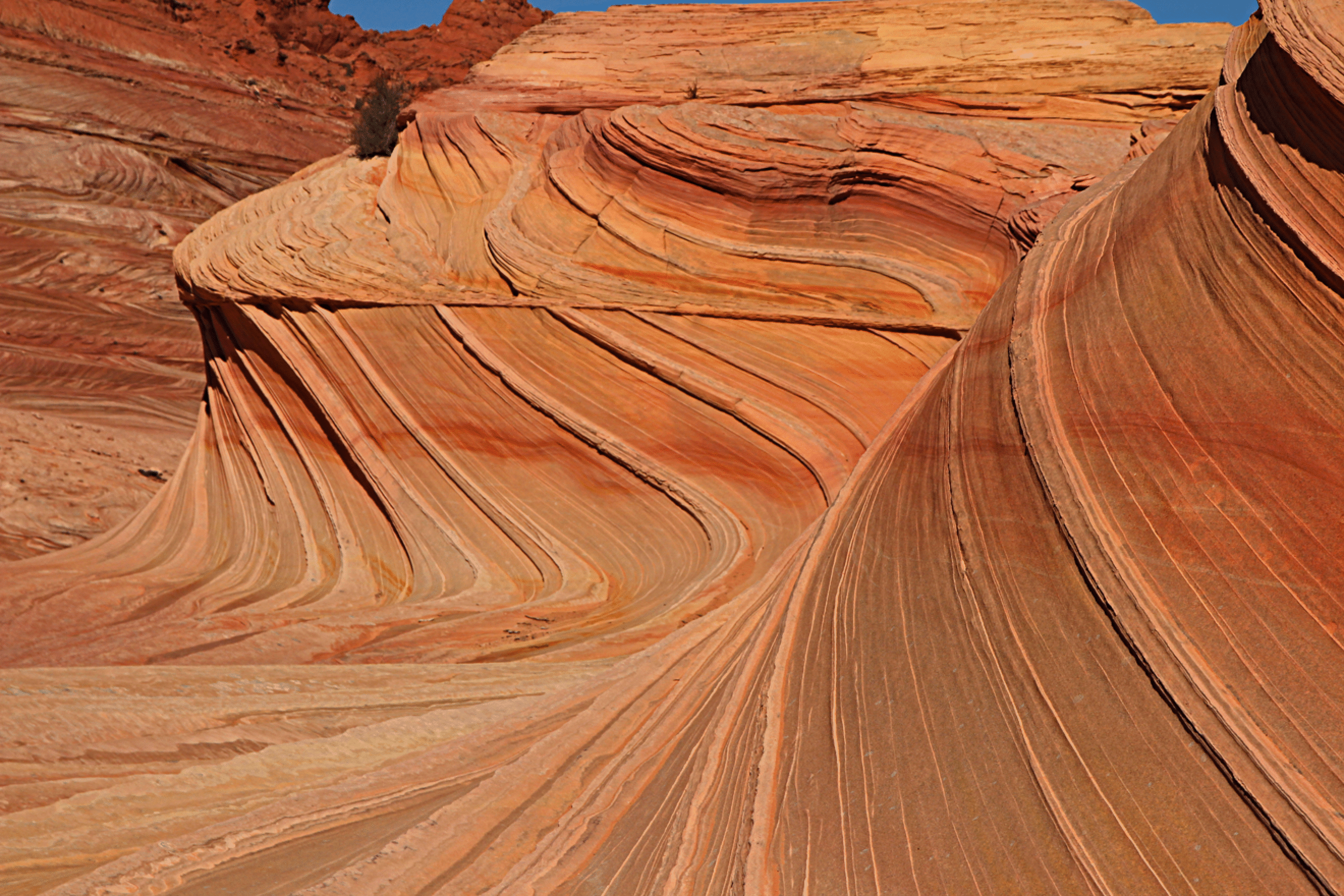
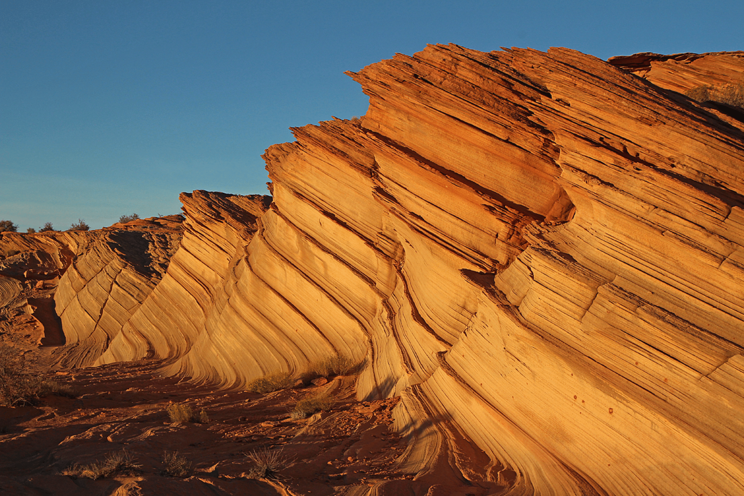
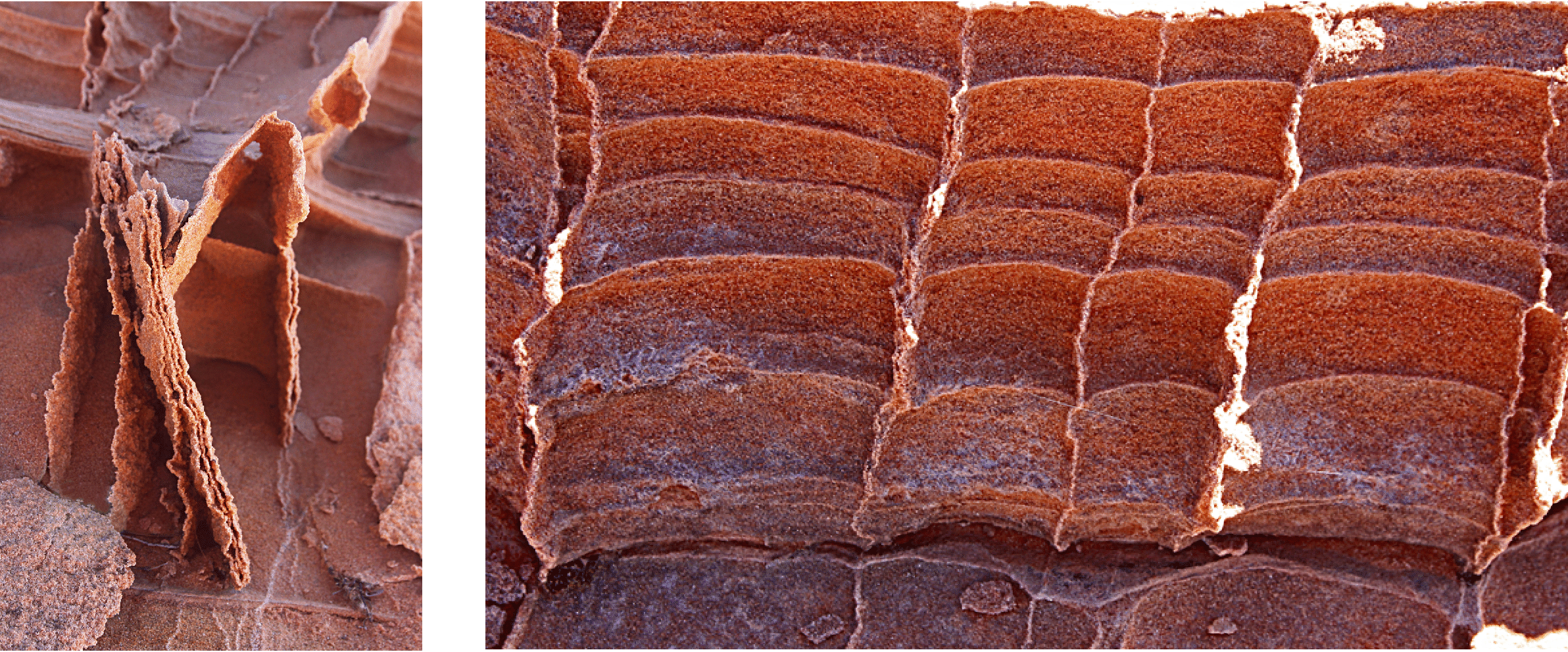
The main point (thanks to Winston Seiler for this explanation) is that sand moves in two ways: natural avalanches from the top and wind-carried grains. The first method moves larger grains. So when it all settles into layers and is compressed into sandstone, the grain size is different in the layers. Then when ground water passes through the stone later, it causes the leaching of iron at different rates, and hence the stronger red coloration occurs in the large-grained area. See also the last image here for a finer image of such layering elsewhere, with some added fracturing.
The Wave in North Coyote Buttes, a magical spot. This image is an eight-frame panorama.
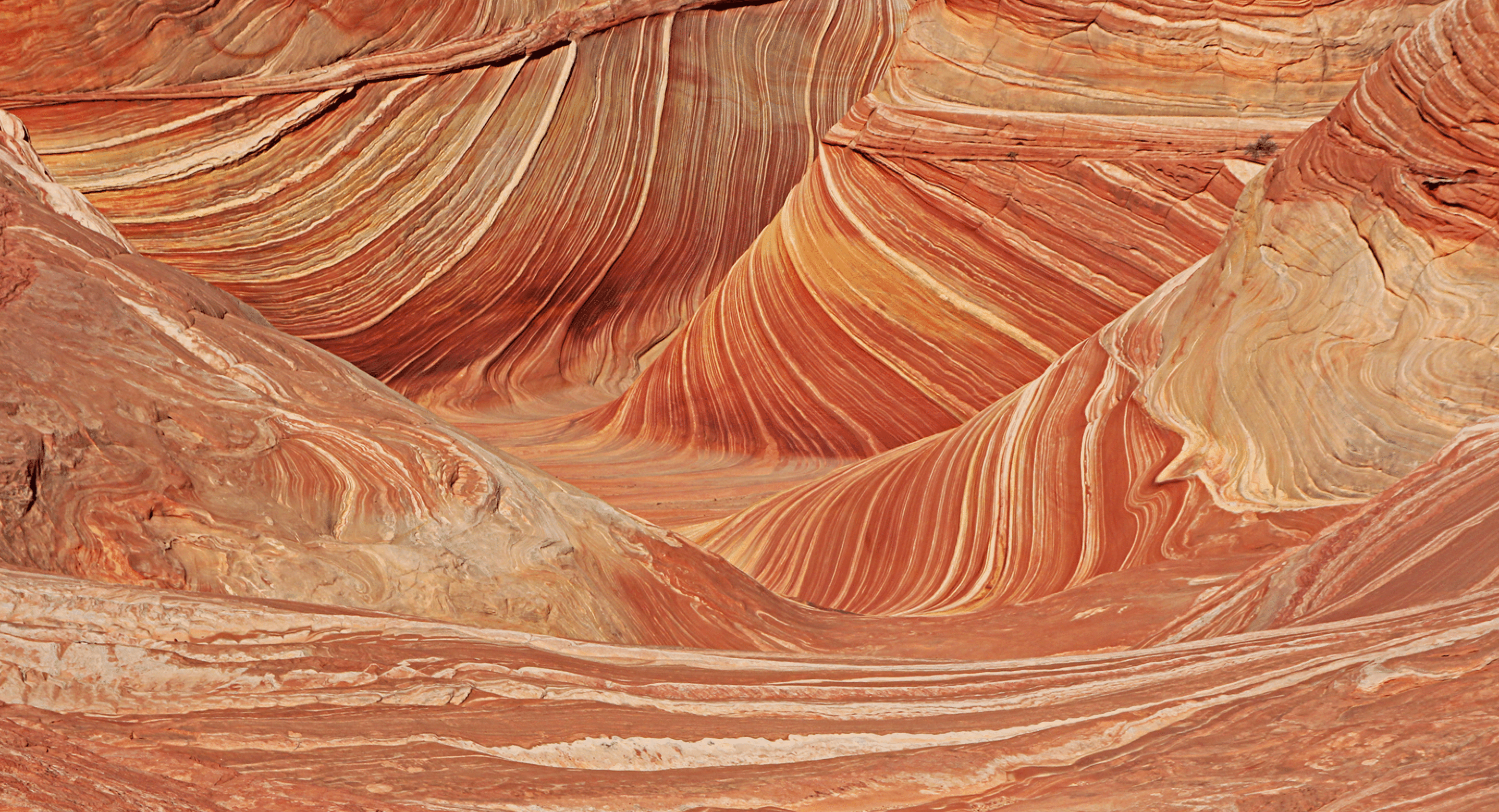
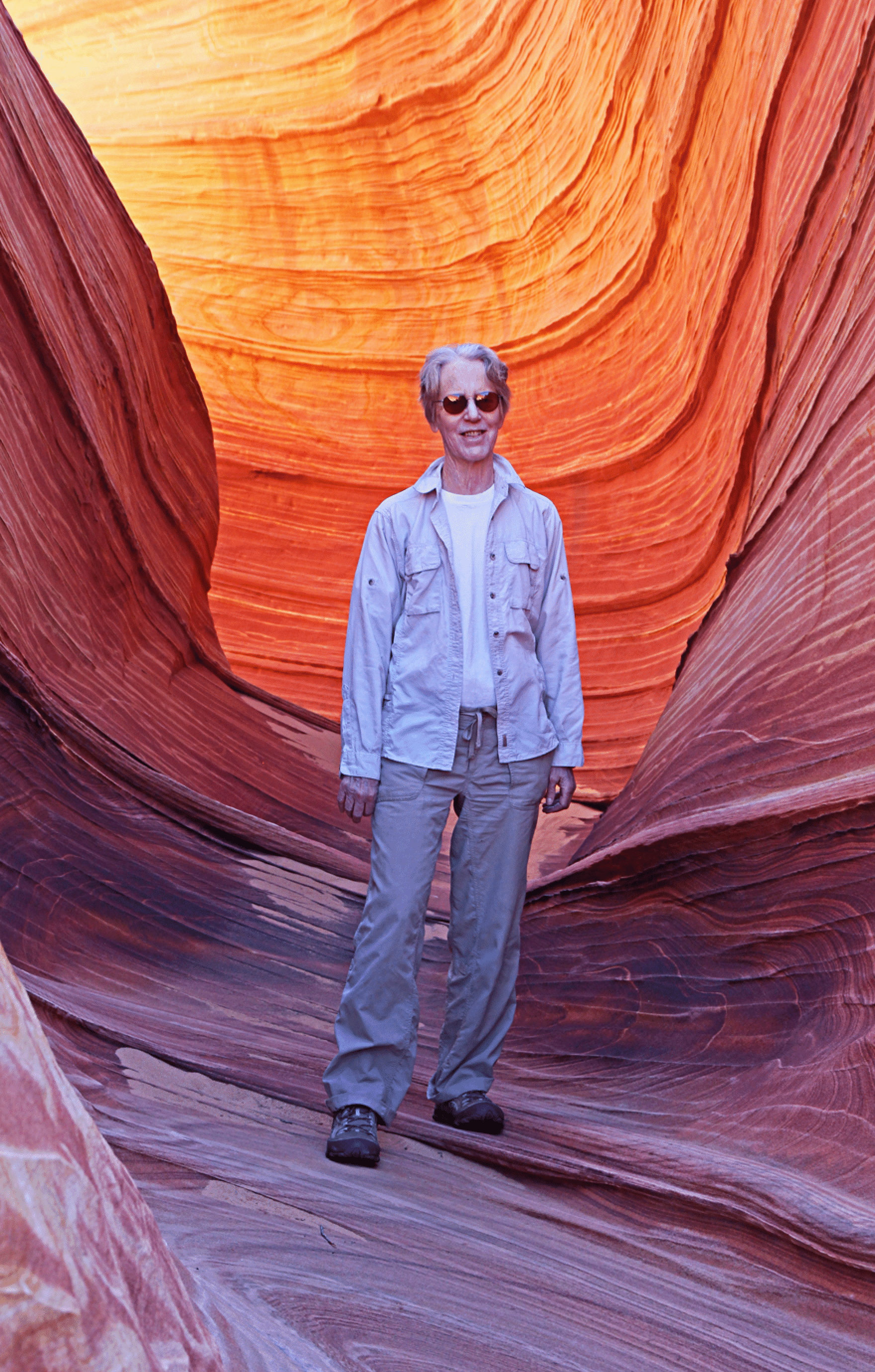
The view from a little higher up. The lack of sky makes this a less attractive image, but yet it does convey well the intensity of the spot.
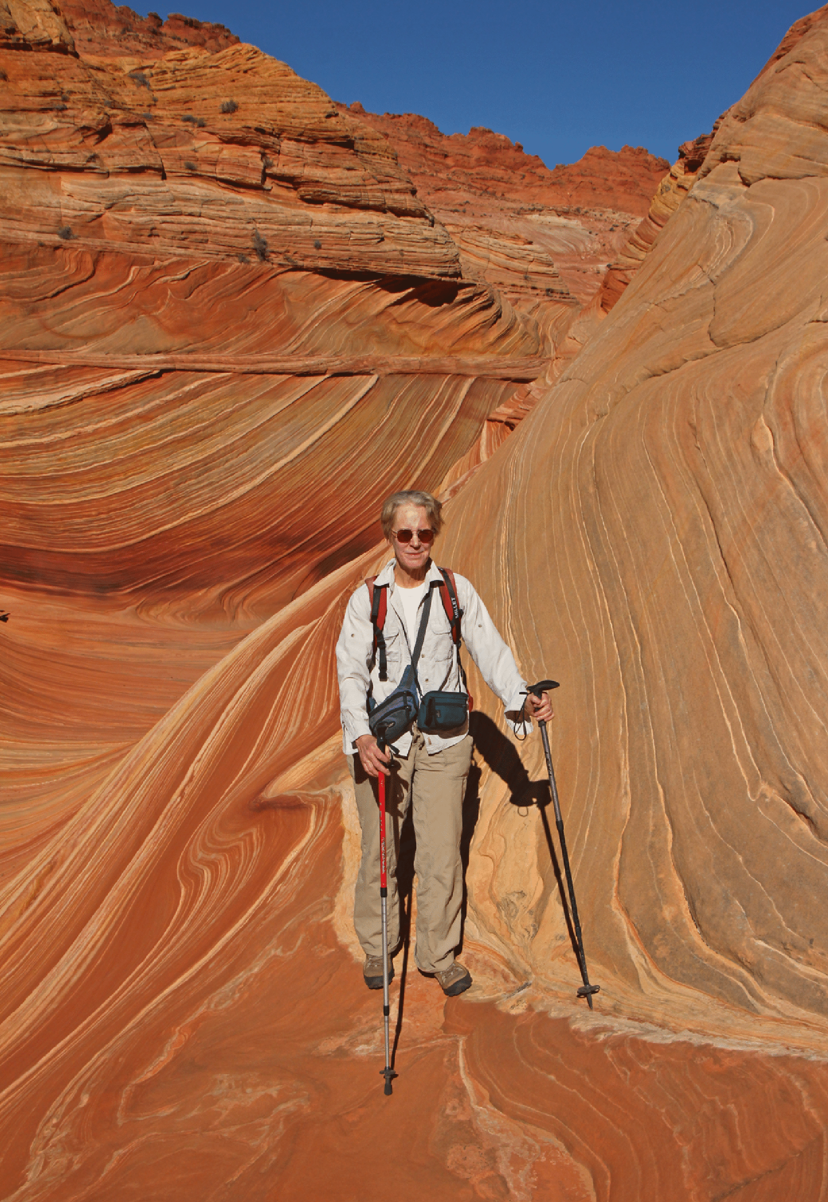
Joan surfs the Wave.
The approach to the Wave is a three-mile hike over varied sandstone. Elaine and Joan.
The “Second Wave” is about a third of a mile south and a little above the Wave.
Joan in a pretty side canyon that lies adjacent to the center of the Wave.
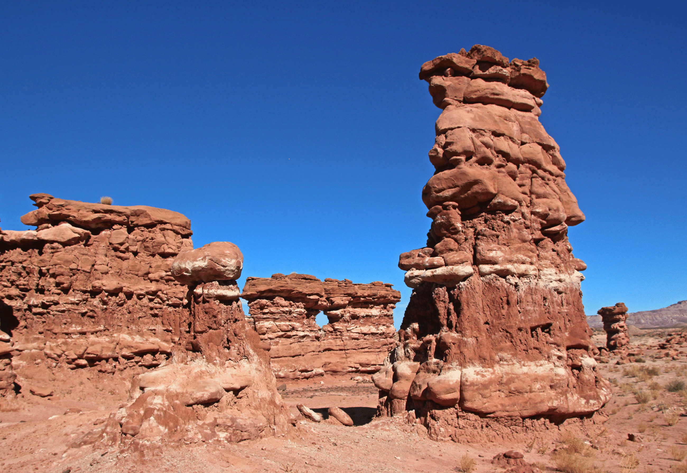
The Great Wall on the rim of Waterholes Canyon, south of Page. This is on the north rim, about a mile from the highway (upstream). We were here the day before the Wave.
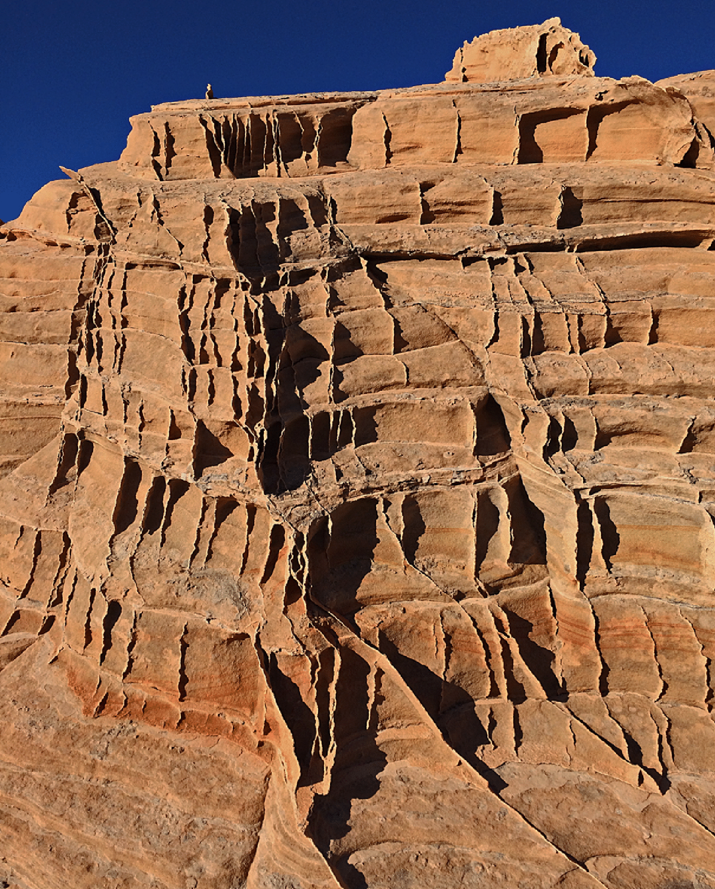
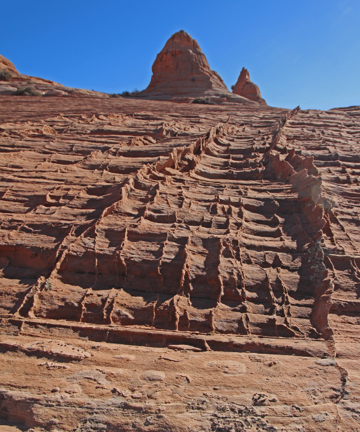
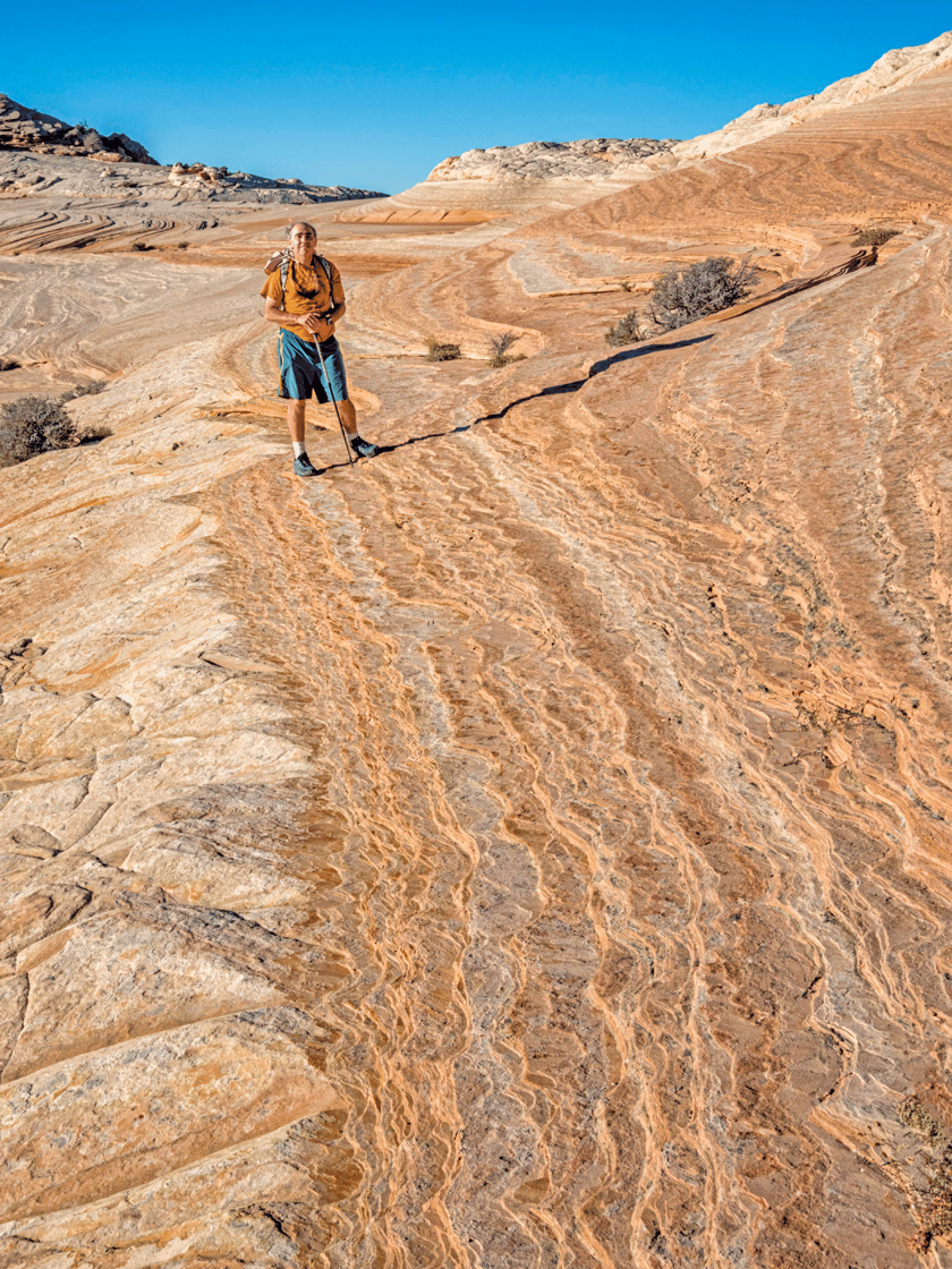
West Clark Bench (a high area of Navajo Sandstone just north of the Wave) provides great photography, with many regions of beautiful sandstone fins. We visited there the day after the Wave. The beauty of this place is the plethora of untouched delicate fins.
We stumbled across a great arch:
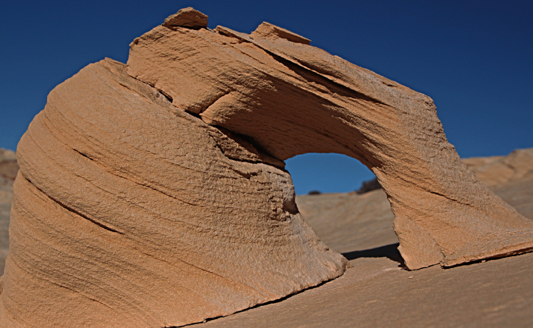
I call this Nano Arch.
This arch is more typical of the size of these things in the Navajo sandstone. Again, note the delicate fins.
The late-day light was superb. We reached the car just after sunset. (Photo by Elaine Belvin)
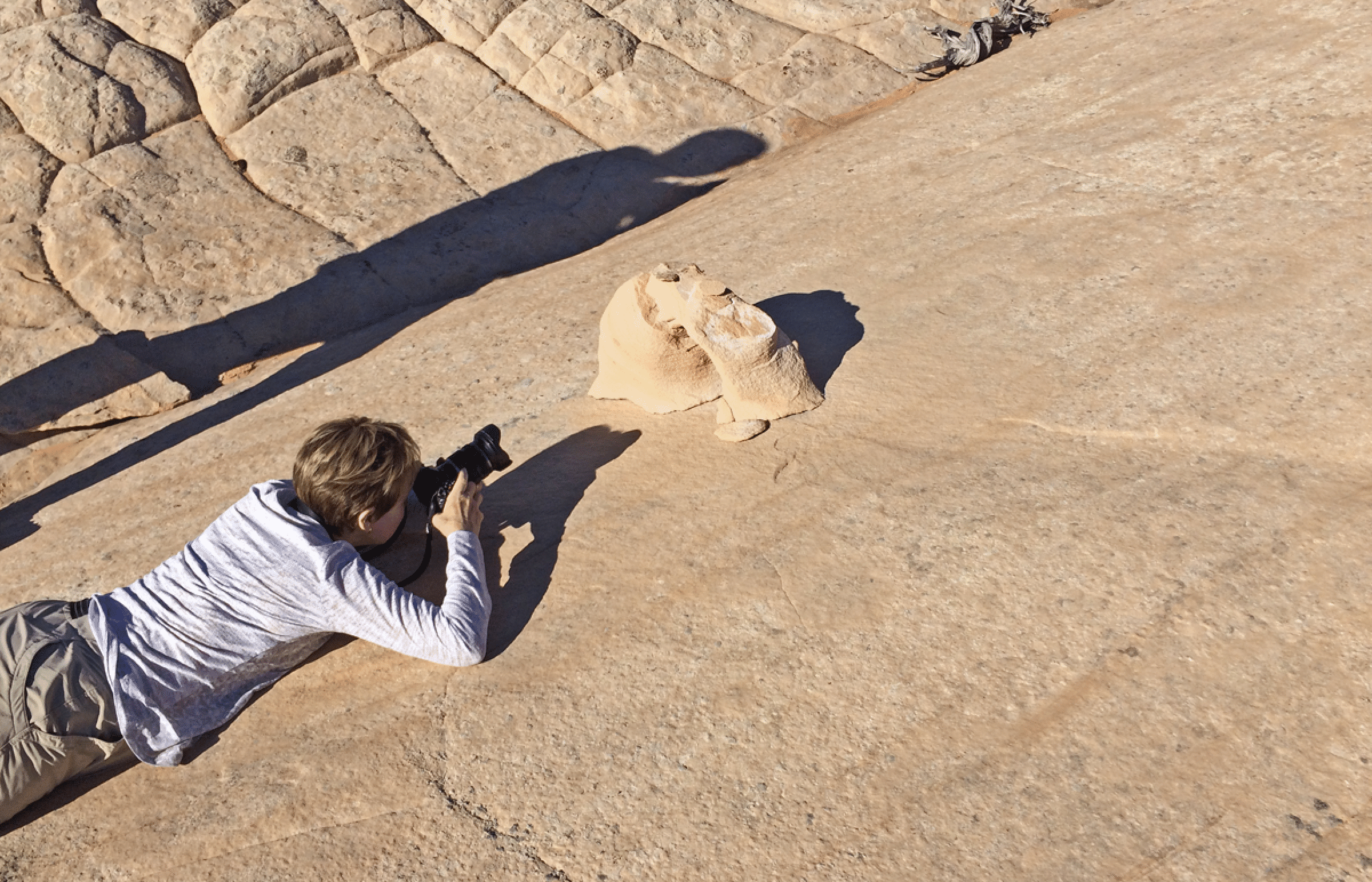
On the morning of the West Clark Bench day Joan and I visited the Toadstools, accessed by a pleasant one-mile hike.
![]()

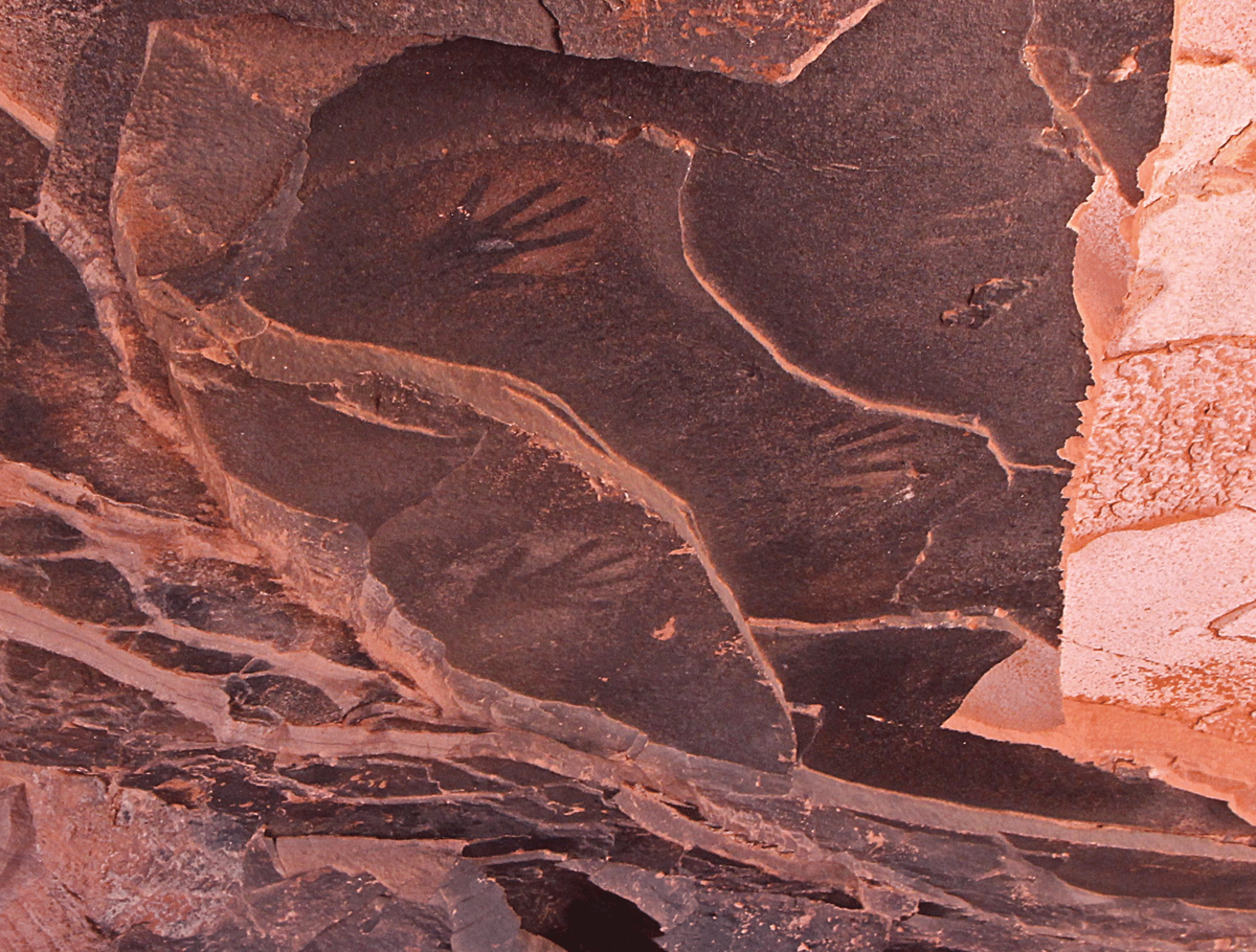
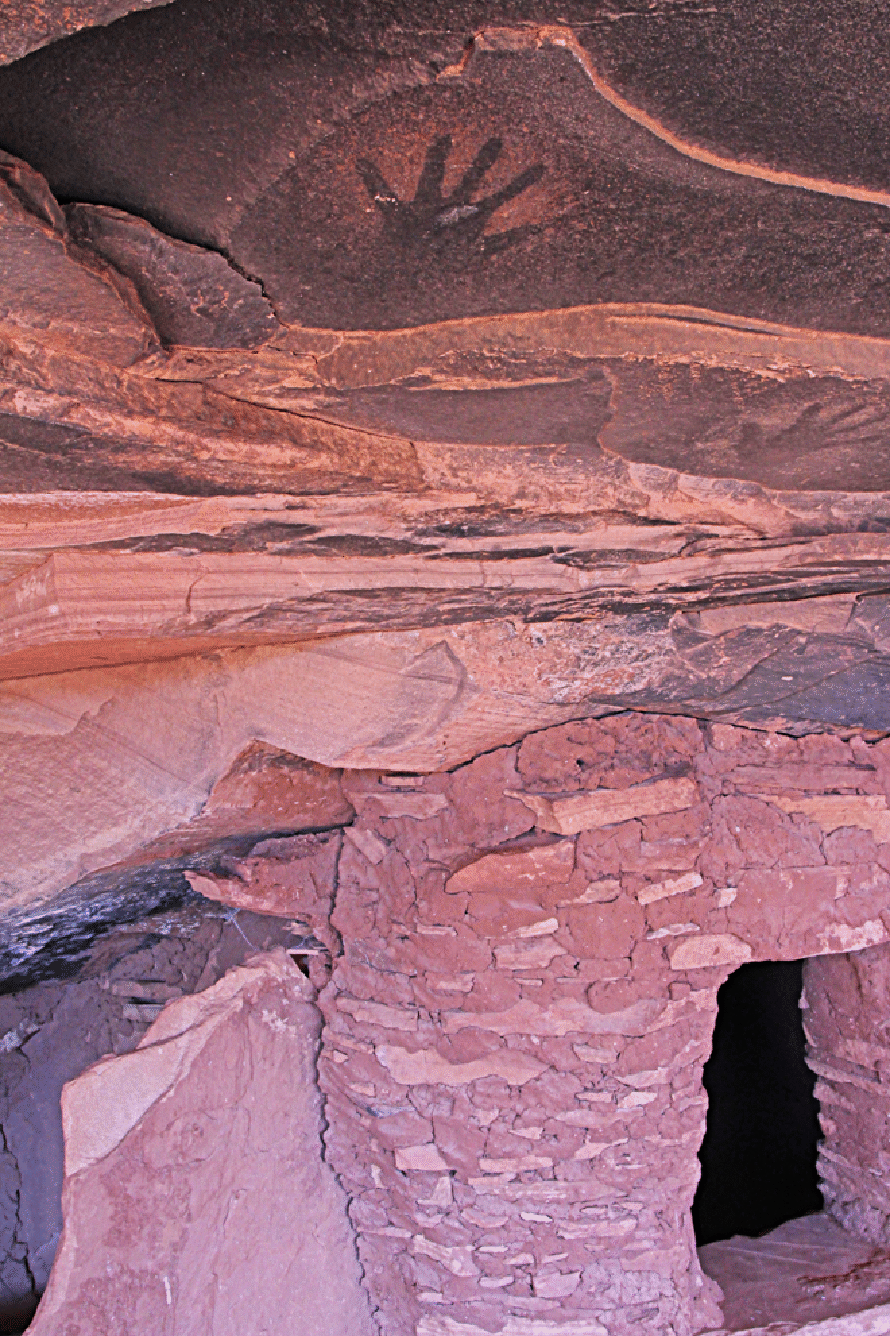
Fallen Roof Ruin. This image is a composite of 17 images. Some interesting handprints are visible on the black roof above the leftmost window. The roof collapsed after the ruins were built, revealing the intriguing light-colored shapes. This ruin is in Road Canyon, a mile and a quarter from the trailhead. The next two show the hands. The first handprint image below is one of the 17 images in the pano; the second is not. The handprints are on the blacker area, which is not part of the main collapsed roof.
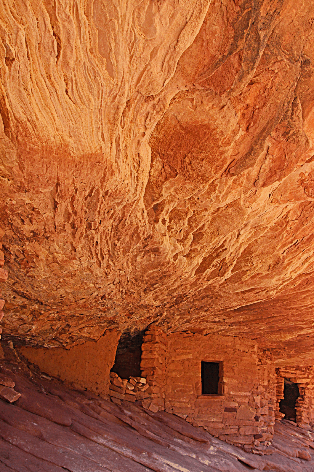
House on Fire, a famous ruin in the south fork of Mule Canyon, off Route 95.
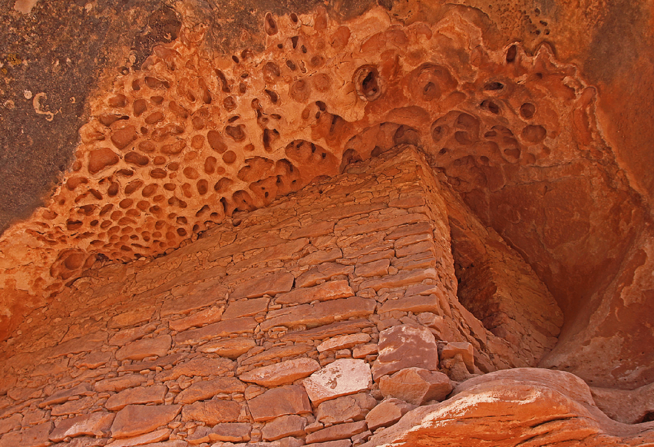
As we left Blanding for Hovenweep National Monument and the return home, we first visited Montezuma Canyon to search for the Honeycomb Roof Ruin. This is on the road north of the Bradford Ruins, and was a little hard to find. I love the examples of tafoni I have found over the years, but finding some tafoni and an ancient ruin is a double victory. Tafoni usually forms on vertical walls, so I wonder if this formed on a giant boulder that fell into this position.
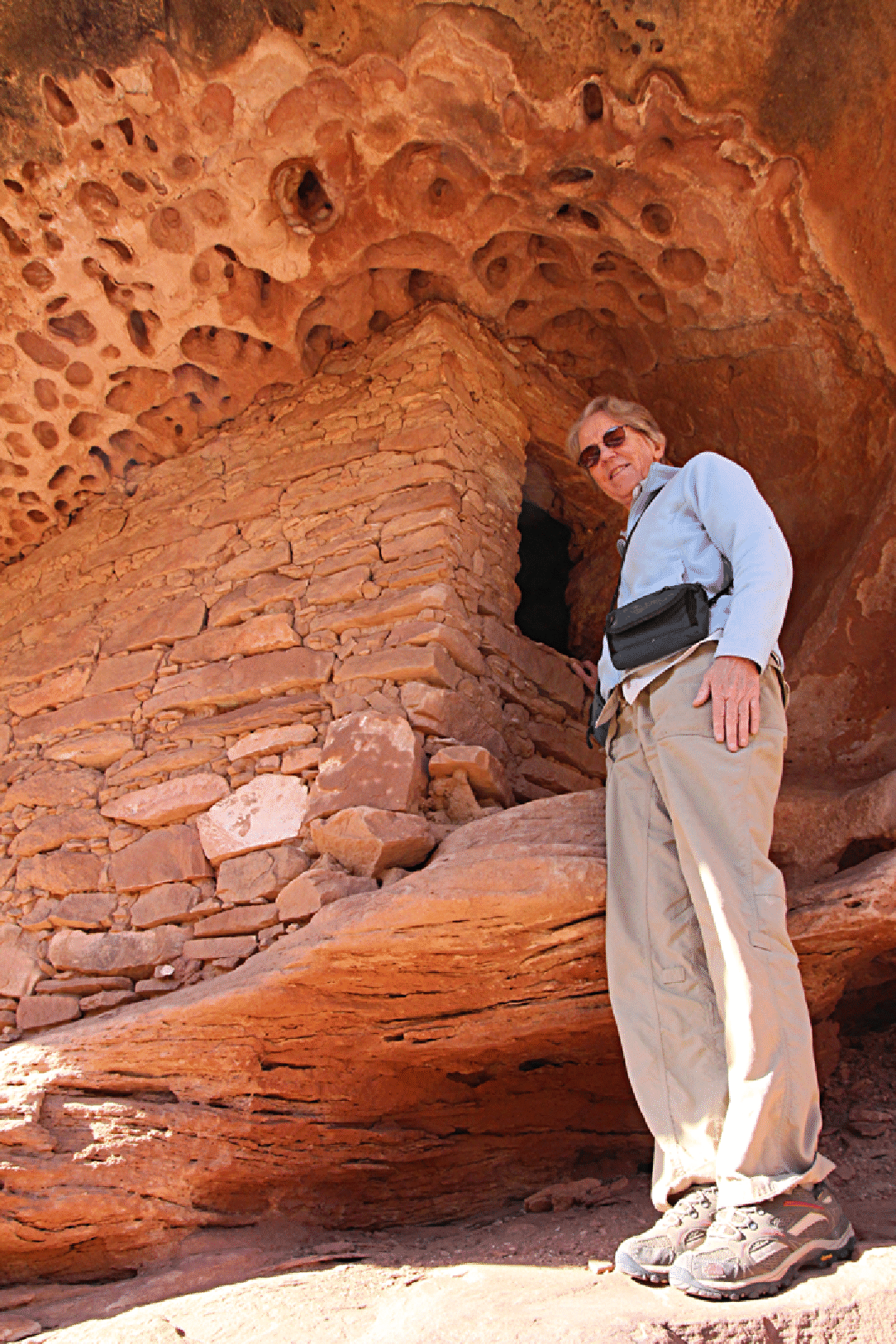
This ruin, like so many that are well-preserved is a granary, not a residence.
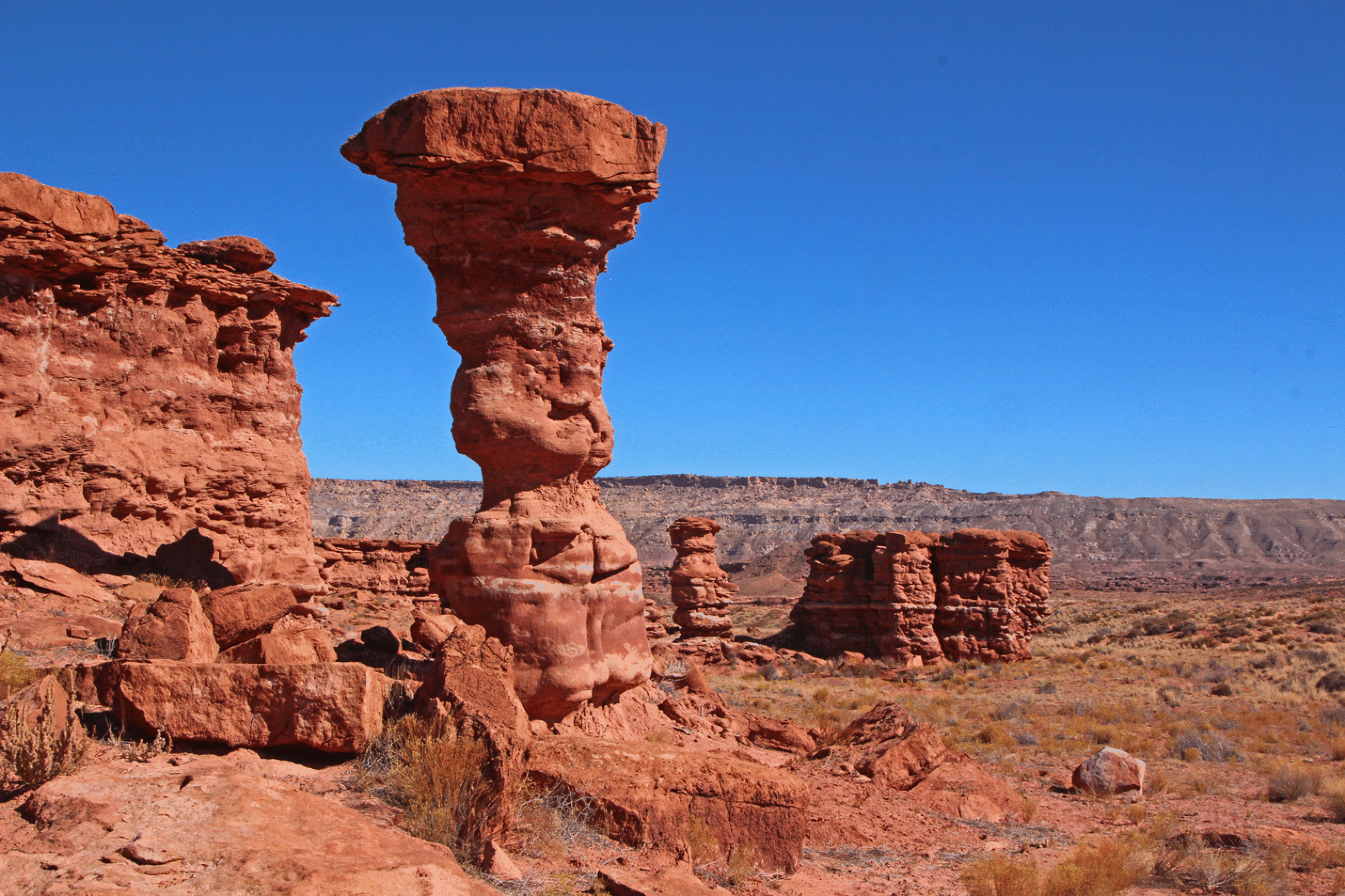
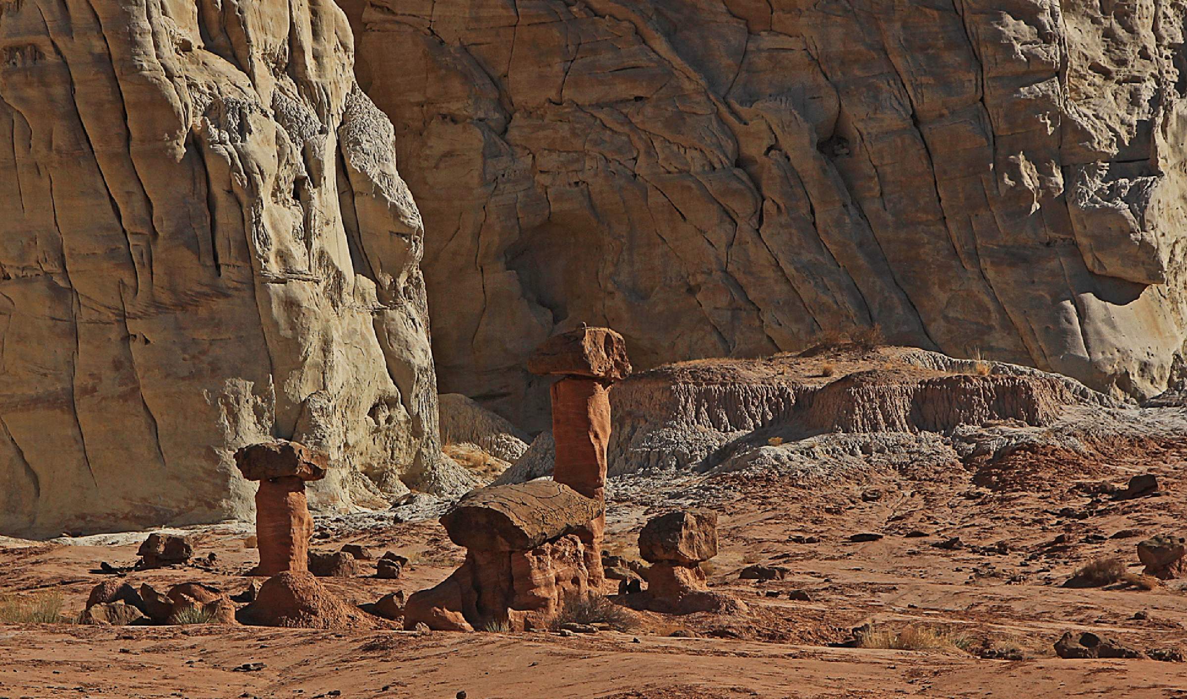
On our way to Blanding we visited the towers of Recapture Pocket. Group 3 above, and Group 2 below.