Black Ridge Canyon Arches 2010: West Rim, Crown, and Two Feathers Arches
Joan and I spent May 13-16, 2010, in Grand Junction, Colo., looking for some obscure arches. On the way there we went for a hike and run on the Boy Scout Trail in Glenwood Springs, which was fun. On May 14, a cloudy day, we found West Rim Arch (aka Finger Arch), which lives on the west side of Rattlesnake Canyon, opposite to the more famous series of arches. But this arch is as spectacular as any over there, and fun to find. Here are UTM coords in the 1983 system. BE VERY CAREFUL: The topo map uses the 1927 system, and I often forget that! Coords for this one are: UTM 1983 = Zone 12; 686294 E; 4333134 N. There is a new Trails Illustrated/National Geographic map of the area; it is quite useful for navigating the dirt roads and finding tralheads.
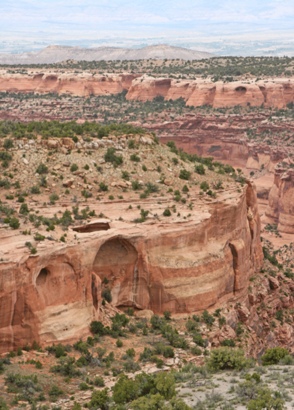
The region of Rattlesnake Arches, and the adjacent canyons are well known for having more arches than anywhere else in the world, except for Arches National Park. On p. 93 of the book "Messages in Stone" by Matthews et al, one finds: "In Rattlesnake Canyon there are thirty-five arches carved in Mesozoic sandstones. Locals point with pride to this assemblage calling it "Colorado's Parade of Arches". Although it is difficult to prove definitively, some authorities claim that it is the second-largest concentration of natural arches in the world."
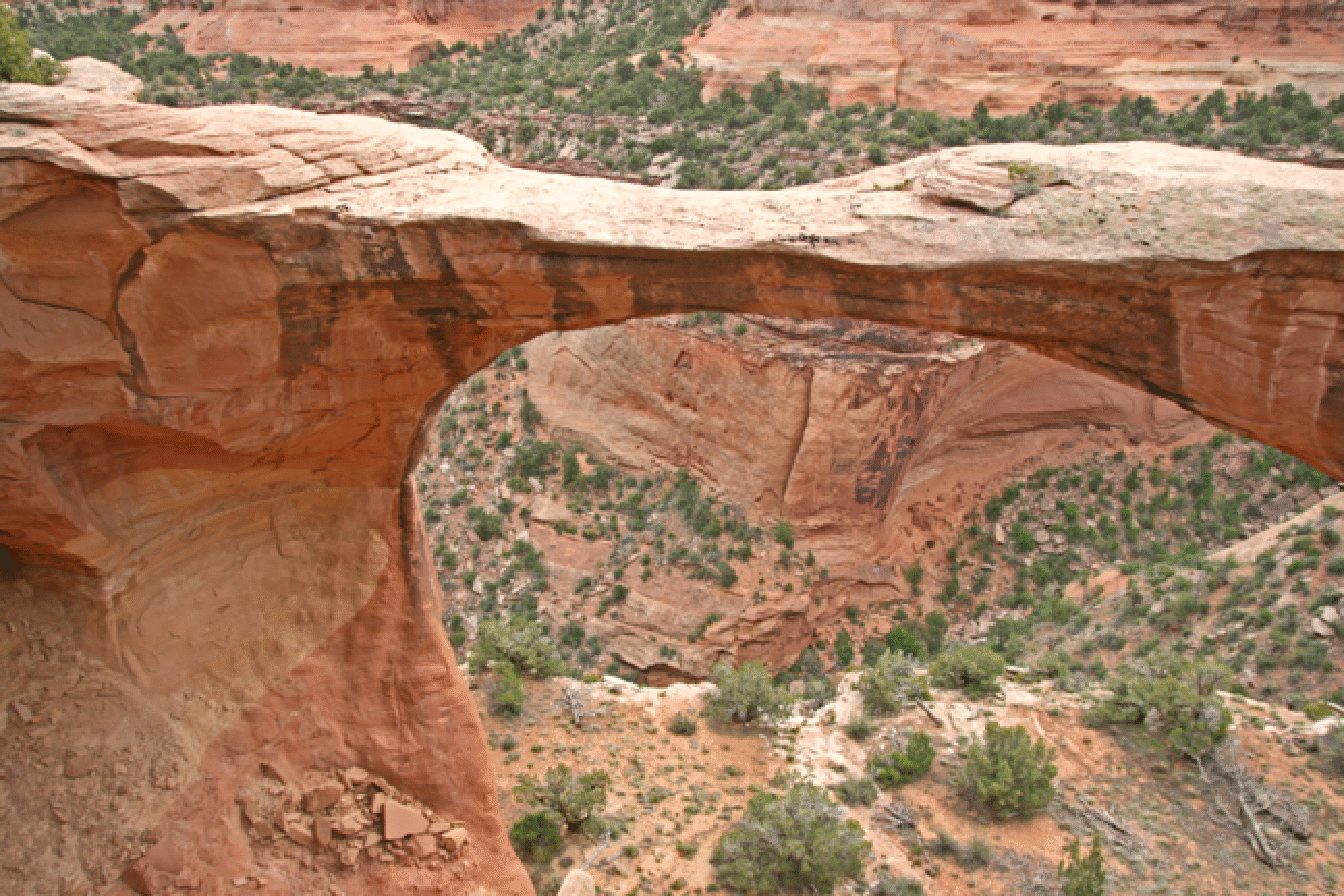
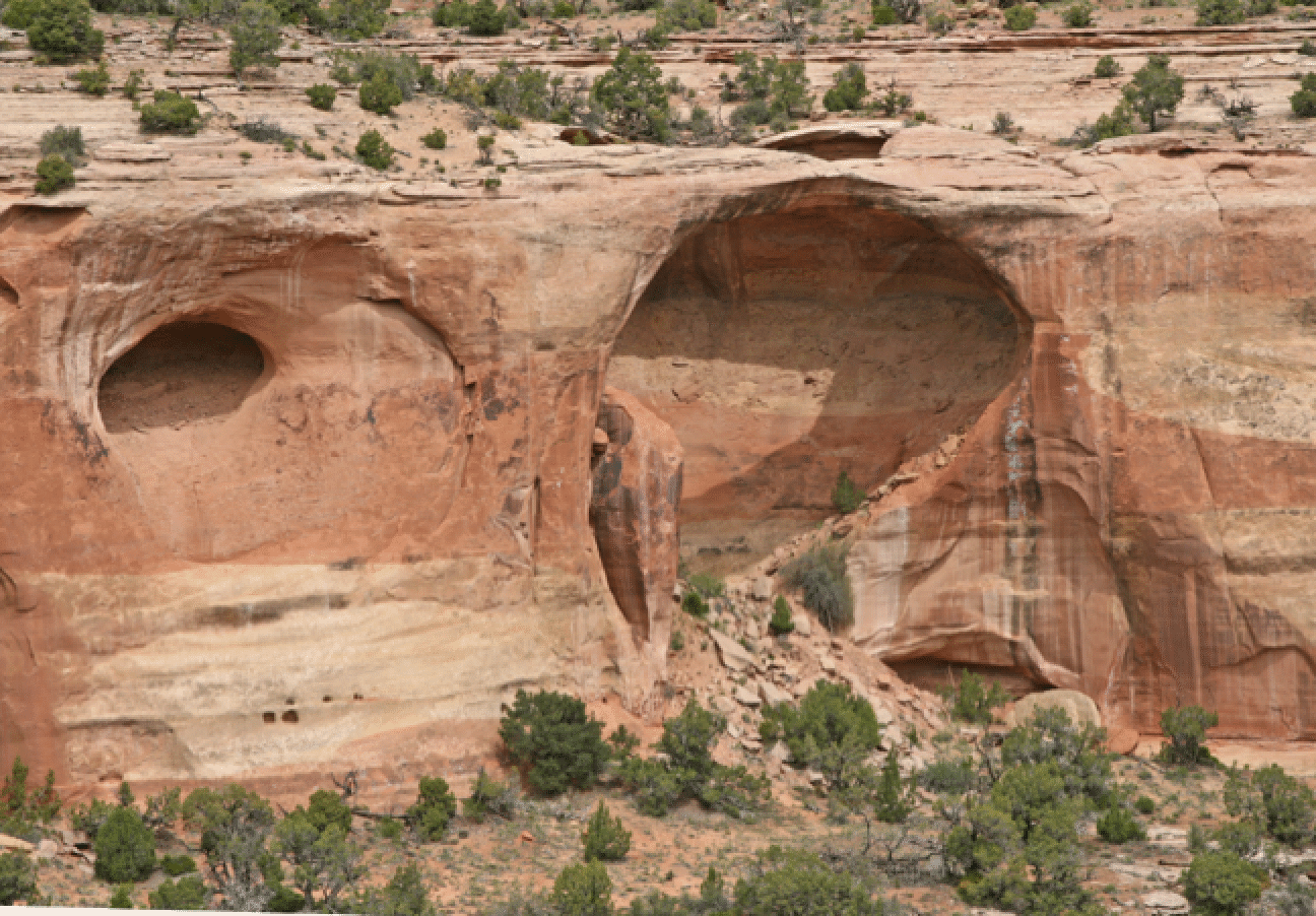
Because of my botched data entry we approached this one from the top (a reasonable approach). That makes it quite exciting as one does not see it until one is just about on top of it. Geology: The arch is in the Entrada formation. The cliffs leading to the floor of the canyon in this area are Wingate. The bench that one walks on at the base of the arches is Kayenta. [[See 2011 trip report for views of this arch for a shorter approach and views from below and inside.]]
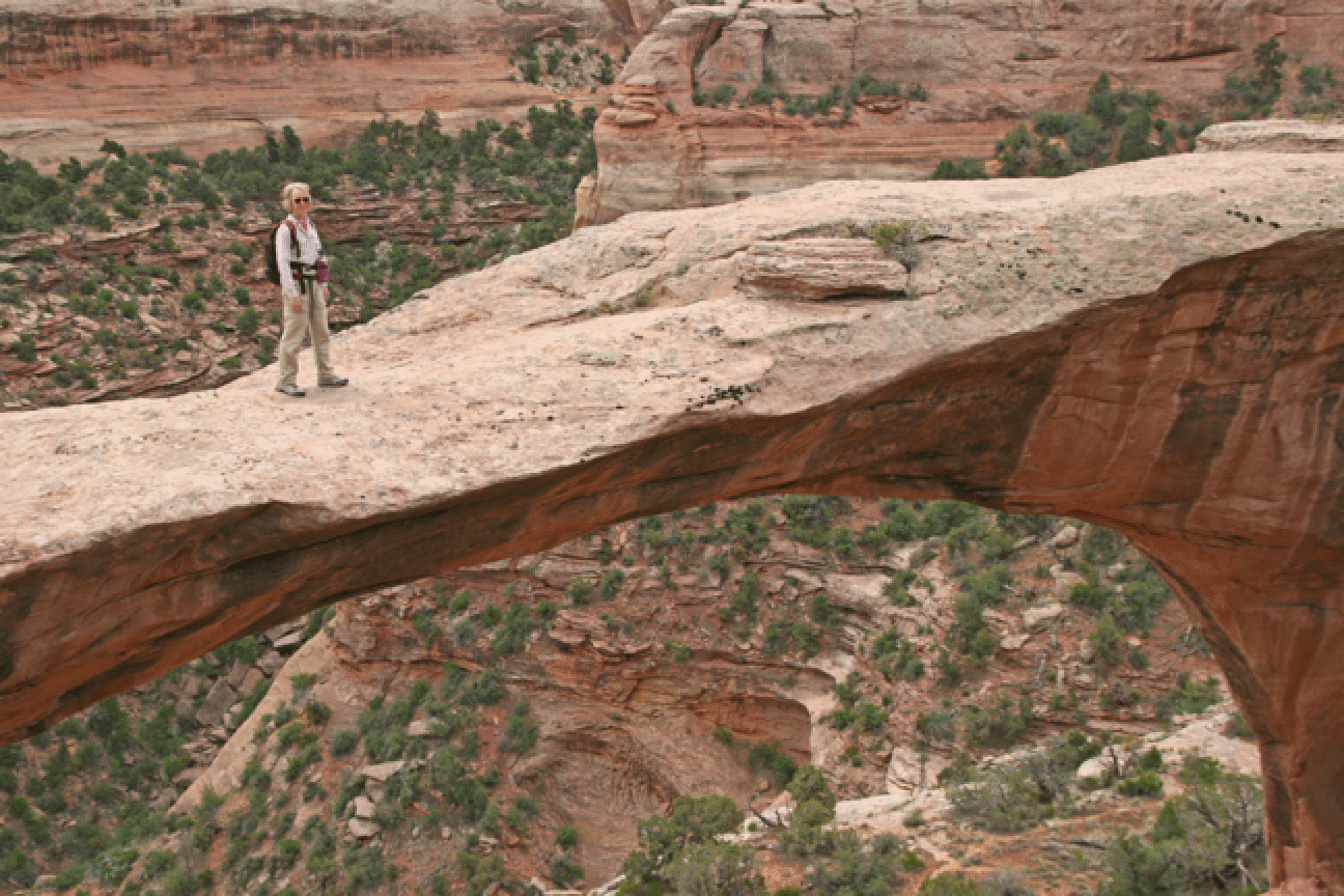
Joan headed right out to the top of the arch:
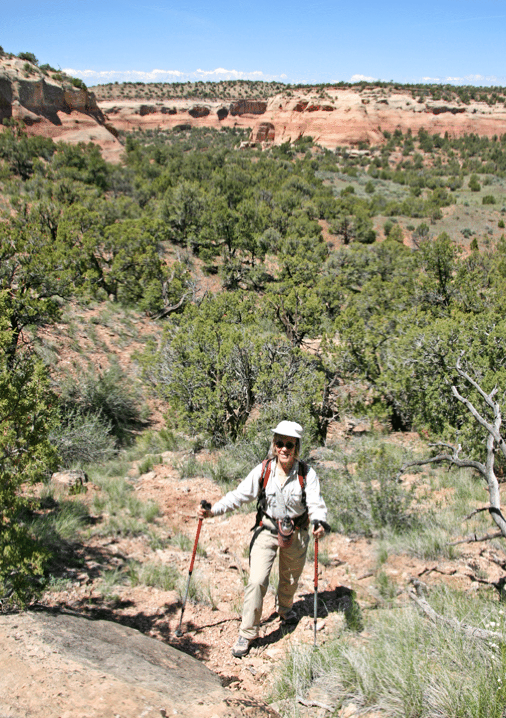
We left by rim walking, which got us to a nice position across the side canyon containing the arch. A game trail goes around the exposed rim and it was amusing to see how the animals avoid exposure at the cliff edge. This arch is called a cave arch, and there is indeed a large cave under it. It seems feasible to get below the arch by entering Rattlesnake Canyon at its true head and traversing at the right level. Next time. The picture below shows the more popular area of Rattlesnake arches in the background.
May 15 was a rainy day. We hiked in Bangs Canyon. Joan went on the Mica Mines trail, which she enjoyed, while I went through Rough Canyon, returning on the jeep road above it.
May 16: We followed instruction obtained from Bob Fagley to some arches in Mee Canyon. This turned out to be a great day: six hours total and the two large arches we found in Mee were spectacular, Crown Arch especially so. Other arches seen were Tublok and Two Feathers. And there are others in the area (such as Will Minor) that we did not take the trouble to find. Note that this area is between the middle level of Mee and the top. The official trailhead into Mee Canyon near its head is not relevant, and hikers who stay in the bottom of Mee will not see this region.
Directions: Drive as if to Rattlesnake Arches and park where the lower and upper access roads meet (7.9 miles from the road start; about 0.7 past the signed Mee Canyon trailhead; do not take that Mee turn; 4WD needed for first and last mile), at a gate. Head down the road 0.7 miles to a 4WD road remnant on the left. Or go 0.8 miles to a clearer 4WD road (closed; no parking). Either approach works; the two roads meet at a closed gate in 100 yards or so. Take said 4WD road for about a mile and then head to the "Entrance" point, where one descends to the 5550 foot level -- the flat area between the rim and the canyon bottom. Finding the entrance is tricky: Use the UTM coords to the nearest meter -- make sure your GPS is set to NAD CONUS 1927! -- as this is a short fourth class downclimb of about 10 feet. Then stay on the 5550-foot level as it winds downcanyon quite a ways. You will soon come to the arch area. Then use the exit for the easy canyon exit and head E, then slightly N to catch the road that takes you back to the drivable road. While it is possible and probably quicker [indeed: done in 2012] to use the exit for both the entrance and exit, the hike is more interesting when making a loop, and we are pleased to have done it that way.
Key UTM points using the NAD 1927 map data (because that is what the maps are in). All in zone 12.
The point on the road to Rattlesnake Parking at which one leaves that road and heads west on gated old road: 686945 4331570
Enter 684744 4332269
Exit 682200 4333650
Crown 681950 4333450
Two Feathers 682050 4333950
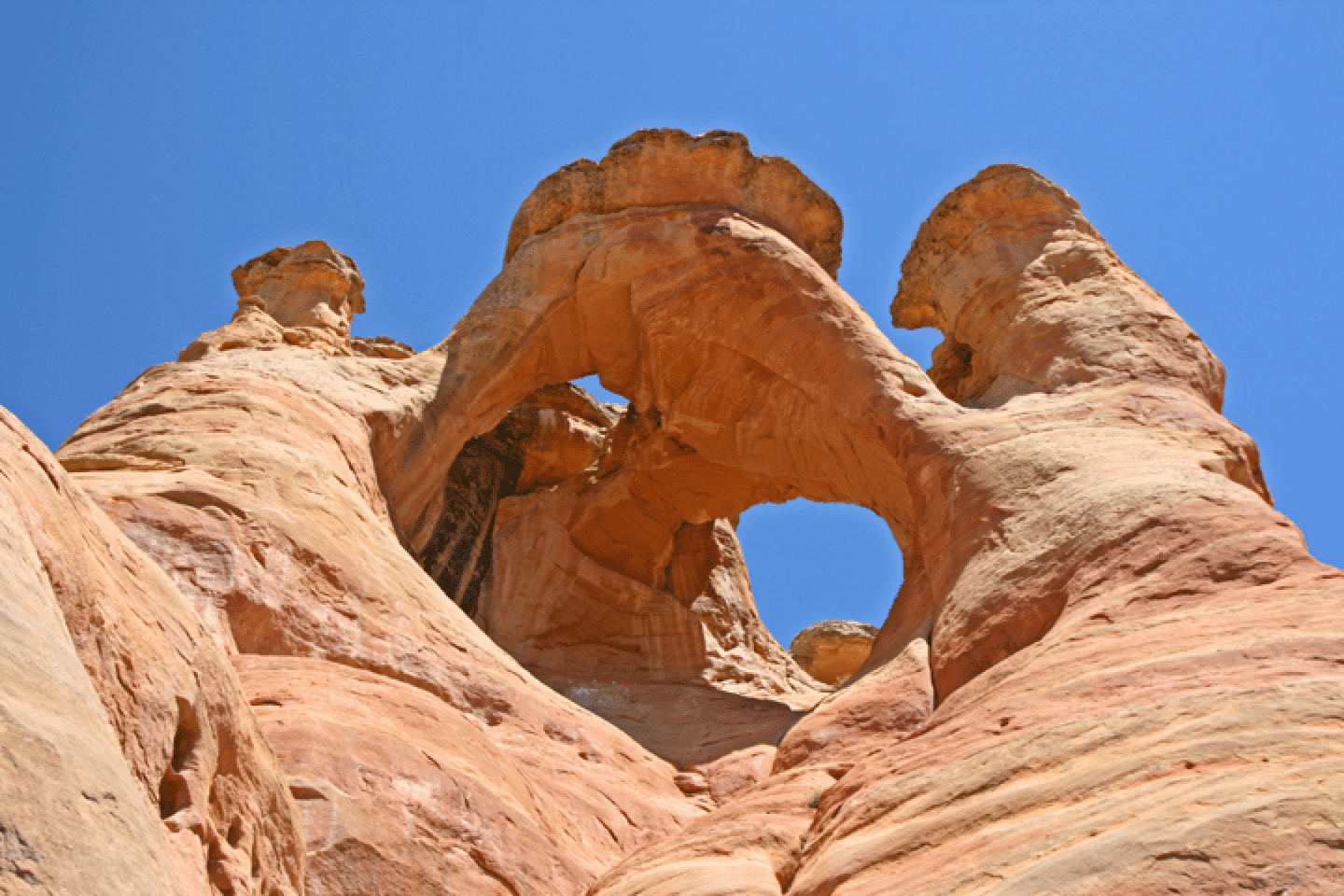
Crown Arch is surely the most spectacular arch in the area. It might be fun to try to find this arch from above. The photo shows that it is not small, and has great complexity and charm.
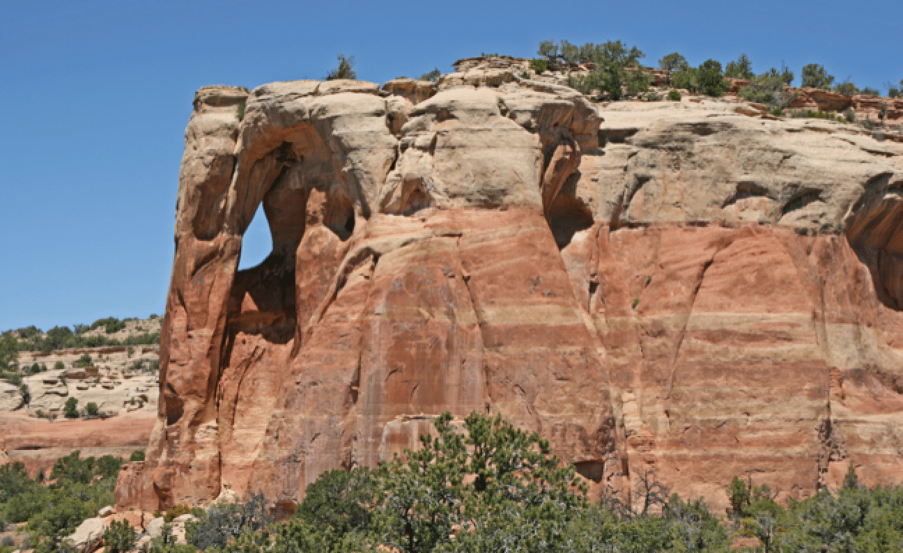
Two Feathers Arch; photo taken from the steep slope that exits to the rim.
Getting to these arches requires a bit of walking along the flat region between the rim and floor of Mee Canyon and getting into and out of this area requires a short bit of travel on steep terrain. Here Joan starts up the steep slope that provides the exit back to the rim.