March 24-27, 2011: Ski from Moab: Skied PreLaurel Peak, Gold Basin, Horse Mountain
April 30, 2011: Tuk At Last
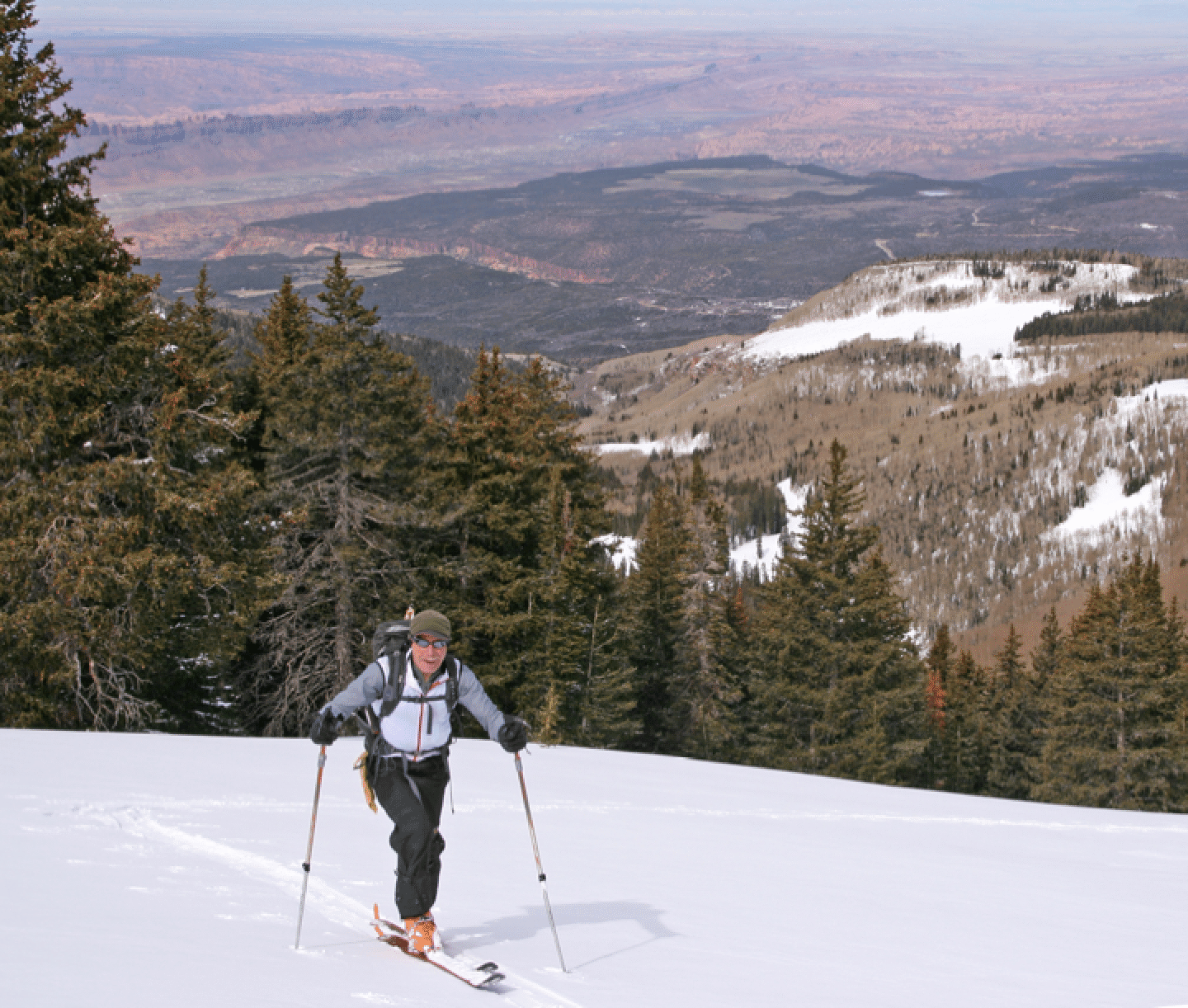
March 24, 2011: Jonathan Kriegel and I left Silverthorne at 5 am and skied up Miners Basin for about a mile past the basin. Extremely snowy and windy at the car, but some sun breaks later. 2800 feet climb. Some good steep skiing at the end, on a bump SE of the basin.
March 25: Stormy day. Hiked Murphy’s Hogback trail in Canyonlands National Park. Ten miles round trip. Very nice trail.
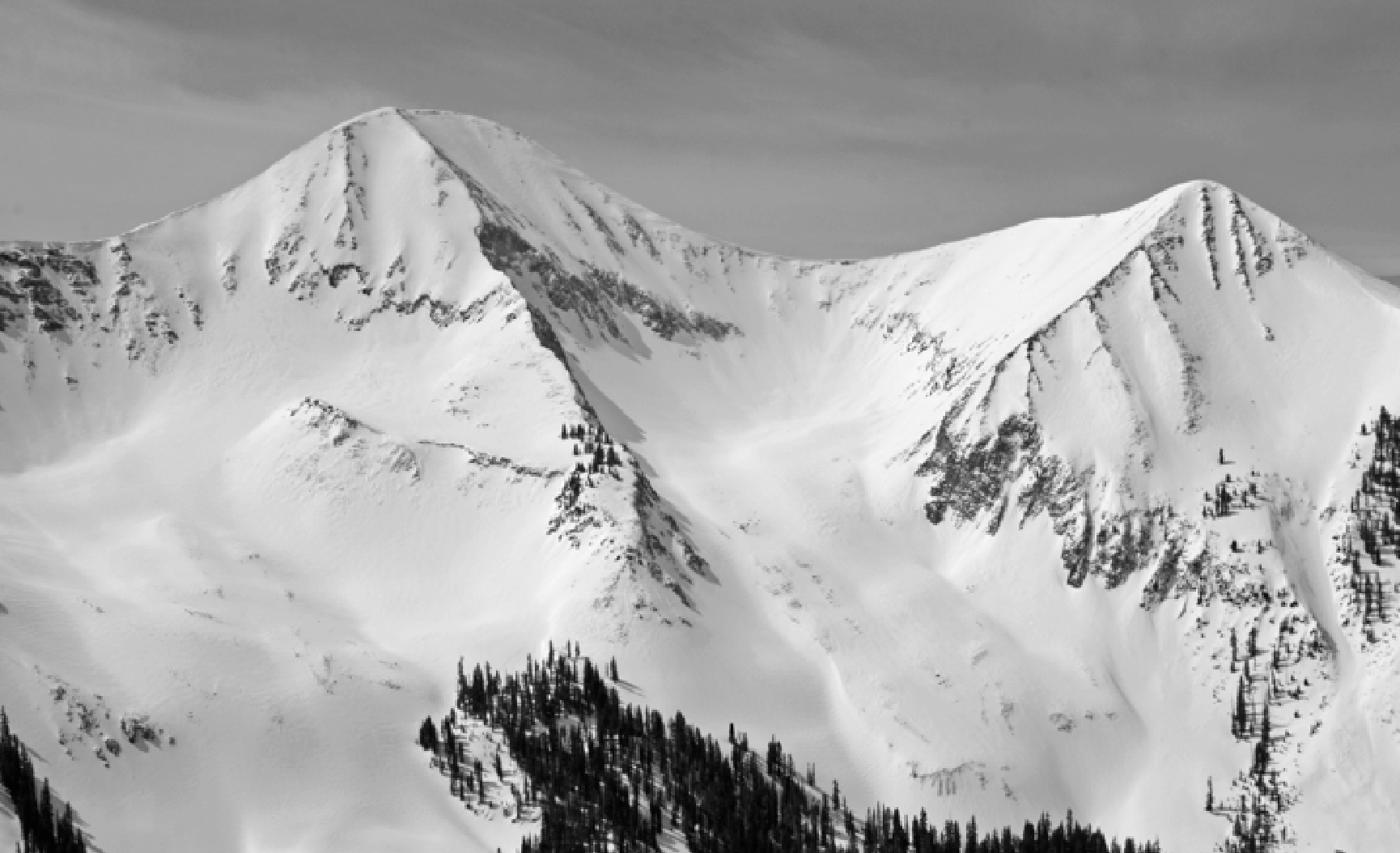
Saturday March 26. Avy conditions were high according to the Utah Avy Center, though we saw no activity on our tour. We climbed PreLaurel Peak (11700), skied a SE run from the top called Goldminers, then climbed up out of Gold Basin into the high basin below Tukuhnikivatz, stopping at 11700 (700 feet below summit) and descending the fine slopes below us. Conditions were excellent everywhere, except for the hardpack above our stopping point on the face of Tuk. On descent we missed the road and ended up too low, having to climb a difficult sun-baked hill to get back E and above the car. 4200 feet total climb. Weather was nice in the morning, allowing some good pictures, shown below. Great views from PreLaurel of the magnificent ski runs on Tuk and Tuk No.
Sunday March 27. Another stormy morning. We went back to Miners Basin for this last day of skiing, but this time turned left (north) at the basin, allowing a very pleasant ascent through aspens of Horse Mountain (11180). From there we skied down the east side on some steep terrain (avy path in forest) below very large cornices. Superb powder skiing. We went down about 700 feet and then climbed back very steeply to the 10800 bump just N of the pass between Horse and the large massif to its south (Green Mt?). The descent back to Miners Basin was also super. One outstanding feature of this range is the mature and varied forest. So this was the best ski day of the trip, though Saturday provided the best views and alpine skiing. We did see one large natural avalanche on steep NE slopes on the S side of the saddle. Total climb: 4000 feet. It appears very few people ski up in this basin. It is true that there are no easily accessible big lines such as in Gold Basin; but we found the area fun and will likely return. We met a USFS ranger at the parking lot who confirmed that it is seldom visited in winter. He also said that this loop road should be plowed from now on, useful to know as last year we got blocked at an unplowed section.
Summary: We had to deal with poor weather almost every day. We had one break on Saturday and made the most of the it. We saw a lot of terrain that was new for us, and Miners Basin was a pretty rewarding area for superb forest and good skiing. I think next time we have to move this trip to April, and perhaps go for the Manns-Waas Traverse as we now have good familiarity with both ends of that route. On the other hand, it could be a rocky traverse up high without very good snow cover.
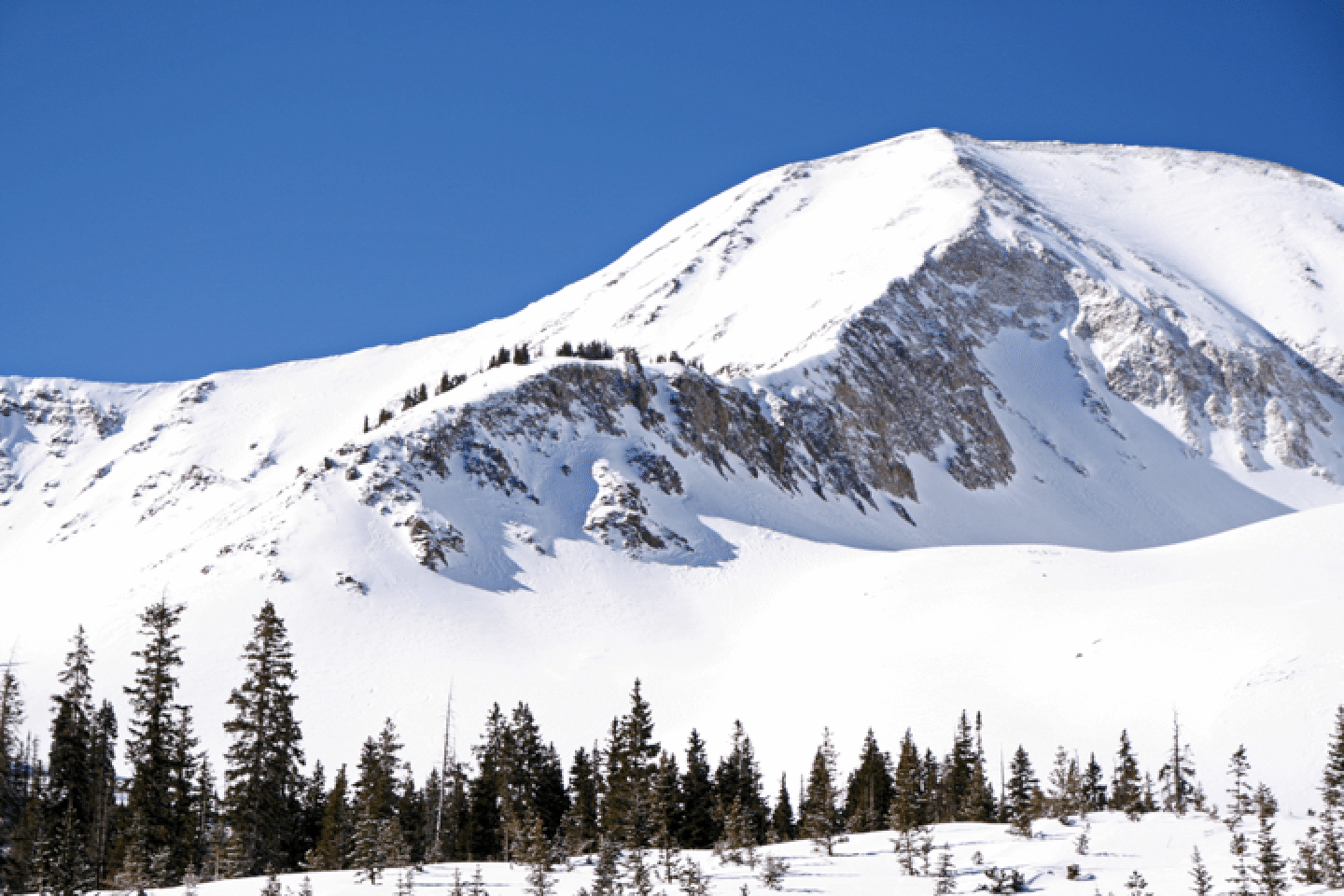
Here is a shot of the impressive north side of Tukuhnikivatz. The line we wanted is just lookers left of the prominent north ridge, but it will have to wait for another trip. Exxon’s Folly is the super-cool line descending from the summit of Tuk No on the right. And there are many other named runs shown here. We skied the northeast basin from below, starting at bottom left and getting to just below the horizontal band of rocks splitting the face.
We got a bit lost on our way up PreLaurel, just across the valley from Tuk, but finally found the proper route without any loss of elevation. The route is called the Laurel Highway. From the top of Laurel we skied a nice 900-foot run called Goldminer into the uppermost reaches of Gold Basin.
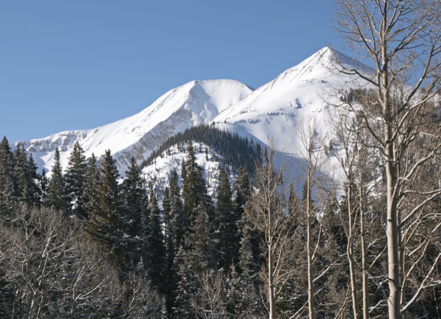
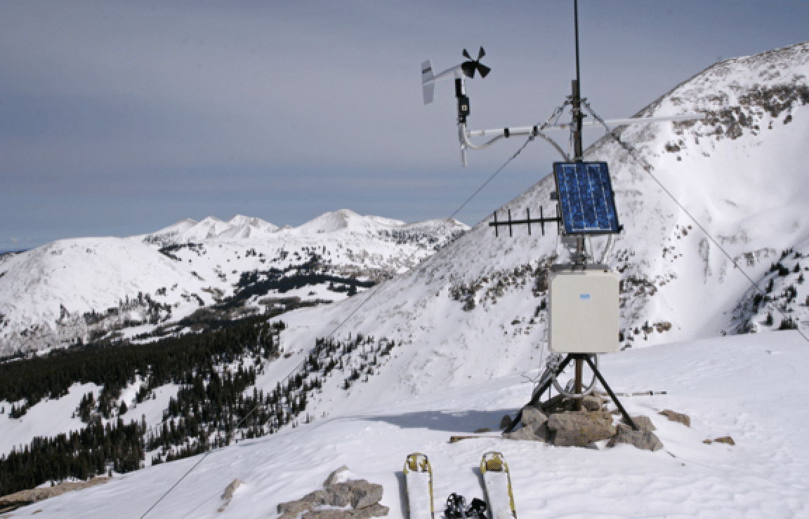
And here is a shot of the weather station atop PreLaurel, with Haystack, Green, unnamed, Waas (in far rear), Manns, and Mellenthin (right of weather station) visible. My little anemometer was jealous of this nice directional one! I can report gusts to 14 mph on this day.
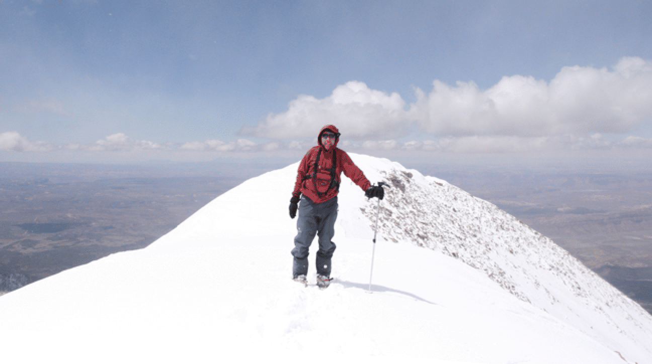
On April 30 Jonathan and I drove over early from Grand Junction, where we were staying. We climbed the N ridge of Tuk, which was very strenuous. Crampons and ax (and a whippet) were used, and snow varied from deep to firm. This is a fun ascent route, though we wonder if ascending the slopes well lookers left of the ski line would make for an easier ascent. The descent conditions were not great, but skiable: wintry and a little crusty. It was a cold day (19 degrees at the start). About 2/3 of the way down I headed hard skiers right avoiding the steep gully that finishes the route; but there was not much gained by doing that.