March 23, 2014: Exxon’s Folly on Tuk No
April 14, 2014: Solo to PreLaurel
Exxon’s Folly on Tuk No: Photo taken April 14, 2014, from the Laurel Highway below PreLaurel.
This has to rank as one of my best ski mountaineering days ever. We saw the line many years ago. It is so beautiful: Tyson Bradley, in his guidebook, calls it the most esthetic line in the range. The upper portion is wonderfully well defined between two prominent parallel rock ribs. A late season attempt failed last year as it was much too slushy. But this year Jonathan Kriegel and I got it: an exhausting climb of Tuk No and ski descent of Exxon’s Folly. It is amazing how steep it looks face-on, yet the profile view shows that it is moderate, and so should be easily skiable in decent conditions. The trick of course is getting it in good condition.
Snow cover was excellent and temperatures nicely low as we headed up the road from the Geyser Pass parking lot at 8:30 a.m. Snow levels in the La Sals this day were 68% of normal, but that was fine. We skinned to the base of the chute and then cut back right to head for the north ridge, switching to crampons and carrying our skis. The ascent to the north ridge was miserable, with lots of postholing. Jonathan had it easier as he used two whippets and could often avoid breaking through. I had one whippet and an ax, and am heavier, and so would, frustratingly, step in his steps and break through. Once on the ridge the going was easier, with straightforward cramponing, a little bit through the snowy rocks, to the spectacular summit. Time to summit was 3.5 hours (for me); JK was faster! We were there at noon.
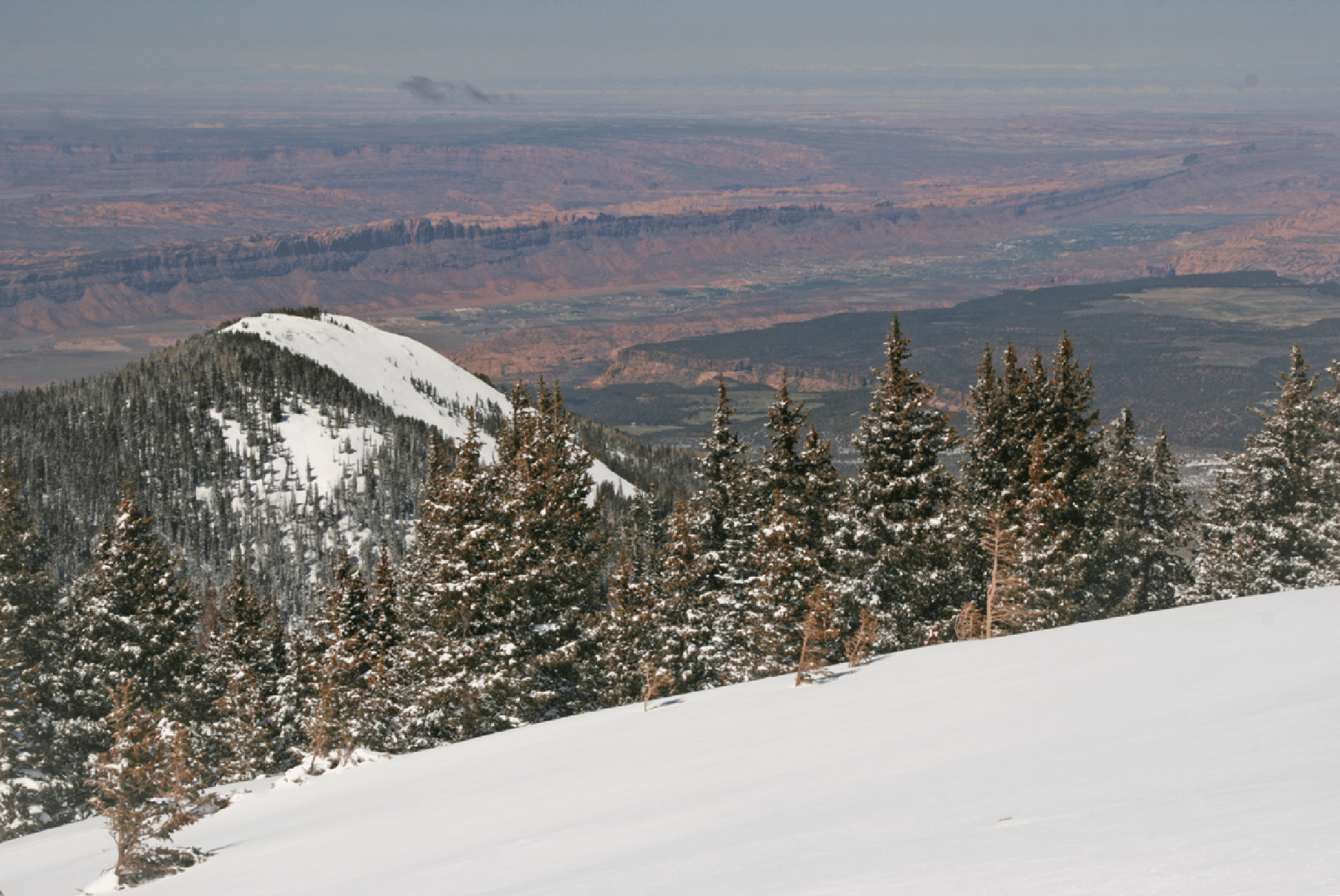
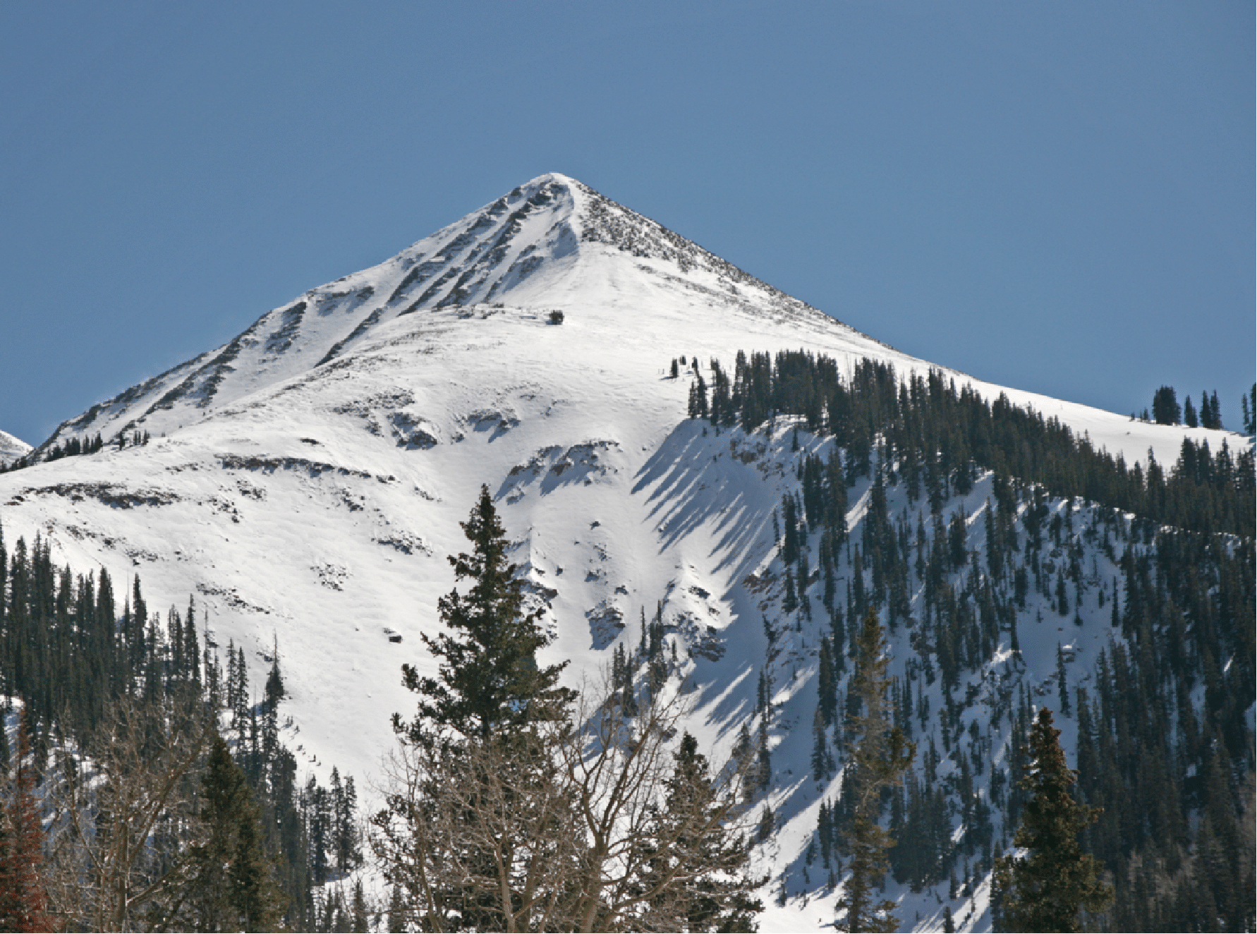
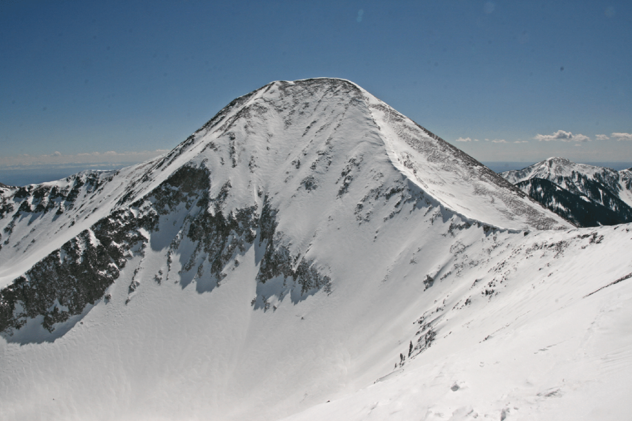
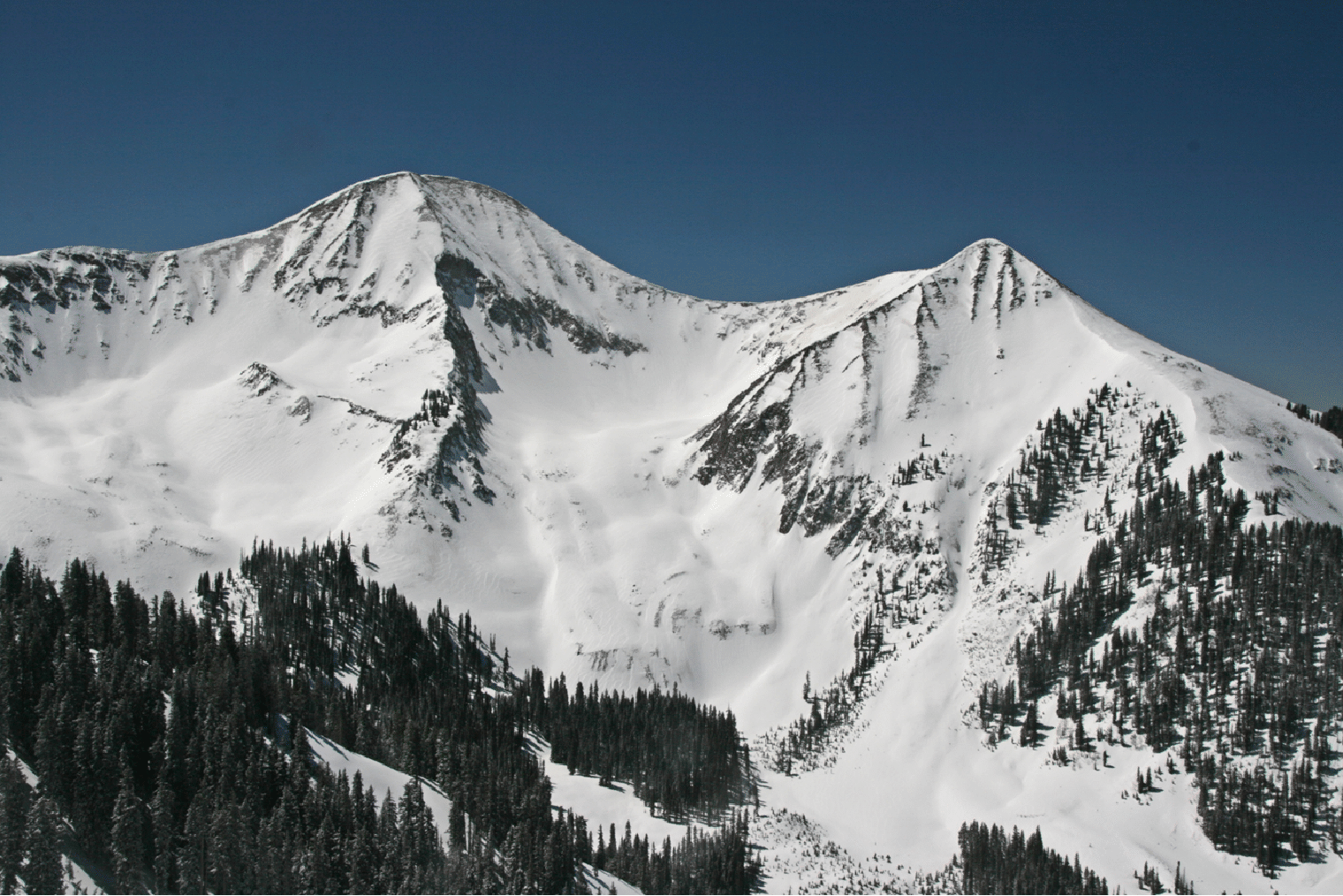
The picture below shows Tukuhnikivatz (left) and Tuk No (right). Exxon’s Folly is the elegant line in the main couloir coming straight off the summit of Tuk No; the aspect is northeast. There are several options as the couloir immediately to looker’s left of Exxon gets skied too. Also there is the broad face towards Tuk (east face) that has a lower angle at the top and descends into Red Snow Cirque; there are rocks below, but I think there is a clean way through, though it might reach 50° (according to Bradley guide book). And there is also the broad face from well below the summit at looker’s right, but that is corniced so entry looked tricky.
For more on this area see this. And here is a video that shows what this can be like in perfect conditions (a top to bottom ski in about a minute).
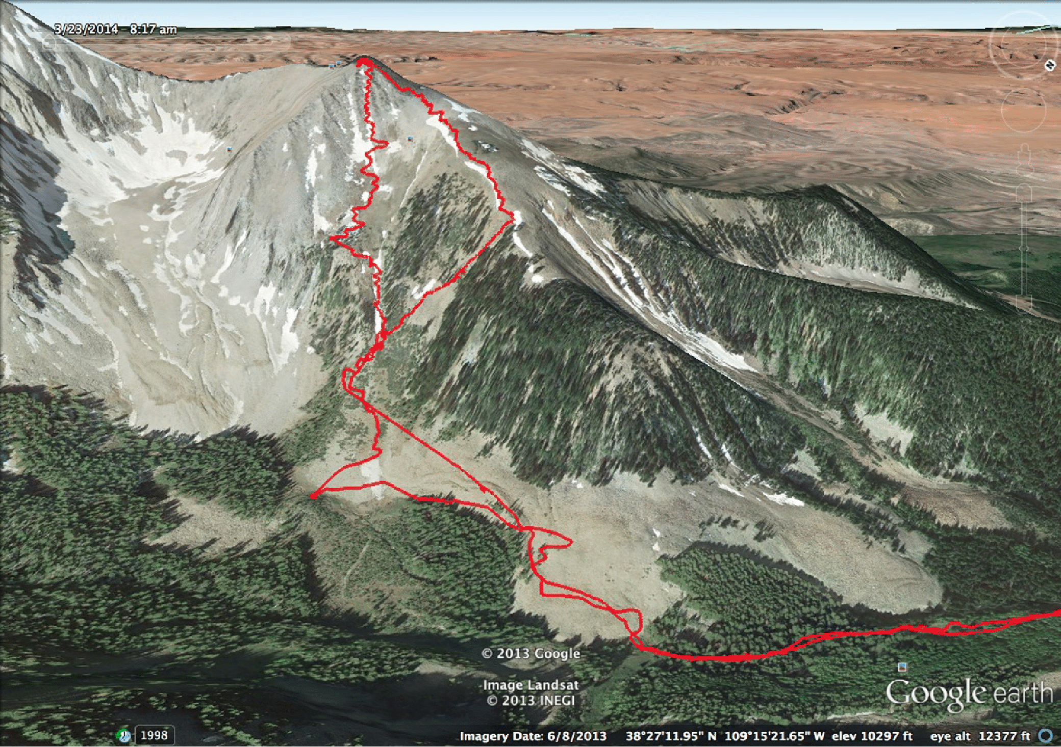
As we climbed, we could only wonder about snow conditions in the Folly: from above they looked like they would be good, so in we went. We entered via a nice slot on skiers left of the gully 50 feet below the summit, with me going first. It was chalky, but skiable. The overall angle did not feel so high, but yet a measurement using Google Earth's Ruler tool showed that it is 40.5 degrees for the top 350 feet, with an average angle from top to bottom (roughly 1500 feet) of 35 degrees. So it is steep and sustained. There was some debris (not a lot, and the debris was actually quite soft) in the final part of the chute, so we entered that from skier's right avoiding a small steep section of the gully. In truth, the main reason for this little dodge was to catch some powder skiing in the lightly treed area. The final bit of steep skiing was difficult, but soon we were down and cruising the meadow to a well earned lunch. Very satisfying day. Seven hours total. The first image below is the Garmin/GoogleEarth view of our track. It is pretty phenomenal that the GPS picks up each turn. Or maybe my turns are too wide!
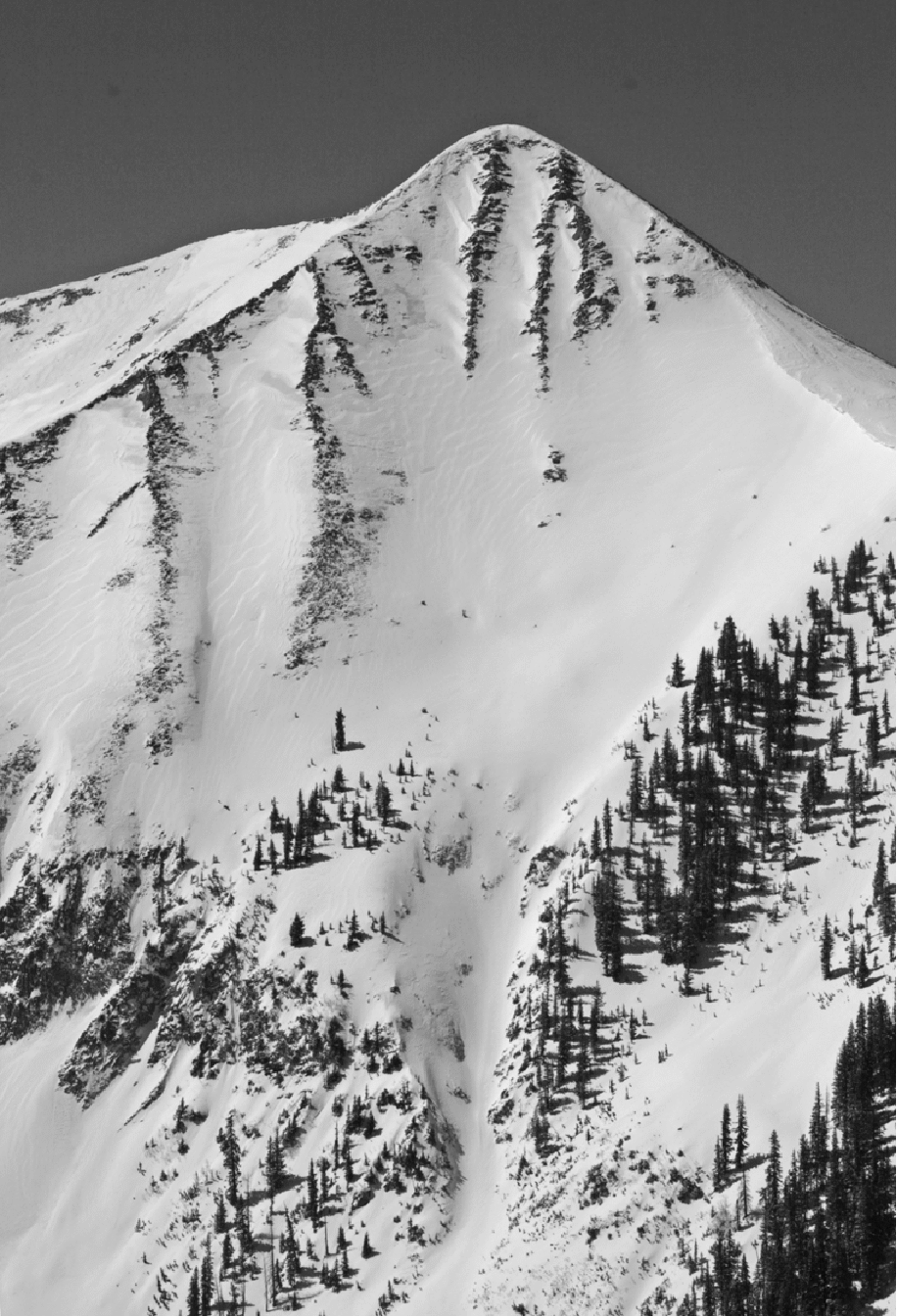
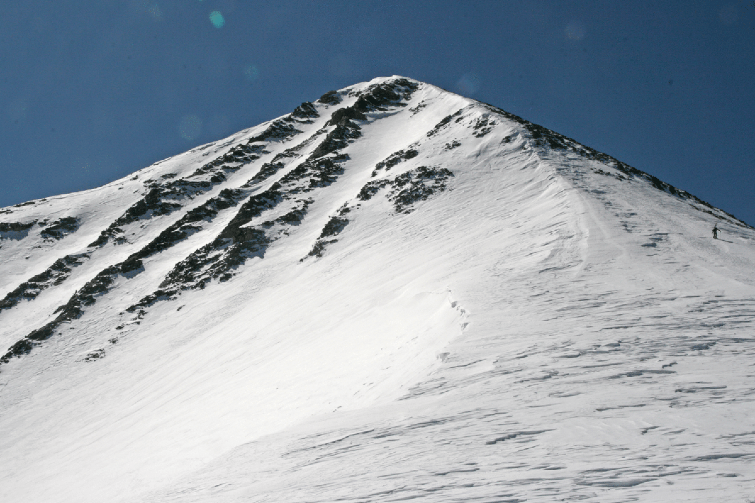
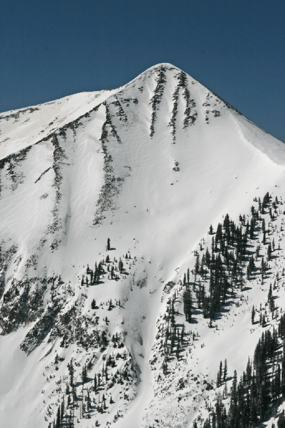
Below is the view of Tuk No summit from the road out at day’s end. Exxon’s Folly is just visible as the central couloir from the summit. Our final ascent was by the wind-packed snow ridge on the edge, which was pretty easy climbing with crampons.
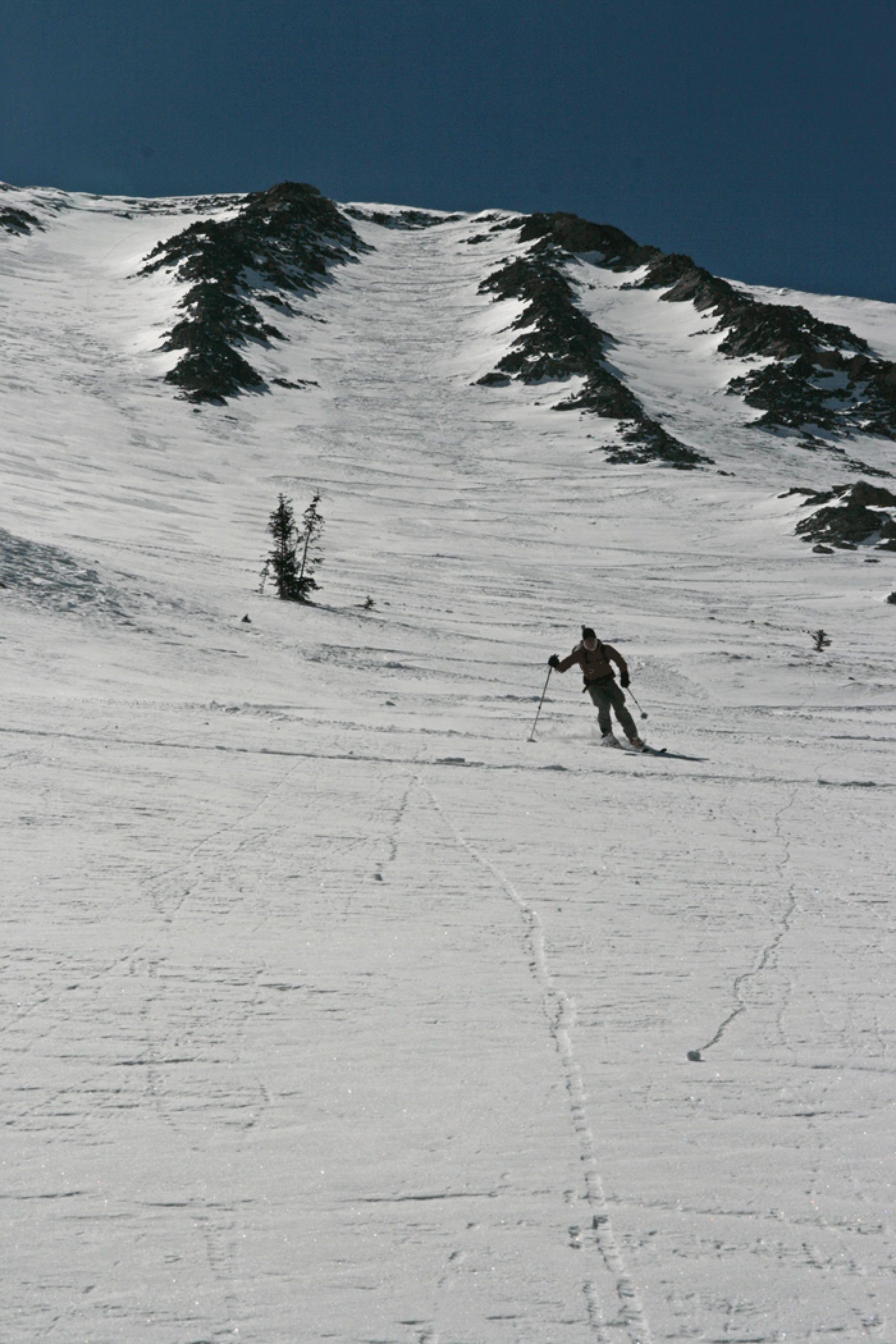
Here is the final ascent to the top; Jonathan is making his way up at right. Exxon’s Folly is clearly visible. This section of the ridge was pretty easy going compared to the horrendous postholing in sugar snow to gain the ridge. You can see here how a small cliff protects the very top of Exxon, but there is a just visible wind feature that allowed easy entrance.
Jonathan atop Tuk No looking down over 8000 feet to Moab.
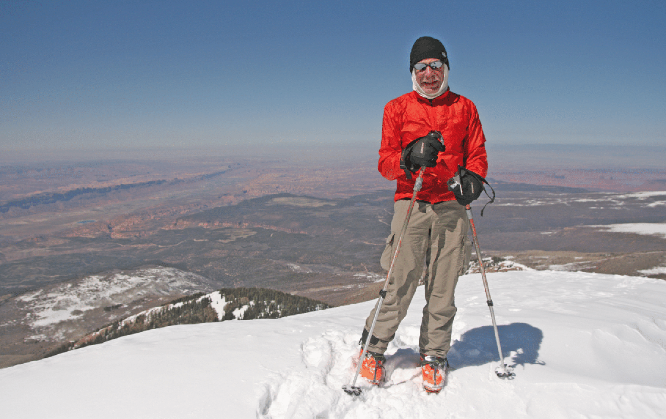
Here I am at the summit of Tuk No. Big Mel (Mellenthin) is the high peak behind and left of me, with Tomasaki at very far left. The gully at far left is how I climbed Pre-Laurel solo last spring; it is known as The Funnel.
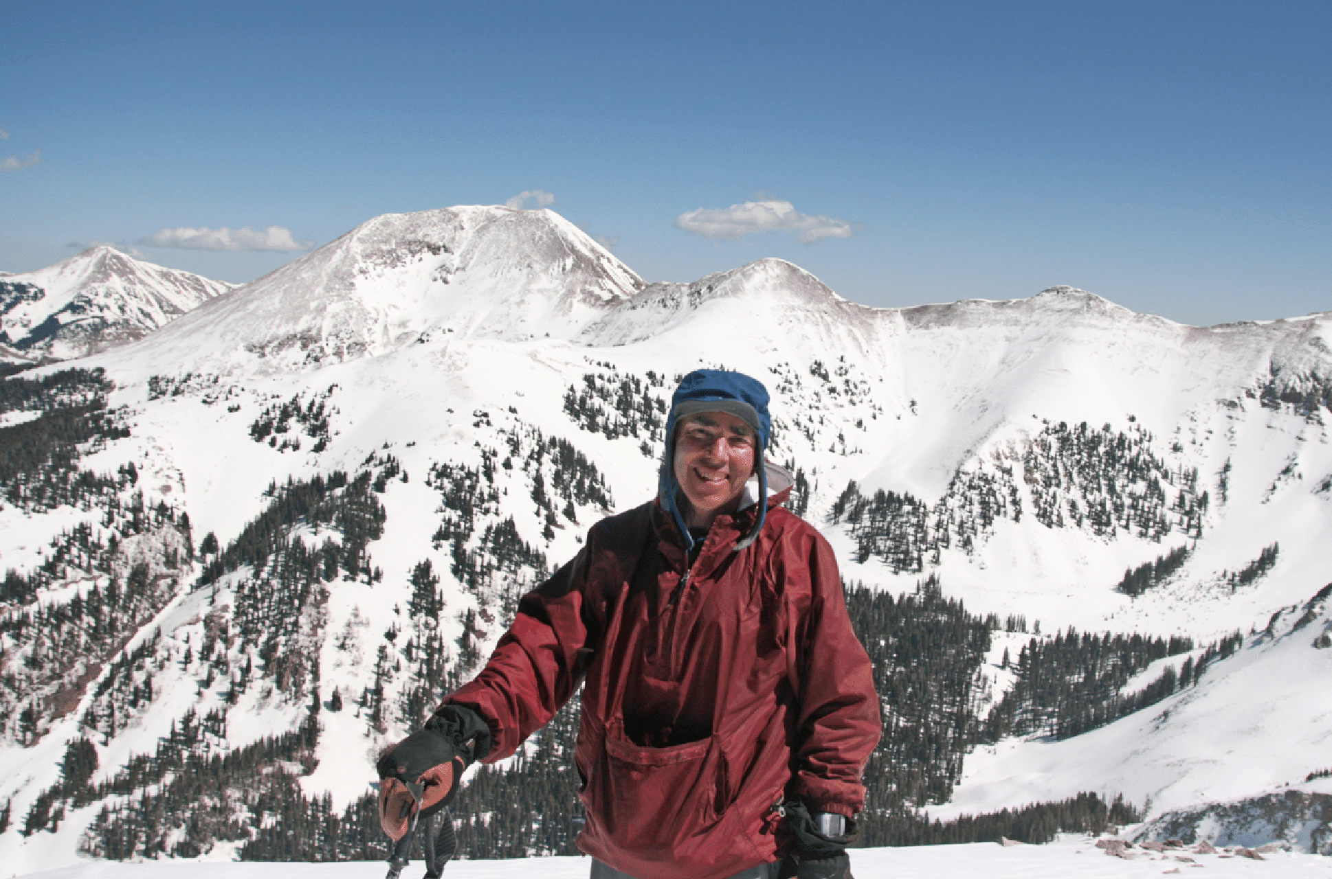
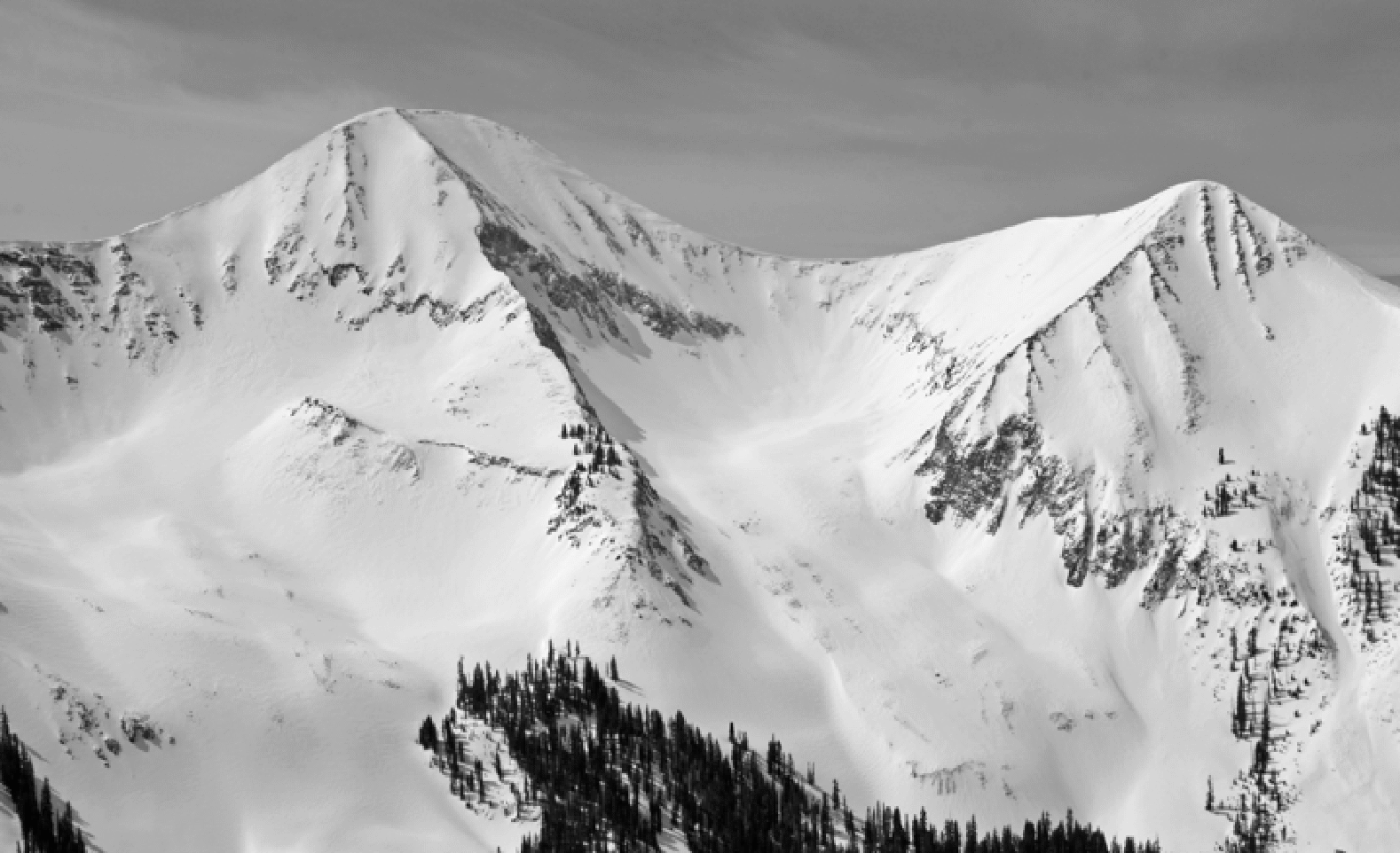
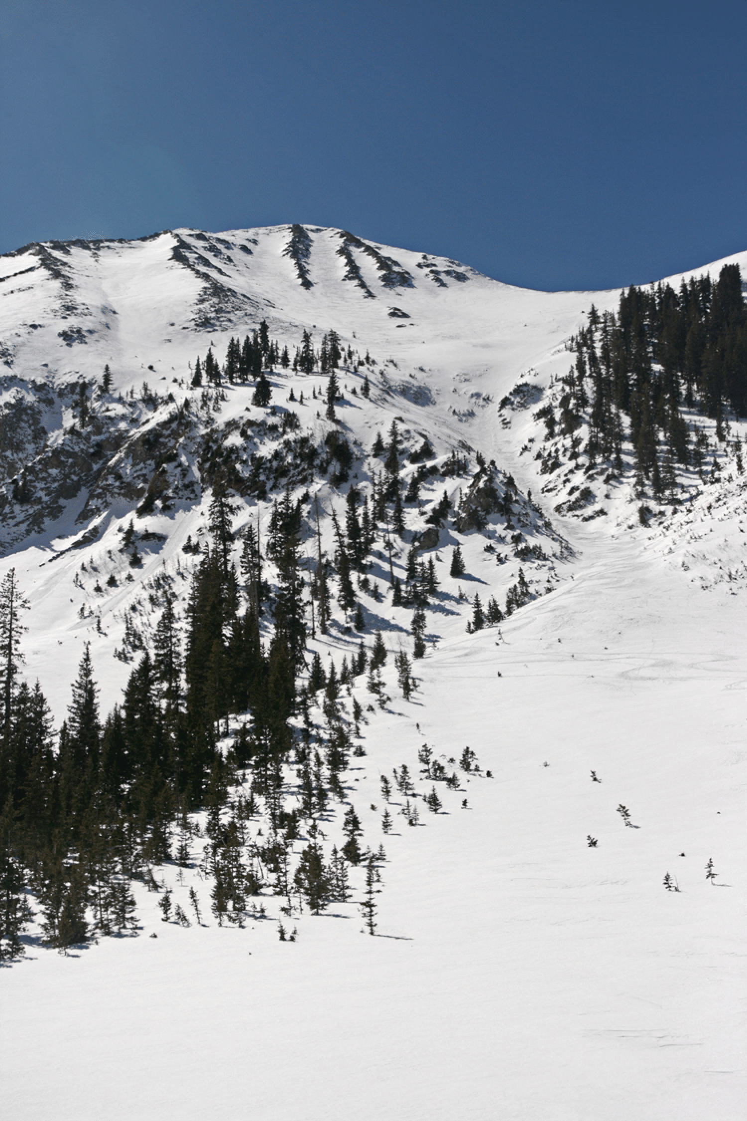
The nice view of the main peak of Tuk from the summit of Tuk No. The popular ski descent on Tuk is the east face, seen in profile here on the left. But people do ski this steep north face, rappelling the cliff in the middle at the narrow snow line (see the video linked to above for a descent of that).
The image below shows Jonathan finishing up the upper part of the Folly. The entrance at the top is visible here, to lookers right of the uppermost cliff.
Looking up at the whole wonderful line.
A few weeks later, April 14, I went solo to just below the summit of PreLaurel. It was a tough drive in 8 inches of new snow, and no other cars were up there, even at the end of the day.
Here was the shot I wanted: Exxon’s Folly on Tuk No from straight across the valley.
And another shot of Tuk and Tuk No.
Looking back to town; the air was nicely clear today. I just skied down my uptrack, which took no time at all. Fresh cold powder the whole way, with some very pleasant sections in the aspens.